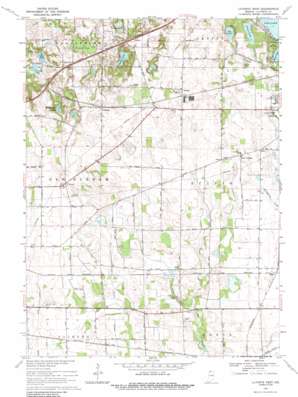
Laporte West Topo Map Indiana
To zoom in, hover over the map of Laporte West
USGS Topo Quad 41086e7 - 1:24,000 scale
| Topo Map Name: | Laporte West |
| USGS Topo Quad ID: | 41086e7 |
| Print Size: | ca. 21 1/4" wide x 27" high |
| Southeast Coordinates: | 41.5° N latitude / 86.75° W longitude |
| Map Center Coordinates: | 41.5625° N latitude / 86.8125° W longitude |
| U.S. State: | IN |
| Filename: | o41086e7.jpg |
| Download Map JPG Image: | Laporte West topo map 1:24,000 scale |
| Map Type: | Topographic |
| Topo Series: | 7.5´ |
| Map Scale: | 1:24,000 |
| Source of Map Images: | United States Geological Survey (USGS) |
| Alternate Map Versions: |
La Porte West IN 1961, updated 1964 Download PDF Buy paper map La Porte West IN 1969, updated 1971 Download PDF Buy paper map La Porte West IN 1969, updated 1988 Download PDF Buy paper map La Porte West IN 1969, updated 1988 Download PDF Buy paper map LaPorte West IN 2010 Download PDF Buy paper map LaPorte West IN 2013 Download PDF Buy paper map LaPorte West IN 2016 Download PDF Buy paper map |
1:24,000 Topo Quads surrounding Laporte West
> Back to 41086e1 at 1:100,000 scale
> Back to 41086a1 at 1:250,000 scale
> Back to U.S. Topo Maps home
Laporte West topo map: Gazetteer
Laporte West: Dams
Pretty Prairie Creek Road Dam elevation 237m 777′Walton Lake Dam elevation 229m 751′
Laporte West: Lakes
Crane Lake elevation 245m 803′Hildebrand Lake elevation 241m 790′
Orr Lake elevation 243m 797′
Round Lake elevation 226m 741′
Ryden Lakes elevation 257m 843′
Swede Lake elevation 241m 790′
Laporte West: Parks
Camp To-Pe-Ne-Bee elevation 239m 784′Soldiers Memorial Park elevation 245m 803′
Laporte West: Populated Places
Door Village elevation 247m 810′Durham elevation 250m 820′
Magee elevation 236m 774′
Pinhook elevation 252m 826′
Pinola elevation 257m 843′
Laporte West: Reservoirs
Walton Lake elevation 229m 751′Laporte West: Swamps
Pinhook Bog elevation 251m 823′Laporte West digital topo map on disk
Buy this Laporte West topo map showing relief, roads, GPS coordinates and other geographical features, as a high-resolution digital map file on DVD:
Northern Illinois, Northern Indiana & Southwestern Michigan
Buy digital topo maps: Northern Illinois, Northern Indiana & Southwestern Michigan


