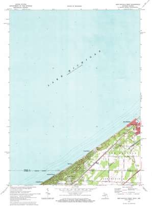
New Buffalo West Topo Map Michigan
To zoom in, hover over the map of New Buffalo West
USGS Topo Quad 41086g7 - 1:24,000 scale
| Topo Map Name: | New Buffalo West |
| USGS Topo Quad ID: | 41086g7 |
| Print Size: | ca. 21 1/4" wide x 27" high |
| Southeast Coordinates: | 41.75° N latitude / 86.75° W longitude |
| Map Center Coordinates: | 41.8125° N latitude / 86.8125° W longitude |
| U.S. States: | MI, IN |
| Filename: | o41086g7.jpg |
| Download Map JPG Image: | New Buffalo West topo map 1:24,000 scale |
| Map Type: | Topographic |
| Topo Series: | 7.5´ |
| Map Scale: | 1:24,000 |
| Source of Map Images: | United States Geological Survey (USGS) |
| Alternate Map Versions: |
New Buffalo West MI 1970, updated 1973 Download PDF Buy paper map New Buffalo West MI 1970, updated 1973 Download PDF Buy paper map New Buffalo West MI 2011 Download PDF Buy paper map New Buffalo West MI 2014 Download PDF Buy paper map New Buffalo West MI 2016 Download PDF Buy paper map |
1:24,000 Topo Quads surrounding New Buffalo West
Stevensville |
||||
Bridgman |
||||
New Buffalo West |
New Buffalo East |
Three Oaks |
||
Dune Acres |
Michigan City West |
Michigan City East |
Springville |
New Carlisle |
Chesterton |
Westville |
Laporte West |
Laporte East |
Stillwell |
> Back to 41086e1 at 1:100,000 scale
> Back to 41086a1 at 1:250,000 scale
> Back to U.S. Topo Maps home
New Buffalo West topo map: Gazetteer
New Buffalo West: Populated Places
Duneland Beach elevation 180m 590′Grand Beach elevation 189m 620′
Judy's Mobile Home Court elevation 189m 620′
Michiana elevation 186m 610′
Michiana Shores elevation 185m 606′
New Buffalo West: Post Offices
Grand Beach Post Office (historical) elevation 190m 623′New Buffalo West: Streams
White Ditch elevation 177m 580′New Buffalo West digital topo map on disk
Buy this New Buffalo West topo map showing relief, roads, GPS coordinates and other geographical features, as a high-resolution digital map file on DVD:
Northern Illinois, Northern Indiana & Southwestern Michigan
Buy digital topo maps: Northern Illinois, Northern Indiana & Southwestern Michigan


