Parr Topo Map Indiana
To zoom in, hover over the map of Parr
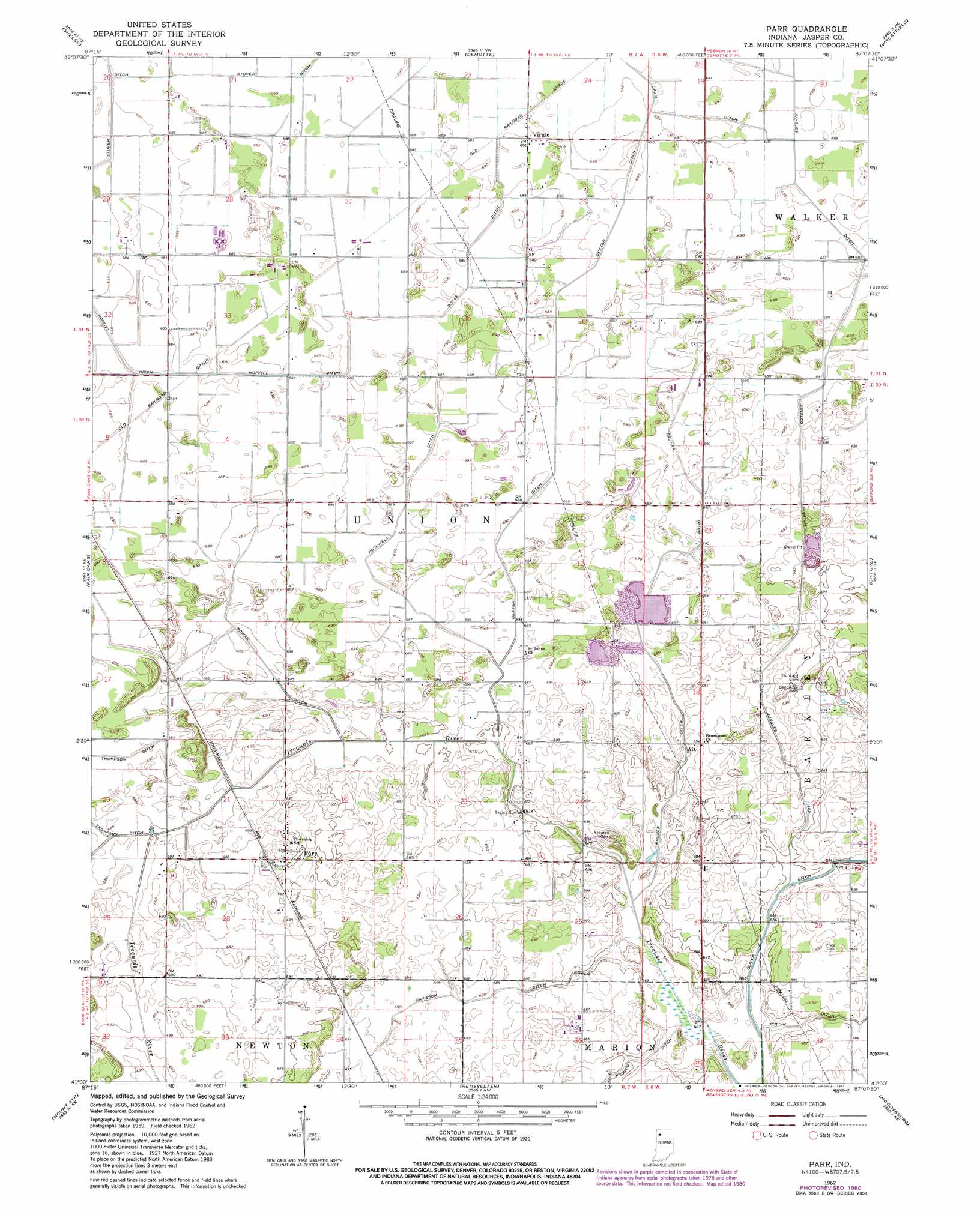
USGS Topo Quad 41087a2 - 1:24,000 scale
| Topo Map Name: | Parr |
| USGS Topo Quad ID: | 41087a2 |
| Print Size: | ca. 21 1/4" wide x 27" high |
| Southeast Coordinates: | 41° N latitude / 87.125° W longitude |
| Map Center Coordinates: | 41.0625° N latitude / 87.1875° W longitude |
| U.S. State: | IN |
| Filename: | o41087a2.jpg |
| Download Map JPG Image: | Parr topo map 1:24,000 scale |
| Map Type: | Topographic |
| Topo Series: | 7.5´ |
| Map Scale: | 1:24,000 |
| Source of Map Images: | United States Geological Survey (USGS) |
| Alternate Map Versions: |
Parr IN 1962, updated 1964 Download PDF Buy paper map Parr IN 1962, updated 1981 Download PDF Buy paper map Parr IN 2010 Download PDF Buy paper map Parr IN 2013 Download PDF Buy paper map Parr IN 2016 Download PDF Buy paper map |
1:24,000 Topo Quads surrounding Parr
Lowell |
Leroy |
Hebron |
Kouts |
La Crosse |
Schneider |
Shelby |
Demotte |
Wheatfield |
San Pierre |
Enos |
Fair Oaks |
Parr |
Gifford |
Medaryville |
Morocco |
Mount Ayr |
Rensselaer |
Mccoysburg |
Francesville |
Kentland |
Goodland |
Remington |
Wolcott |
Monon |
> Back to 41087a1 at 1:100,000 scale
> Back to 41086a1 at 1:250,000 scale
> Back to U.S. Topo Maps home
Parr topo map: Gazetteer
Parr: Canals
Boyle Ditch elevation 210m 688′Bruner Ditch elevation 210m 688′
Davis Ditch elevation 208m 682′
Davison Ditch elevation 208m 682′
Dexter Ditch elevation 209m 685′
Jungles Ditch elevation 210m 688′
Pullin Ditch elevation 208m 682′
Rockwell Ditch elevation 209m 685′
Rowan Ditch elevation 210m 688′
Stover Ditch elevation 209m 685′
Parr: Populated Places
Aix elevation 209m 685′Moffitt elevation 209m 685′
Parr elevation 212m 695′
Rosebud elevation 210m 688′
Virgie elevation 210m 688′
Parr digital topo map on disk
Buy this Parr topo map showing relief, roads, GPS coordinates and other geographical features, as a high-resolution digital map file on DVD:
Northern Illinois, Northern Indiana & Southwestern Michigan
Buy digital topo maps: Northern Illinois, Northern Indiana & Southwestern Michigan