Fair Oaks Topo Map Indiana
To zoom in, hover over the map of Fair Oaks
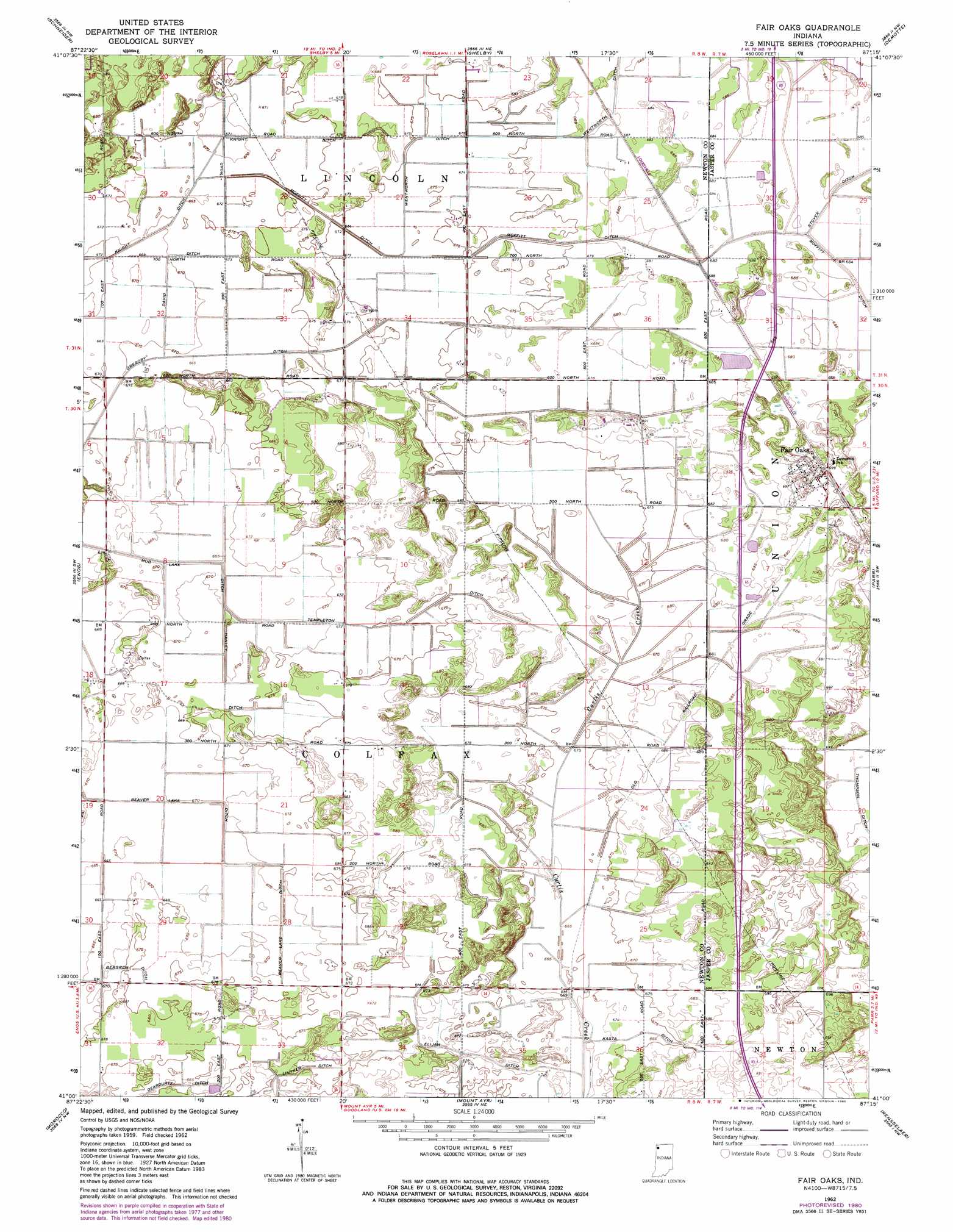
USGS Topo Quad 41087a3 - 1:24,000 scale
| Topo Map Name: | Fair Oaks |
| USGS Topo Quad ID: | 41087a3 |
| Print Size: | ca. 21 1/4" wide x 27" high |
| Southeast Coordinates: | 41° N latitude / 87.25° W longitude |
| Map Center Coordinates: | 41.0625° N latitude / 87.3125° W longitude |
| U.S. State: | IN |
| Filename: | o41087a3.jpg |
| Download Map JPG Image: | Fair Oaks topo map 1:24,000 scale |
| Map Type: | Topographic |
| Topo Series: | 7.5´ |
| Map Scale: | 1:24,000 |
| Source of Map Images: | United States Geological Survey (USGS) |
| Alternate Map Versions: |
Fair Oaks IN 1962, updated 1964 Download PDF Buy paper map Fair Oaks IN 1962, updated 1980 Download PDF Buy paper map Fair Oaks IN 2010 Download PDF Buy paper map Fair Oaks IN 2013 Download PDF Buy paper map Fair Oaks IN 2016 Download PDF Buy paper map |
1:24,000 Topo Quads surrounding Fair Oaks
Beecher East |
Lowell |
Leroy |
Hebron |
Kouts |
Illiana Heights |
Schneider |
Shelby |
Demotte |
Wheatfield |
Leesville |
Enos |
Fair Oaks |
Parr |
Gifford |
Donovan |
Morocco |
Mount Ayr |
Rensselaer |
Mccoysburg |
Sheldon |
Kentland |
Goodland |
Remington |
Wolcott |
> Back to 41087a1 at 1:100,000 scale
> Back to 41086a1 at 1:250,000 scale
> Back to U.S. Topo Maps home
Fair Oaks topo map: Gazetteer
Fair Oaks: Canals
David Ditch elevation 204m 669′Deardurff Ditch elevation 205m 672′
Elijah Ditch elevation 204m 669′
Gregory Ditch elevation 206m 675′
Hanley Ditch elevation 205m 672′
Kasta Ditch elevation 205m 672′
Lintner Ditch elevation 206m 675′
Moffitt Ditch elevation 208m 682′
Templeton Ditch elevation 205m 672′
Thompson Ditch elevation 210m 688′
Wentworth Ditch elevation 207m 679′
Fair Oaks: Populated Places
Fair Oaks elevation 214m 702′Pembroke elevation 209m 685′
Fair Oaks digital topo map on disk
Buy this Fair Oaks topo map showing relief, roads, GPS coordinates and other geographical features, as a high-resolution digital map file on DVD:
Northern Illinois, Northern Indiana & Southwestern Michigan
Buy digital topo maps: Northern Illinois, Northern Indiana & Southwestern Michigan