Saint Anne Topo Map Illinois
To zoom in, hover over the map of Saint Anne
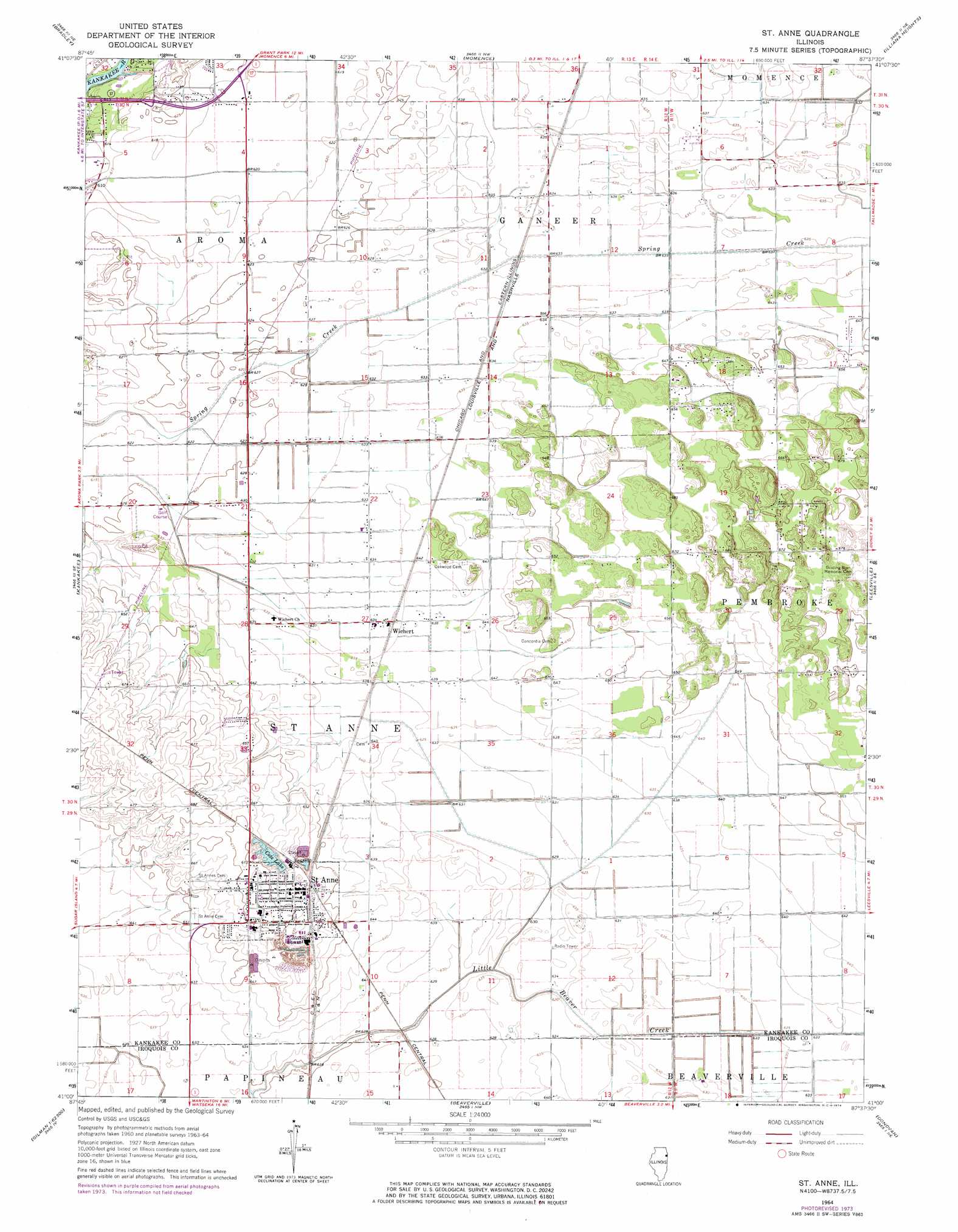
USGS Topo Quad 41087a6 - 1:24,000 scale
| Topo Map Name: | Saint Anne |
| USGS Topo Quad ID: | 41087a6 |
| Print Size: | ca. 21 1/4" wide x 27" high |
| Southeast Coordinates: | 41° N latitude / 87.625° W longitude |
| Map Center Coordinates: | 41.0625° N latitude / 87.6875° W longitude |
| U.S. State: | IL |
| Filename: | o41087a6.jpg |
| Download Map JPG Image: | Saint Anne topo map 1:24,000 scale |
| Map Type: | Topographic |
| Topo Series: | 7.5´ |
| Map Scale: | 1:24,000 |
| Source of Map Images: | United States Geological Survey (USGS) |
| Alternate Map Versions: |
St. Anne IL 1964, updated 1965 Download PDF Buy paper map St. Anne IL 1964, updated 1974 Download PDF Buy paper map Saint Anne IL 2012 Download PDF Buy paper map Saint Anne IL 2015 Download PDF Buy paper map |
1:24,000 Topo Quads surrounding Saint Anne
Wilton Center |
Peotone |
Beecher West |
Beecher East |
Lowell |
Bourbonnais |
Bradley |
Momence |
Illiana Heights |
Schneider |
West Kankakee |
Kankakee |
Saint Anne |
Leesville |
Enos |
Clifton |
L'Erable |
Beaverville |
Donovan |
Morocco |
Gilman |
Crescent |
Watseka |
Sheldon |
Kentland |
> Back to 41087a1 at 1:100,000 scale
> Back to 41086a1 at 1:250,000 scale
> Back to U.S. Topo Maps home
Saint Anne topo map: Gazetteer
Saint Anne: Lakes
Cote Lake elevation 201m 659′Saint Anne: Populated Places
Collins (historical) elevation 195m 639′Doney elevation 210m 688′
Hopkins Park elevation 207m 679′
Koster elevation 193m 633′
Leesville elevation 195m 639′
Saint Anne elevation 203m 666′
Saint Anne Woods elevation 202m 662′
Tallmadge elevation 193m 633′
Wichert elevation 193m 633′
Saint Anne digital topo map on disk
Buy this Saint Anne topo map showing relief, roads, GPS coordinates and other geographical features, as a high-resolution digital map file on DVD:
Northern Illinois, Northern Indiana & Southwestern Michigan
Buy digital topo maps: Northern Illinois, Northern Indiana & Southwestern Michigan