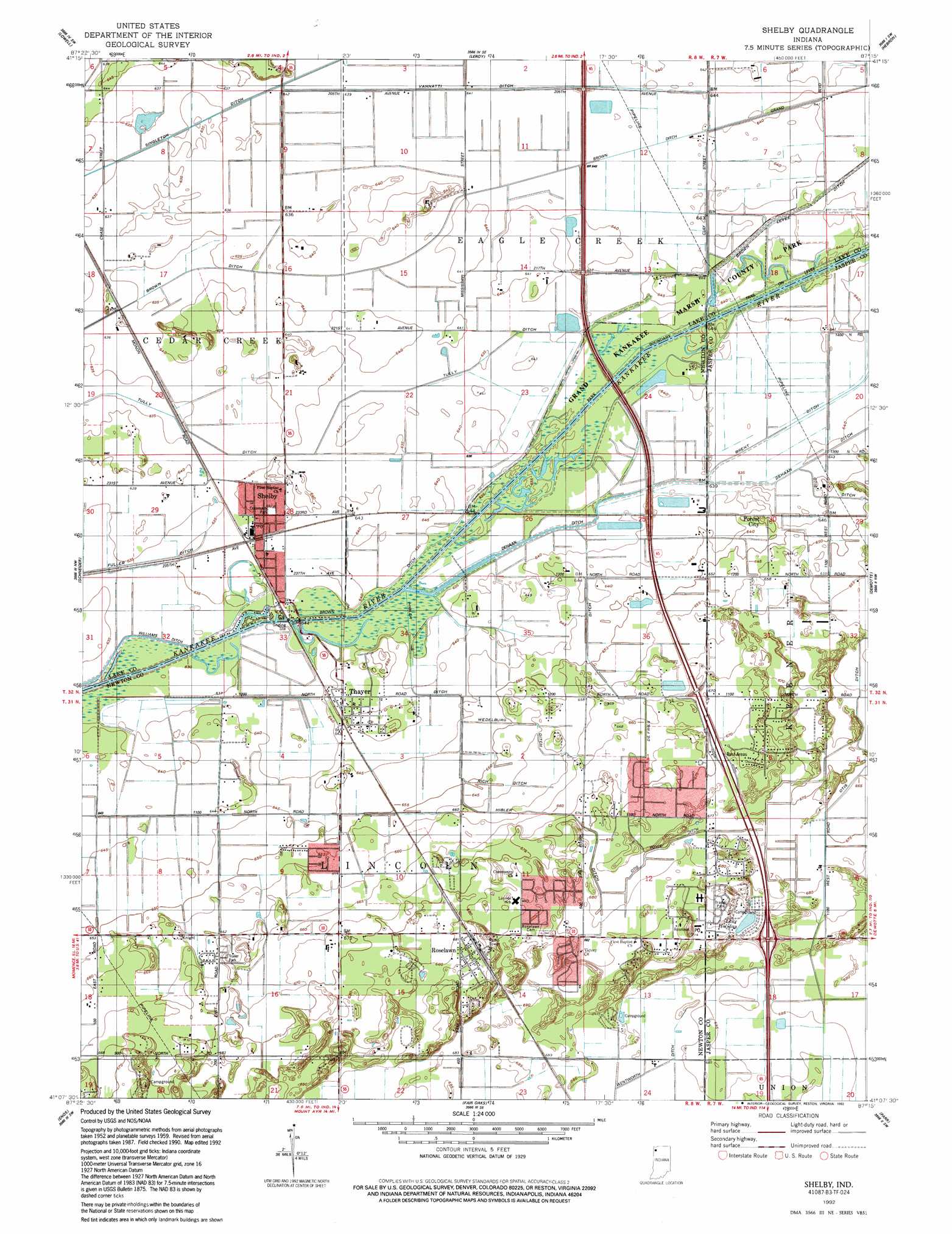
Shelby Topo Map Indiana
To zoom in, hover over the map of Shelby
USGS Topo Quad 41087b3 - 1:24,000 scale
| Topo Map Name: | Shelby |
| USGS Topo Quad ID: | 41087b3 |
| Print Size: | ca. 21 1/4" wide x 27" high |
| Southeast Coordinates: | 41.125° N latitude / 87.25° W longitude |
| Map Center Coordinates: | 41.1875° N latitude / 87.3125° W longitude |
| U.S. State: | IN |
| Filename: | o41087b3.jpg |
| Download Map JPG Image: | Shelby topo map 1:24,000 scale |
| Map Type: | Topographic |
| Topo Series: | 7.5´ |
| Map Scale: | 1:24,000 |
| Source of Map Images: | United States Geological Survey (USGS) |
| Alternate Map Versions: |
Shelby IN 1959, updated 1960 Download PDF Buy paper map Shelby IN 1959, updated 1980 Download PDF Buy paper map Shelby IN 1992, updated 1992 Download PDF Buy paper map Shelby IN 2010 Download PDF Buy paper map Shelby IN 2013 Download PDF Buy paper map Shelby IN 2016 Download PDF Buy paper map |
1:24,000 Topo Quads surrounding Shelby
Dyer |
Saint John |
Crown Point |
Palmer |
Valparaiso |
Beecher East |
Lowell |
Leroy |
Hebron |
Kouts |
Illiana Heights |
Schneider |
Shelby |
Demotte |
Wheatfield |
Leesville |
Enos |
Fair Oaks |
Parr |
Gifford |
Donovan |
Morocco |
Mount Ayr |
Rensselaer |
Mccoysburg |
> Back to 41087a1 at 1:100,000 scale
> Back to 41086a1 at 1:250,000 scale
> Back to U.S. Topo Maps home
Shelby topo map: Gazetteer
Shelby: Airports
Dick Drosts Naked City Airport elevation 206m 675′Naked City Airstrip (historical) elevation 206m 675′
Shelby: Canals
Brown Ditch elevation 194m 636′Defries Ditch elevation 198m 649′
Dehaan Ditch elevation 196m 643′
Hibler Ditch elevation 197m 646′
Otis Ditch elevation 205m 672′
Otis-Boyle Ditch elevation 206m 675′
Rich Ditch elevation 200m 656′
Singleton Ditch elevation 0m 0′
Tully Ditch elevation 195m 639′
Vannatti Ditch elevation 194m 636′
Wedelburg Ditch elevation 199m 652′
Shelby: Lakes
Lake Holiday elevation 210m 688′Shelby: Parks
Shelby Community Park elevation 196m 643′Shelby: Populated Places
Forest City elevation 199m 652′Roselawn elevation 208m 682′
Shelby elevation 195m 639′
Thayer elevation 196m 643′
Shelby digital topo map on disk
Buy this Shelby topo map showing relief, roads, GPS coordinates and other geographical features, as a high-resolution digital map file on DVD:
Northern Illinois, Northern Indiana & Southwestern Michigan
Buy digital topo maps: Northern Illinois, Northern Indiana & Southwestern Michigan