Bradley Topo Map Illinois
To zoom in, hover over the map of Bradley
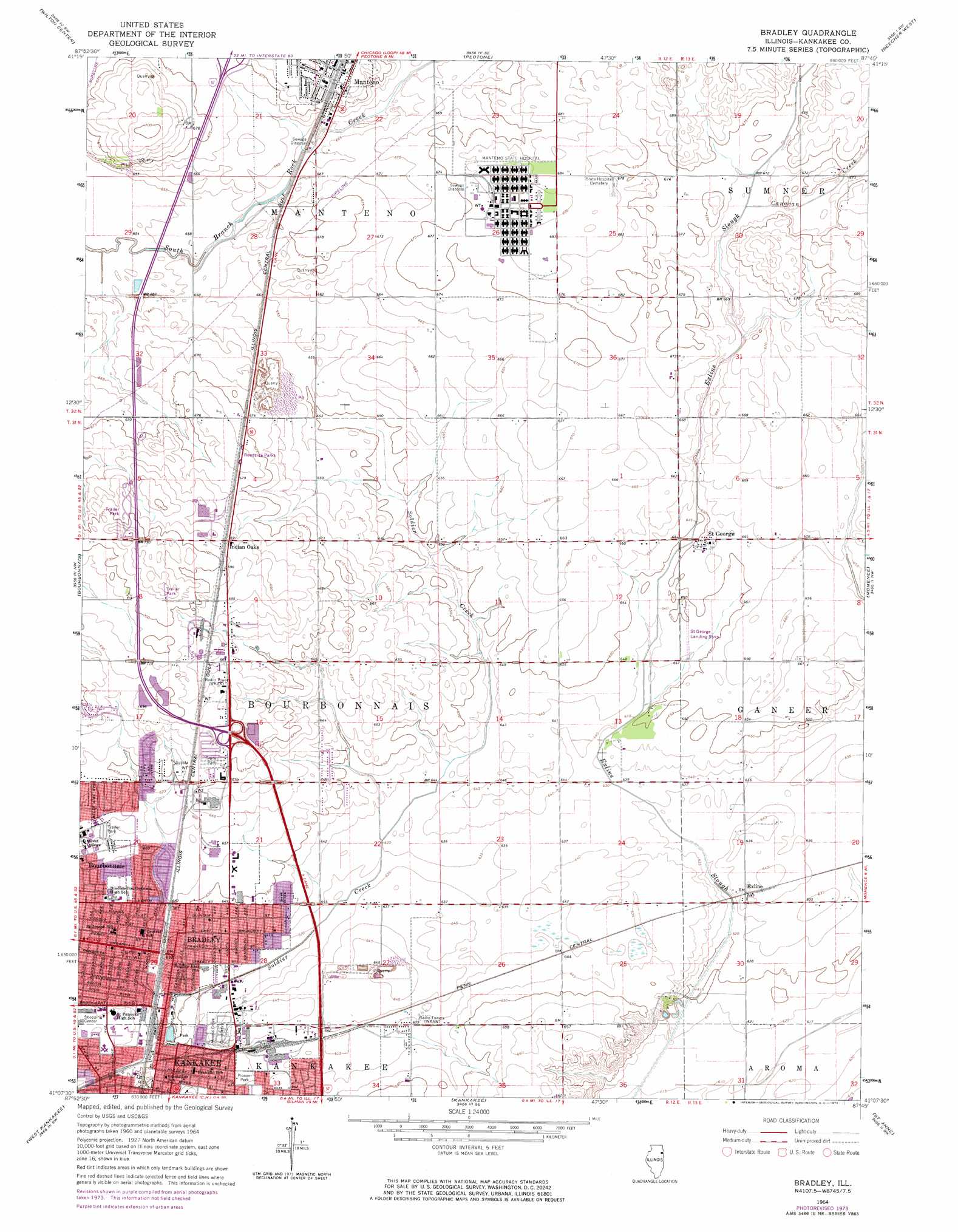
USGS Topo Quad 41087b7 - 1:24,000 scale
| Topo Map Name: | Bradley |
| USGS Topo Quad ID: | 41087b7 |
| Print Size: | ca. 21 1/4" wide x 27" high |
| Southeast Coordinates: | 41.125° N latitude / 87.75° W longitude |
| Map Center Coordinates: | 41.1875° N latitude / 87.8125° W longitude |
| U.S. State: | IL |
| Filename: | o41087b7.jpg |
| Download Map JPG Image: | Bradley topo map 1:24,000 scale |
| Map Type: | Topographic |
| Topo Series: | 7.5´ |
| Map Scale: | 1:24,000 |
| Source of Map Images: | United States Geological Survey (USGS) |
| Alternate Map Versions: |
Bradley IL 1964, updated 1965 Download PDF Buy paper map Bradley IL 1964, updated 1974 Download PDF Buy paper map Bradley IL 1964, updated 1974 Download PDF Buy paper map Bradley IL 2012 Download PDF Buy paper map Bradley IL 2015 Download PDF Buy paper map |
1:24,000 Topo Quads surrounding Bradley
Elwood |
Manhattan |
Frankfort |
Steger |
Dyer |
Symerton |
Wilton Center |
Peotone |
Beecher West |
Beecher East |
Bonfield |
Bourbonnais |
Bradley |
Momence |
Illiana Heights |
Herscher |
West Kankakee |
Kankakee |
Saint Anne |
Leesville |
Piper City Ne |
Clifton |
L'Erable |
Beaverville |
Donovan |
> Back to 41087a1 at 1:100,000 scale
> Back to 41086a1 at 1:250,000 scale
> Back to U.S. Topo Maps home
Bradley topo map: Gazetteer
Bradley: Airports
Benoit Airport elevation 201m 659′Phipps Airport elevation 204m 669′
Saint George Airport elevation 202m 662′
Spangler Airport elevation 205m 672′
Bradley: Crossings
Interchange 315 elevation 211m 692′Bradley: Parks
Lills Park elevation 197m 646′Old Fair Park elevation 191m 626′
Pioneer Park elevation 193m 633′
Bradley: Populated Places
Bradley elevation 194m 636′Exline elevation 194m 636′
Indian Oaks elevation 211m 692′
Saint George elevation 200m 656′
Bradley: Streams
Canavan Creek elevation 203m 666′Farr Creek elevation 198m 649′
Bradley digital topo map on disk
Buy this Bradley topo map showing relief, roads, GPS coordinates and other geographical features, as a high-resolution digital map file on DVD:
Northern Illinois, Northern Indiana & Southwestern Michigan
Buy digital topo maps: Northern Illinois, Northern Indiana & Southwestern Michigan