Palmer Topo Map Indiana
To zoom in, hover over the map of Palmer
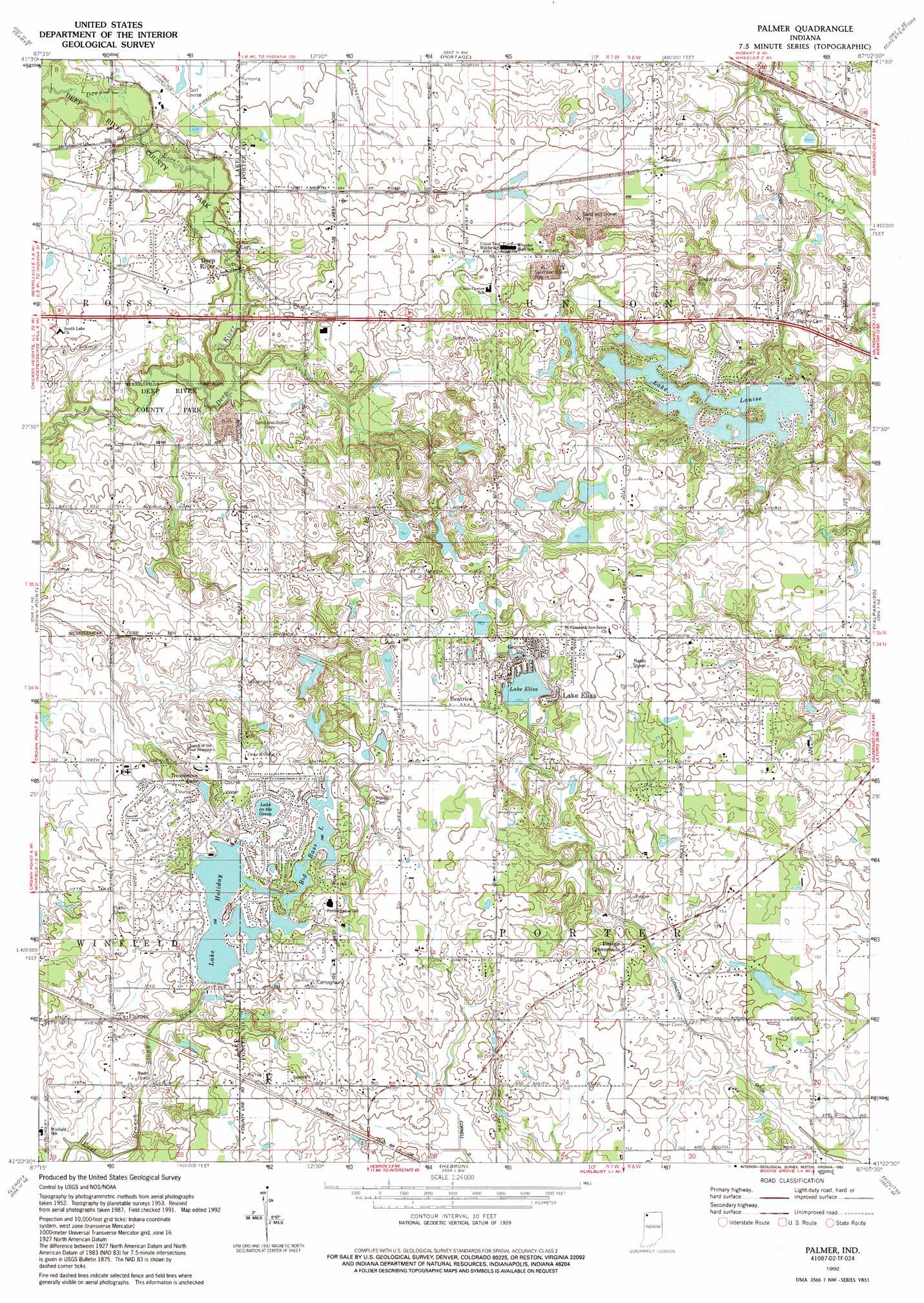
USGS Topo Quad 41087d2 - 1:24,000 scale
| Topo Map Name: | Palmer |
| USGS Topo Quad ID: | 41087d2 |
| Print Size: | ca. 21 1/4" wide x 27" high |
| Southeast Coordinates: | 41.375° N latitude / 87.125° W longitude |
| Map Center Coordinates: | 41.4375° N latitude / 87.1875° W longitude |
| U.S. State: | IN |
| Filename: | o41087d2.jpg |
| Download Map JPG Image: | Palmer topo map 1:24,000 scale |
| Map Type: | Topographic |
| Topo Series: | 7.5´ |
| Map Scale: | 1:24,000 |
| Source of Map Images: | United States Geological Survey (USGS) |
| Alternate Map Versions: |
Palmer IN 1953, updated 1955 Download PDF Buy paper map Palmer IN 1962, updated 1964 Download PDF Buy paper map Palmer IN 1962, updated 1975 Download PDF Buy paper map Palmer IN 1962, updated 1980 Download PDF Buy paper map Palmer IN 1992, updated 1992 Download PDF Buy paper map Palmer IN 2010 Download PDF Buy paper map Palmer IN 2013 Download PDF Buy paper map Palmer IN 2016 Download PDF Buy paper map |
1:24,000 Topo Quads surrounding Palmer
Whiting |
Ogden Dunes |
Dune Acres |
Michigan City West |
|
Highland |
Gary |
Portage |
Chesterton |
Westville |
Saint John |
Crown Point |
Palmer |
Valparaiso |
Wanatah |
Lowell |
Leroy |
Hebron |
Kouts |
La Crosse |
Schneider |
Shelby |
Demotte |
Wheatfield |
San Pierre |
> Back to 41087a1 at 1:100,000 scale
> Back to 41086a1 at 1:250,000 scale
> Back to U.S. Topo Maps home
Palmer topo map: Gazetteer
Palmer: Canals
Ludington Ditch elevation 213m 698′Palmer: Dams
Lake Louise Dam elevation 233m 764′Norman Olson Lake Dam elevation 242m 793′
Palmer: Lakes
Big Bass Lake elevation 227m 744′Lake Eliza elevation 224m 734′
Lake Holiday elevation 224m 734′
Lake on the Green elevation 227m 744′
Trouthaven Lake elevation 226m 741′
Palmer: Parks
Deep River County Park elevation 195m 639′Palmer: Populated Places
Beatrice elevation 238m 780′Deep River elevation 198m 649′
Lake Eliza elevation 237m 777′
Lakes of the Four Seasons elevation 233m 764′
Palmer elevation 225m 738′
Porter Crossroads elevation 231m 757′
Sedley elevation 210m 688′
Palmer: Reservoirs
Lake Louise elevation 233m 764′Norman Olson Lake elevation 242m 793′
Palmer digital topo map on disk
Buy this Palmer topo map showing relief, roads, GPS coordinates and other geographical features, as a high-resolution digital map file on DVD:
Northern Illinois, Northern Indiana & Southwestern Michigan
Buy digital topo maps: Northern Illinois, Northern Indiana & Southwestern Michigan