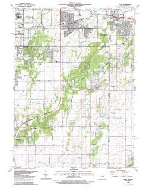
Dyer Topo Map Illinois
To zoom in, hover over the map of Dyer
USGS Topo Quad 41087d5 - 1:24,000 scale
| Topo Map Name: | Dyer |
| USGS Topo Quad ID: | 41087d5 |
| Print Size: | ca. 21 1/4" wide x 27" high |
| Southeast Coordinates: | 41.375° N latitude / 87.5° W longitude |
| Map Center Coordinates: | 41.4375° N latitude / 87.5625° W longitude |
| U.S. States: | IL, IN |
| Filename: | o41087d5.jpg |
| Download Map JPG Image: | Dyer topo map 1:24,000 scale |
| Map Type: | Topographic |
| Topo Series: | 7.5´ |
| Map Scale: | 1:24,000 |
| Source of Map Images: | United States Geological Survey (USGS) |
| Alternate Map Versions: |
Dyer IN 1929, updated 1946 Download PDF Buy paper map Dyer IN 1930 Download PDF Buy paper map Dyer IN 1953, updated 1955 Download PDF Buy paper map Dyer IN 1962, updated 1964 Download PDF Buy paper map Dyer IN 1962, updated 1974 Download PDF Buy paper map Dyer IN 1990, updated 1991 Download PDF Buy paper map Dyer IN 1998, updated 1999 Download PDF Buy paper map Dyer IN 2010 Download PDF Buy paper map Dyer IN 2013 Download PDF Buy paper map Dyer IN 2016 Download PDF Buy paper map |
1:24,000 Topo Quads surrounding Dyer
> Back to 41087a1 at 1:100,000 scale
> Back to 41086a1 at 1:250,000 scale
> Back to U.S. Topo Maps home
Dyer topo map: Gazetteer
Dyer: Airports
Mulderink Heliport elevation 201m 659′Dyer: Canals
Lansing Drainage Ditch elevation 193m 633′Dyer: Dams
Deer Lake Dam elevation 205m 672′Dyer: Parks
Goodenow Grove Forest Preserve elevation 214m 702′Pheasant Hills Park elevation 194m 636′
Plum Creek Forest Preserve elevation 202m 662′
Plum Grove Forest Preserve elevation 229m 751′
Dyer: Populated Places
Brunswick elevation 222m 728′Dyer elevation 195m 639′
Faithorn elevation 221m 725′
Kreitzburg elevation 214m 702′
Lincolnshire elevation 210m 688′
Sauk Village elevation 199m 652′
Willowbrook elevation 218m 715′
Dyer: Reservoirs
Deer Lake elevation 205m 672′Dyer digital topo map on disk
Buy this Dyer topo map showing relief, roads, GPS coordinates and other geographical features, as a high-resolution digital map file on DVD:
Northern Illinois, Northern Indiana & Southwestern Michigan
Buy digital topo maps: Northern Illinois, Northern Indiana & Southwestern Michigan


