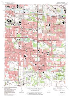
Highland Topo Map Indiana
To zoom in, hover over the map of Highland
USGS Topo Quad 41087e4 - 1:24,000 scale
| Topo Map Name: | Highland |
| USGS Topo Quad ID: | 41087e4 |
| Print Size: | ca. 21 1/4" wide x 27" high |
| Southeast Coordinates: | 41.5° N latitude / 87.375° W longitude |
| Map Center Coordinates: | 41.5625° N latitude / 87.4375° W longitude |
| U.S. State: | IN |
| Filename: | o41087e4.jpg |
| Download Map JPG Image: | Highland topo map 1:24,000 scale |
| Map Type: | Topographic |
| Topo Series: | 7.5´ |
| Map Scale: | 1:24,000 |
| Source of Map Images: | United States Geological Survey (USGS) |
| Alternate Map Versions: |
Highland IN 1953, updated 1955 Download PDF Buy paper map Highland IN 1959, updated 1961 Download PDF Buy paper map Highland IN 1968, updated 1971 Download PDF Buy paper map Highland IN 1968, updated 1980 Download PDF Buy paper map Highland IN 1968, updated 1986 Download PDF Buy paper map Highland IN 1991, updated 1992 Download PDF Buy paper map Highland IN 1998, updated 2001 Download PDF Buy paper map Highland IN 2011 Download PDF Buy paper map Highland IN 2013 Download PDF Buy paper map Highland IN 2016 Download PDF Buy paper map |
1:24,000 Topo Quads surrounding Highland
Englewood |
Jackson Park |
|||
Blue Island |
Lake Calumet |
Whiting |
Ogden Dunes |
|
Harvey |
Calumet City |
Highland |
Gary |
Portage |
Steger |
Dyer |
Saint John |
Crown Point |
Palmer |
Beecher West |
Beecher East |
Lowell |
Leroy |
Hebron |
> Back to 41087e1 at 1:100,000 scale
> Back to 41086a1 at 1:250,000 scale
> Back to U.S. Topo Maps home
Highland topo map: Gazetteer
Highland: Airports
Gary Municipal Airport elevation 179m 587′Griffith Airport elevation 192m 629′
Highland: Canals
Cady Marsh Ditch elevation 186m 610′Hart Ditch elevation 188m 616′
Johnson Ditch elevation 192m 629′
Schererville Ditch elevation 190m 623′
Schoon Ditch elevation 184m 603′
Highland: Crossings
Burr Street Interchange elevation 184m 603′Cline Avenue Interchange elevation 183m 600′
Indianapolis Boulevard Interchange elevation 184m 603′
Kennedy Avenue Interchange elevation 181m 593′
Highland: Parks
Beech Park elevation 182m 597′Bluebird Park elevation 187m 613′
Brantwood Park elevation 183m 600′
Brunswick Park elevation 181m 593′
Central Park elevation 190m 623′
Cheever Park elevation 190m 623′
Circle Park elevation 183m 600′
Columbia Park elevation 179m 587′
Dowling Park elevation 181m 593′
Ellendale Park elevation 187m 613′
Fletcher Park elevation 187m 613′
Franklin Fields Park elevation 192m 629′
Gibson Woods Park elevation 182m 597′
Harding Park elevation 182m 597′
Hessville Park elevation 183m 600′
Homestead Park elevation 180m 590′
Hoosier Prairie State Nature Preserve elevation 190m 623′
Jaycee Park elevation 189m 620′
Jefferson Park elevation 185m 606′
Kennedy Park elevation 180m 590′
Kosciuzko Park elevation 180m 590′
Lakeside Park elevation 188m 616′
Little Turtle Park elevation 183m 600′
Lost Park elevation 182m 597′
Main Square Park elevation 189m 620′
Markley Park elevation 187m 613′
Meadows Park elevation 186m 610′
Memorial Park elevation 181m 593′
Northwood Park elevation 181m 593′
Oak Ridge Prairie County Park elevation 194m 636′
Optimist Park elevation 181m 593′
Orchard Park elevation 185m 606′
Orchard Park elevation 189m 620′
Pettit Park elevation 186m 610′
Phrommer Park elevation 183m 600′
Plum Creek Park elevation 189m 620′
Sheppard Park elevation 189m 620′
Stewart Park elevation 182m 597′
Terrace Park elevation 186m 610′
Twin Creek Park elevation 182m 597′
Wicker Park elevation 181m 593′
Highland: Populated Places
Anderson Mobile Home Park elevation 186m 610′Black Oak elevation 182m 597′
Bonfiglio's Mobile Home Park elevation 181m 593′
Bremerton Mobile Home Park elevation 192m 629′
Char-el Mobile Home Park elevation 188m 616′
Colfax Mobile Home Park elevation 184m 603′
Colonial Mobile Home Park elevation 189m 620′
Gerry Park elevation 184m 603′
Gibson elevation 181m 593′
Glenview Mobile Home Park elevation 189m 620′
Griffith elevation 192m 629′
Hartsdale elevation 191m 626′
Hessville elevation 181m 593′
Highland elevation 190m 623′
Hillcrest Manufactured Housing Community elevation 187m 613′
Honeysuckle Mobile Home Park elevation 195m 639′
Ideal Mobile Home Court elevation 183m 600′
Ivanhoe elevation 181m 593′
IXL Mobile Home Park elevation 182m 597′
Kings Mobile Home Court elevation 189m 620′
Melody Lane Mobile Home Park elevation 186m 610′
Mount Street Mobile Home Park elevation 184m 603′
Noble Mobile Home Park elevation 182m 597′
Osborn elevation 183m 600′
Pine elevation 181m 593′
Ridge Road Mobile Home Community elevation 187m 613′
Sunshine Seven Mobile Home Park elevation 184m 603′
Van Loon elevation 183m 600′
Woodmar elevation 184m 603′
Highland: Post Offices
Griffith Post Office elevation 188m 616′Hessville Station Hammond Post Office elevation 181m 593′
Highland Branch Post Office elevation 183m 600′
Highland digital topo map on disk
Buy this Highland topo map showing relief, roads, GPS coordinates and other geographical features, as a high-resolution digital map file on DVD:
Northern Illinois, Northern Indiana & Southwestern Michigan
Buy digital topo maps: Northern Illinois, Northern Indiana & Southwestern Michigan


