Ogden Dunes Topo Map Indiana
To zoom in, hover over the map of Ogden Dunes
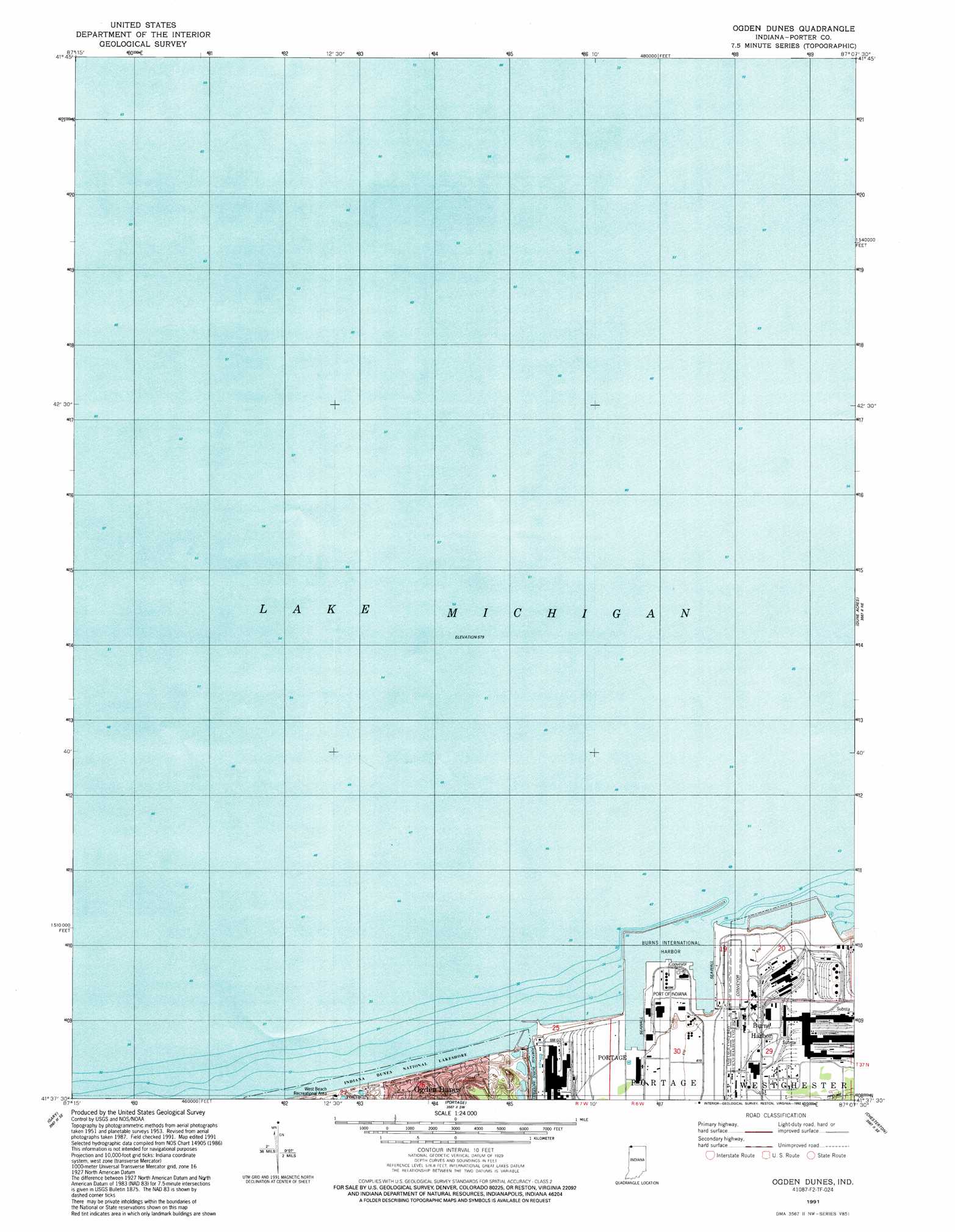
USGS Topo Quad 41087f2 - 1:24,000 scale
| Topo Map Name: | Ogden Dunes |
| USGS Topo Quad ID: | 41087f2 |
| Print Size: | ca. 21 1/4" wide x 27" high |
| Southeast Coordinates: | 41.625° N latitude / 87.125° W longitude |
| Map Center Coordinates: | 41.6875° N latitude / 87.1875° W longitude |
| U.S. State: | IN |
| Filename: | o41087f2.jpg |
| Download Map JPG Image: | Ogden Dunes topo map 1:24,000 scale |
| Map Type: | Topographic |
| Topo Series: | 7.5´ |
| Map Scale: | 1:24,000 |
| Source of Map Images: | United States Geological Survey (USGS) |
| Alternate Map Versions: |
Ogden Dunes IN 1953, updated 1955 Download PDF Buy paper map Ogden Dunes IN 1953, updated 1957 Download PDF Buy paper map Ogden Dunes IN 1968, updated 1980 Download PDF Buy paper map Ogden Dunes IN 1968, updated 1986 Download PDF Buy paper map Ogden Dunes IN 1991, updated 1992 Download PDF Buy paper map Ogden Dunes IN 2011 Download PDF Buy paper map Ogden Dunes IN 2013 Download PDF Buy paper map Ogden Dunes IN 2016 Download PDF Buy paper map |
1:24,000 Topo Quads surrounding Ogden Dunes
Whiting |
Ogden Dunes |
Dune Acres |
Michigan City West |
|
Highland |
Gary |
Portage |
Chesterton |
Westville |
Saint John |
Crown Point |
Palmer |
Valparaiso |
Wanatah |
> Back to 41087e1 at 1:100,000 scale
> Back to 41086a1 at 1:250,000 scale
> Back to U.S. Topo Maps home
Ogden Dunes topo map: Gazetteer
Ogden Dunes: Harbors
Burns International Harbor elevation 175m 574′Burns Waterway Harbor elevation 175m 574′
East Harbor Arm elevation 175m 574′
West Harbor Arm elevation 175m 574′
Ogden Dunes: Populated Places
Burns Harbor elevation 186m 610′Ogden Dunes digital topo map on disk
Buy this Ogden Dunes topo map showing relief, roads, GPS coordinates and other geographical features, as a high-resolution digital map file on DVD:
Northern Illinois, Northern Indiana & Southwestern Michigan
Buy digital topo maps: Northern Illinois, Northern Indiana & Southwestern Michigan