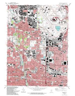
Elmhurst Topo Map Illinois
To zoom in, hover over the map of Elmhurst
USGS Topo Quad 41087h8 - 1:24,000 scale
| Topo Map Name: | Elmhurst |
| USGS Topo Quad ID: | 41087h8 |
| Print Size: | ca. 21 1/4" wide x 27" high |
| Southeast Coordinates: | 41.875° N latitude / 87.875° W longitude |
| Map Center Coordinates: | 41.9375° N latitude / 87.9375° W longitude |
| U.S. State: | IL |
| Filename: | o41087h8.jpg |
| Download Map JPG Image: | Elmhurst topo map 1:24,000 scale |
| Map Type: | Topographic |
| Topo Series: | 7.5´ |
| Map Scale: | 1:24,000 |
| Source of Map Images: | United States Geological Survey (USGS) |
| Alternate Map Versions: |
Elmhurst IL 1928 Download PDF Buy paper map Elmhurst IL 1928 Download PDF Buy paper map Elmhurst IL 1928, updated 1946 Download PDF Buy paper map Elmhurst IL 1953, updated 1956 Download PDF Buy paper map Elmhurst IL 1963, updated 1964 Download PDF Buy paper map Elmhurst IL 1963, updated 1973 Download PDF Buy paper map Elmhurst IL 1963, updated 1981 Download PDF Buy paper map Elmhurst IL 1993, updated 1993 Download PDF Buy paper map Elmhurst IL 1997, updated 1999 Download PDF Buy paper map Elmhurst IL 2012 Download PDF Buy paper map Elmhurst IL 2015 Download PDF Buy paper map |
1:24,000 Topo Quads surrounding Elmhurst
> Back to 41087e1 at 1:100,000 scale
> Back to 41086a1 at 1:250,000 scale
> Back to U.S. Topo Maps home
Elmhurst topo map: Gazetteer
Elmhurst: Airports
Chicago O'Hare International Airport elevation 201m 659′Garden City Garage Heliport elevation 201m 659′
Patten Industries Heliport elevation 215m 705′
Elmhurst: Canals
Bensenville Ditch elevation 197m 646′Elmhurst: Crossings
Interchange 1 elevation 189m 620′Interchange 10 elevation 213m 698′
Interchange 12 elevation 211m 692′
Interchange 13 elevation 205m 672′
Interchange 14 elevation 209m 685′
Interchange 15 elevation 210m 688′
Elmhurst: Mines
Elmhurst Quarry elevation 196m 643′Elmhurst: Parks
Bensenville Ditch County Forest Preserve elevation 201m 659′Berens Park elevation 216m 708′
Bryon Park elevation 207m 679′
Central Park elevation 215m 705′
Cherokee Park elevation 204m 669′
College Mall elevation 212m 695′
Community Park elevation 204m 669′
Conrad Fisher Park elevation 207m 679′
Crestview Park elevation 209m 685′
Cricket Creek County Forest Preserve elevation 202m 662′
Deer Park elevation 210m 688′
Diorio Park elevation 207m 679′
East End Park elevation 205m 672′
Eisenhower Park elevation 198m 649′
Elmhurst Salt Creek County Forest Preserve elevation 201m 659′
Fairchild Park elevation 215m 705′
Fischer Woods County Forest Preserve elevation 212m 695′
Founders Common elevation 208m 682′
Frazen Grove Park elevation 213m 698′
Friendship Plaza elevation 210m 688′
Golden Meadows Park elevation 215m 705′
Gouin Park elevation 195m 639′
Green Meadow Park elevation 204m 669′
Highview Park elevation 207m 679′
Langhorst Field elevation 209m 685′
Lions Park elevation 205m 672′
Maple Meadows County Forest Preserve elevation 210m 688′
Marjorie Davis Park elevation 212m 695′
Memorial Park elevation 192m 629′
Muir Park elevation 218m 715′
North Salt Creek County Forest Preserve elevation 206m 675′
North Terrace Park elevation 216m 708′
Oak Knoll Park elevation 213m 698′
Oak Meadows County Forest Preserve elevation 204m 669′
Pioneer Park elevation 204m 669′
Pluckett Park elevation 206m 675′
Salt Creek County Forest Preserve elevation 207m 679′
Salt Creek Park elevation 208m 682′
Salt Creek Park elevation 193m 633′
Sunrise Park elevation 204m 669′
Sunset Park elevation 207m 679′
Tamera Heights Park elevation 210m 688′
Veterans Park elevation 202m 662′
Washington Park elevation 212m 695′
Westdale Park elevation 199m 652′
Westview Park elevation 207m 679′
White Oak Park elevation 216m 708′
Wilder Park elevation 212m 695′
Wood Dale Grove County Forest Preserve elevation 215m 705′
York Commons Park elevation 204m 669′
Elmhurst: Populated Places
Addison elevation 210m 688′Bellwood elevation 193m 633′
Bensenville elevation 207m 679′
Berkeley elevation 198m 649′
Churchville elevation 212m 695′
Elmhurst elevation 209m 685′
Hillside elevation 200m 656′
Northlake elevation 197m 646′
Rosemont elevation 194m 636′
South Addison elevation 215m 705′
South Elmhurst elevation 204m 669′
Stone Park elevation 195m 639′
Villa Park elevation 214m 702′
Wood Dale elevation 211m 692′
Elmhurst: Post Offices
Addison Post Office elevation 208m 682′Hillside Post Office elevation 200m 656′
Elmhurst: Reservoirs
Lake O'Hare elevation 193m 633′Elmhurst: Streams
Spring Brook elevation 205m 672′Elmhurst: Woods
Fisher Woods elevation 211m 692′Wood Dale Grove elevation 213m 698′
Elmhurst digital topo map on disk
Buy this Elmhurst topo map showing relief, roads, GPS coordinates and other geographical features, as a high-resolution digital map file on DVD:
Northern Illinois, Northern Indiana & Southwestern Michigan
Buy digital topo maps: Northern Illinois, Northern Indiana & Southwestern Michigan


