Buckingham Topo Map Illinois
To zoom in, hover over the map of Buckingham
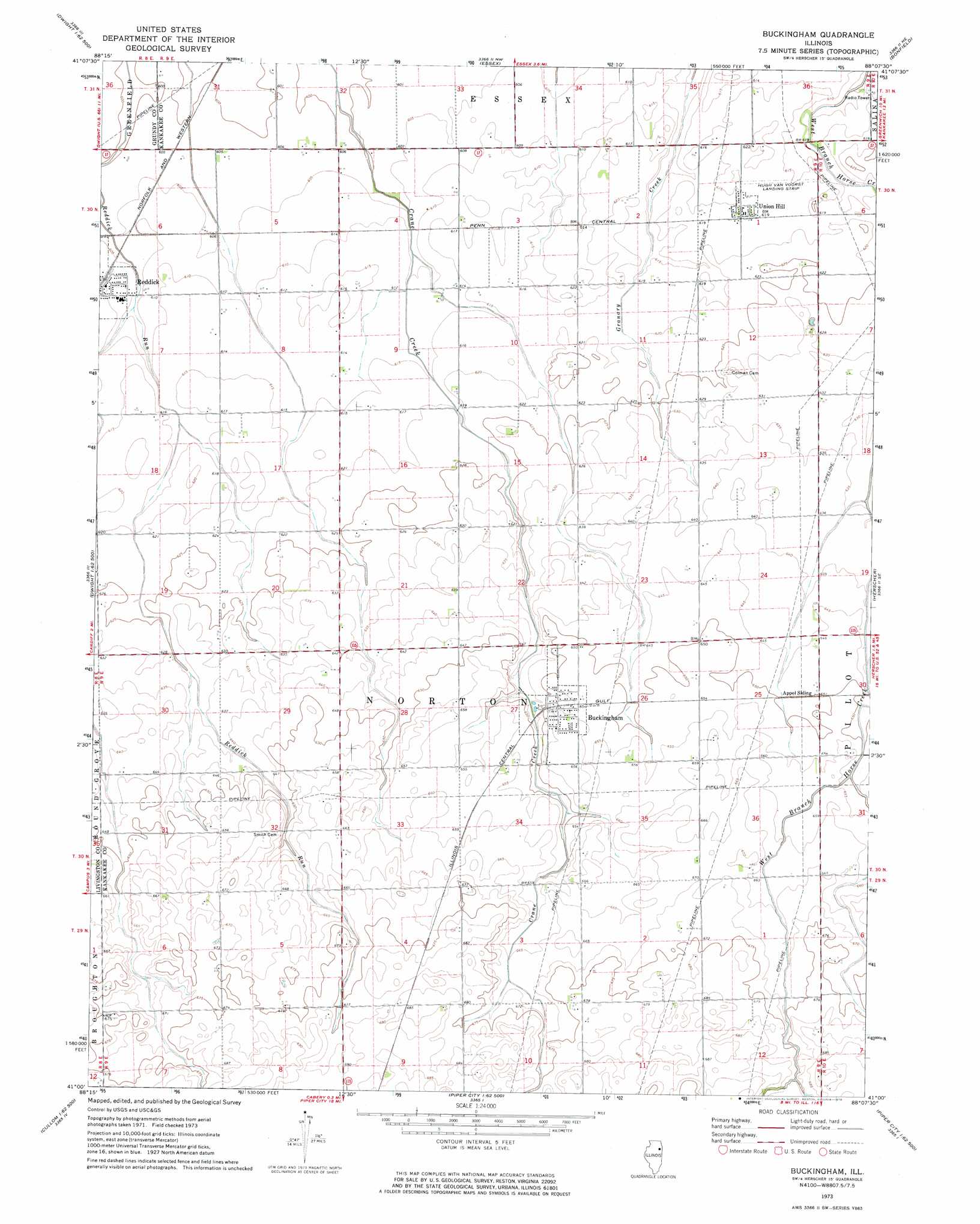
USGS Topo Quad 41088a2 - 1:24,000 scale
| Topo Map Name: | Buckingham |
| USGS Topo Quad ID: | 41088a2 |
| Print Size: | ca. 21 1/4" wide x 27" high |
| Southeast Coordinates: | 41° N latitude / 88.125° W longitude |
| Map Center Coordinates: | 41.0625° N latitude / 88.1875° W longitude |
| U.S. State: | IL |
| Filename: | o41088a2.jpg |
| Download Map JPG Image: | Buckingham topo map 1:24,000 scale |
| Map Type: | Topographic |
| Topo Series: | 7.5´ |
| Map Scale: | 1:24,000 |
| Source of Map Images: | United States Geological Survey (USGS) |
| Alternate Map Versions: |
Buckingham IL 1973, updated 1975 Download PDF Buy paper map Buckingham IL 2012 Download PDF Buy paper map Buckingham IL 2015 Download PDF Buy paper map |
1:24,000 Topo Quads surrounding Buckingham
Morris |
Coal City |
Wilmington |
Symerton |
Wilton Center |
Mazon |
Gardner |
Essex |
Bonfield |
Bourbonnais |
Dwight |
Campus |
Buckingham |
Herscher |
West Kankakee |
Saunemin |
Cullom |
Cabery |
Piper City Ne |
Clifton |
Forrest North |
Chatsworth North |
Piper City |
La Hogue |
Gilman |
> Back to 41088a1 at 1:100,000 scale
> Back to 41088a1 at 1:250,000 scale
> Back to U.S. Topo Maps home
Buckingham topo map: Gazetteer
Buckingham: Airports
Hendrix Airport elevation 200m 656′Hugh Van Voorst Airport elevation 188m 616′
Buckingham: Populated Places
Buckingham elevation 200m 656′Union Hill elevation 188m 616′
Buckingham: Post Offices
Norton Post Office (historical) elevation 197m 646′Buckingham digital topo map on disk
Buy this Buckingham topo map showing relief, roads, GPS coordinates and other geographical features, as a high-resolution digital map file on DVD:
Northern Illinois, Northern Indiana & Southwestern Michigan
Buy digital topo maps: Northern Illinois, Northern Indiana & Southwestern Michigan