Odell Topo Map Illinois
To zoom in, hover over the map of Odell
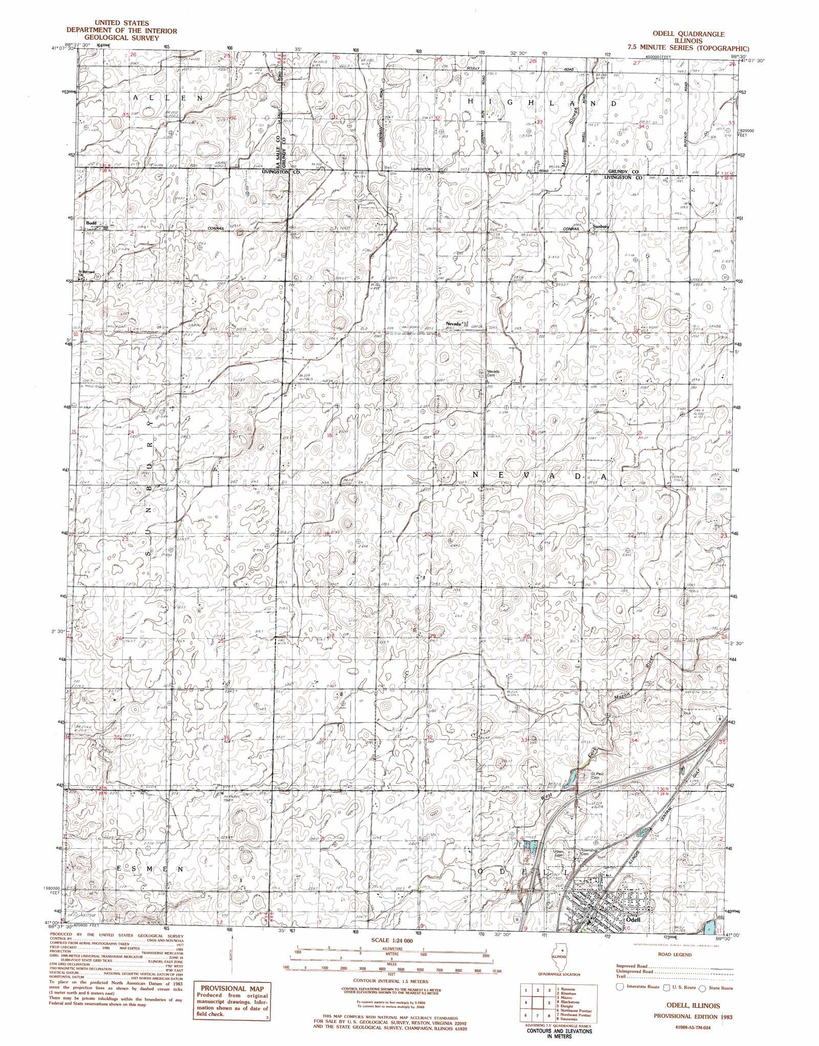
USGS Topo Quad 41088a5 - 1:24,000 scale
| Topo Map Name: | Odell |
| USGS Topo Quad ID: | 41088a5 |
| Print Size: | ca. 21 1/4" wide x 27" high |
| Southeast Coordinates: | 41° N latitude / 88.5° W longitude |
| Map Center Coordinates: | 41.0625° N latitude / 88.5625° W longitude |
| U.S. State: | IL |
| Filename: | o41088a5.jpg |
| Download Map JPG Image: | Odell topo map 1:24,000 scale |
| Map Type: | Topographic |
| Topo Series: | 7.5´ |
| Map Scale: | 1:24,000 |
| Source of Map Images: | United States Geological Survey (USGS) |
| Alternate Map Versions: |
Odell IL 1983, updated 1983 Download PDF Buy paper map Odell IL 2012 Download PDF Buy paper map Odell IL 2015 Download PDF Buy paper map |
1:24,000 Topo Quads surrounding Odell
Ottawa |
Marseilles |
Seneca |
Morris |
Coal City |
Streator North |
Ransom |
Kinsman |
Mazon |
Gardner |
Streator South |
Blackstone |
Odell |
Dwight |
Campus |
Flanagan North |
Northwest Pontiac |
Northeast Pontiac |
Saunemin |
Cullom |
Flanagan South |
Southwest Pontiac |
Southeast Pontiac |
Forrest North |
Chatsworth North |
> Back to 41088a1 at 1:100,000 scale
> Back to 41088a1 at 1:250,000 scale
> Back to U.S. Topo Maps home
Odell topo map: Gazetteer
Odell: Crossings
Interchange 209 elevation 220m 721′Odell: Parks
Sunbury Railroad Prairie Nature Preserve elevation 216m 708′Odell: Populated Places
Adams (historical) elevation 207m 679′Budd elevation 215m 705′
Nevada elevation 207m 679′
Odell elevation 219m 718′
Sunbury elevation 202m 662′
Odell digital topo map on disk
Buy this Odell topo map showing relief, roads, GPS coordinates and other geographical features, as a high-resolution digital map file on DVD:
Northern Illinois, Northern Indiana & Southwestern Michigan
Buy digital topo maps: Northern Illinois, Northern Indiana & Southwestern Michigan