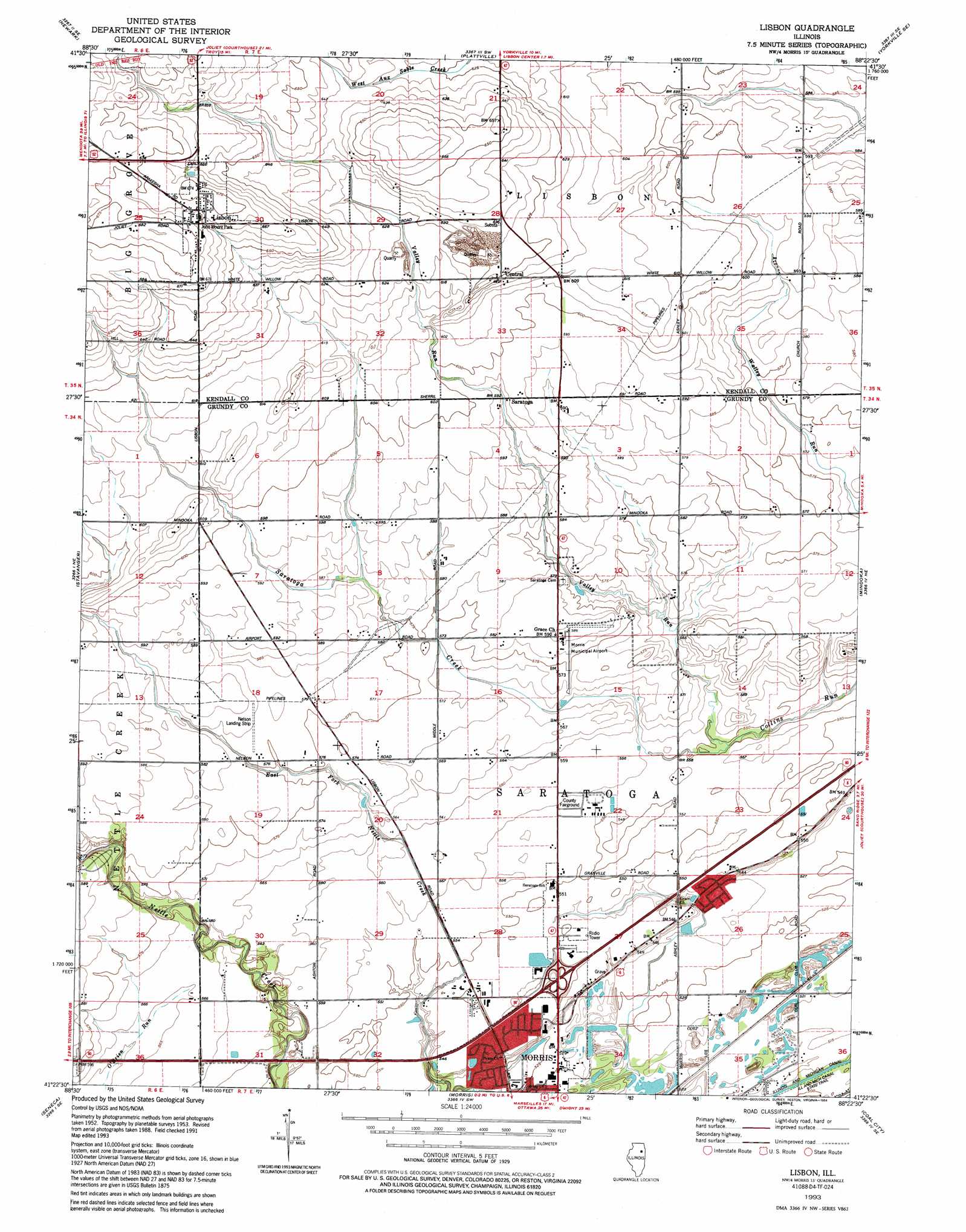
Lisbon Topo Map Illinois
To zoom in, hover over the map of Lisbon
USGS Topo Quad 41088d4 - 1:24,000 scale
| Topo Map Name: | Lisbon |
| USGS Topo Quad ID: | 41088d4 |
| Print Size: | ca. 21 1/4" wide x 27" high |
| Southeast Coordinates: | 41.375° N latitude / 88.375° W longitude |
| Map Center Coordinates: | 41.4375° N latitude / 88.4375° W longitude |
| U.S. State: | IL |
| Filename: | o41088d4.jpg |
| Download Map JPG Image: | Lisbon topo map 1:24,000 scale |
| Map Type: | Topographic |
| Topo Series: | 7.5´ |
| Map Scale: | 1:24,000 |
| Source of Map Images: | United States Geological Survey (USGS) |
| Alternate Map Versions: |
Lisbon IL 1953, updated 1955 Download PDF Buy paper map Lisbon IL 1953, updated 1974 Download PDF Buy paper map Lisbon IL 1953, updated 1989 Download PDF Buy paper map Lisbon IL 1993, updated 1994 Download PDF Buy paper map Lisbon IL 2012 Download PDF Buy paper map Lisbon IL 2015 Download PDF Buy paper map |
1:24,000 Topo Quads surrounding Lisbon
Somonauk |
Plano |
Yorkville |
Aurora South |
Normantown |
Sheridan |
Newark |
Plattville |
Yorkville Se |
Plainfield |
Serena |
Stavanger |
Lisbon |
Minooka |
Channahon |
Marseilles |
Seneca |
Morris |
Coal City |
Wilmington |
Ransom |
Kinsman |
Mazon |
Gardner |
Essex |
> Back to 41088a1 at 1:100,000 scale
> Back to 41088a1 at 1:250,000 scale
> Back to U.S. Topo Maps home
Lisbon topo map: Gazetteer
Lisbon: Airports
Morris Municipal Airport elevation 175m 574′Nelson Airport elevation 177m 580′
Peterson Farms Airport elevation 190m 623′
Lisbon: Crossings
Interchange 112 elevation 169m 554′Lisbon: Dams
Collins Station Cooling Lake Dam elevation 170m 557′Lisbon: Mines
Central Quarry elevation 180m 590′Lisbon: Parks
Grundy County Fairground elevation 169m 554′John Moore Park elevation 203m 666′
Lisbon: Populated Places
Central elevation 192m 629′Fields of Saratoga elevation 167m 547′
Goode Subdivision elevation 154m 505′
Lisbon elevation 204m 669′
Lisbon North elevation 167m 547′
Ridgecrest elevation 163m 534′
Saratoga elevation 182m 597′
White Willow (historical) elevation 181m 593′
Lisbon: Reservoirs
Collins Cooling Pond elevation 170m 557′Lisbon: Streams
Saratoga Creek elevation 167m 547′Valley Run elevation 166m 544′
Lisbon digital topo map on disk
Buy this Lisbon topo map showing relief, roads, GPS coordinates and other geographical features, as a high-resolution digital map file on DVD:
Northern Illinois, Northern Indiana & Southwestern Michigan
Buy digital topo maps: Northern Illinois, Northern Indiana & Southwestern Michigan