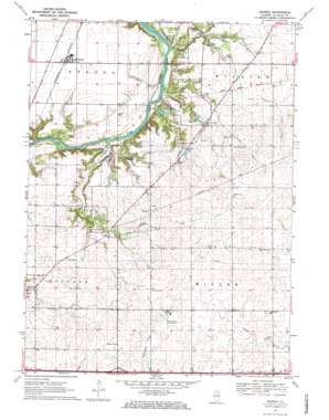
Serena Topo Map Illinois
To zoom in, hover over the map of Serena
USGS Topo Quad 41088d6 - 1:24,000 scale
| Topo Map Name: | Serena |
| USGS Topo Quad ID: | 41088d6 |
| Print Size: | ca. 21 1/4" wide x 27" high |
| Southeast Coordinates: | 41.375° N latitude / 88.625° W longitude |
| Map Center Coordinates: | 41.4375° N latitude / 88.6875° W longitude |
| U.S. State: | IL |
| Filename: | o41088d6.jpg |
| Download Map JPG Image: | Serena topo map 1:24,000 scale |
| Map Type: | Topographic |
| Topo Series: | 7.5´ |
| Map Scale: | 1:24,000 |
| Source of Map Images: | United States Geological Survey (USGS) |
| Alternate Map Versions: |
Serena IL 1970, updated 1972 Download PDF Buy paper map Serena IL 1970, updated 1972 Download PDF Buy paper map Serena IL 2012 Download PDF Buy paper map Serena IL 2015 Download PDF Buy paper map |
1:24,000 Topo Quads surrounding Serena
> Back to 41088a1 at 1:100,000 scale
> Back to 41088a1 at 1:250,000 scale
> Back to U.S. Topo Maps home
Serena topo map: Gazetteer
Serena: Airports
Longview Airport elevation 218m 715′Peacock Airport elevation 190m 623′
Prairie Lake Hunt Club Airport elevation 229m 751′
Serena: Crossings
Interchange 97 elevation 224m 734′Serena: Dams
Lake Herman Dam elevation 187m 613′Serena: Islands
Indian Island elevation 156m 511′Serena: Parks
Norwegian Settlers State Memorial elevation 191m 626′Serena: Populated Places
Danway elevation 213m 698′Norway elevation 195m 639′
Serena elevation 193m 633′
Serena: Post Offices
Serena Post Office elevation 193m 633′Serena: Reservoirs
Lake Herman elevation 187m 613′Serena: Streams
Brumbach Creek elevation 156m 511′Mission Creek elevation 158m 518′
Serena digital topo map on disk
Buy this Serena topo map showing relief, roads, GPS coordinates and other geographical features, as a high-resolution digital map file on DVD:
Northern Illinois, Northern Indiana & Southwestern Michigan
Buy digital topo maps: Northern Illinois, Northern Indiana & Southwestern Michigan


