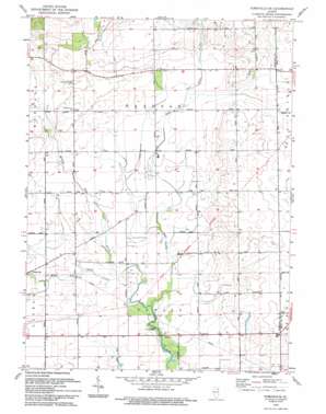
Yorkville Se Topo Map Illinois
To zoom in, hover over the map of Yorkville Se
USGS Topo Quad 41088e3 - 1:24,000 scale
| Topo Map Name: | Yorkville Se |
| USGS Topo Quad ID: | 41088e3 |
| Print Size: | ca. 21 1/4" wide x 27" high |
| Southeast Coordinates: | 41.5° N latitude / 88.25° W longitude |
| Map Center Coordinates: | 41.5625° N latitude / 88.3125° W longitude |
| U.S. State: | IL |
| Filename: | o41088e3.jpg |
| Download Map JPG Image: | Yorkville Se topo map 1:24,000 scale |
| Map Type: | Topographic |
| Topo Series: | 7.5´ |
| Map Scale: | 1:24,000 |
| Source of Map Images: | United States Geological Survey (USGS) |
| Alternate Map Versions: |
Yorkville SE IL 1953, updated 1955 Download PDF Buy paper map Yorkville SE IL 1953, updated 1974 Download PDF Buy paper map Yorkville SE IL 1953, updated 1974 Download PDF Buy paper map Yorkville SE IL 1993, updated 1994 Download PDF Buy paper map Yorkville SE IL 2012 Download PDF Buy paper map Yorkville SE IL 2015 Download PDF Buy paper map |
1:24,000 Topo Quads surrounding Yorkville Se
> Back to 41088e1 at 1:100,000 scale
> Back to 41088a1 at 1:250,000 scale
> Back to U.S. Topo Maps home
Yorkville Se topo map: Gazetteer
Yorkville Se: Airports
Bushby RLA Airport elevation 193m 633′Rileys Field elevation 199m 652′
Rossis Farm Airport elevation 176m 577′
Yorkville Se: Parks
Baker County Forest Preserve elevation 174m 570′Houses Grove Forest Preserve elevation 176m 577′
Yorkville Se: Post Offices
Kendall Post Office (historical) elevation 201m 659′Yorkville Se: Streams
East Aux Sable Creek elevation 174m 570′Little Slough Creek elevation 176m 577′
Middle Aux Sable Creek elevation 174m 570′
West Aux Sable Creek elevation 174m 570′
Yorkville Se: Woods
Aux Sable Grove (historical) elevation 224m 734′Lone Tree Grove elevation 194m 636′
Yorkville Se digital topo map on disk
Buy this Yorkville Se topo map showing relief, roads, GPS coordinates and other geographical features, as a high-resolution digital map file on DVD:
Northern Illinois, Northern Indiana & Southwestern Michigan
Buy digital topo maps: Northern Illinois, Northern Indiana & Southwestern Michigan


