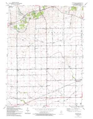
Plattville Topo Map Illinois
To zoom in, hover over the map of Plattville
USGS Topo Quad 41088e4 - 1:24,000 scale
| Topo Map Name: | Plattville |
| USGS Topo Quad ID: | 41088e4 |
| Print Size: | ca. 21 1/4" wide x 27" high |
| Southeast Coordinates: | 41.5° N latitude / 88.375° W longitude |
| Map Center Coordinates: | 41.5625° N latitude / 88.4375° W longitude |
| U.S. State: | IL |
| Filename: | o41088e4.jpg |
| Download Map JPG Image: | Plattville topo map 1:24,000 scale |
| Map Type: | Topographic |
| Topo Series: | 7.5´ |
| Map Scale: | 1:24,000 |
| Source of Map Images: | United States Geological Survey (USGS) |
| Alternate Map Versions: |
Plattville IL 1953, updated 1955 Download PDF Buy paper map Plattville IL 1953, updated 1974 Download PDF Buy paper map Plattville IL 1993, updated 1994 Download PDF Buy paper map Plattville IL 2012 Download PDF Buy paper map Plattville IL 2015 Download PDF Buy paper map |
1:24,000 Topo Quads surrounding Plattville
> Back to 41088e1 at 1:100,000 scale
> Back to 41088a1 at 1:250,000 scale
> Back to U.S. Topo Maps home
Plattville topo map: Gazetteer
Plattville: Parks
Harris County Forest Preserve elevation 224m 734′Plattville: Populated Places
Ament Corners elevation 215m 705′Fox elevation 202m 662′
Helmar elevation 216m 708′
Kentland elevation 204m 669′
Knob Hill elevation 234m 767′
Lisbon Center elevation 196m 643′
Pavillion elevation 229m 751′
Plattville elevation 181m 593′
Plattville: Streams
Lisbon Creek elevation 179m 587′Plattville: Woods
Long Grove elevation 225m 738′Specie Grove elevation 217m 711′
Plattville digital topo map on disk
Buy this Plattville topo map showing relief, roads, GPS coordinates and other geographical features, as a high-resolution digital map file on DVD:
Northern Illinois, Northern Indiana & Southwestern Michigan
Buy digital topo maps: Northern Illinois, Northern Indiana & Southwestern Michigan


