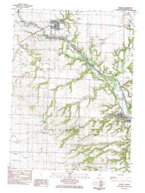
Wyanet Topo Map Illinois
To zoom in, hover over the map of Wyanet
USGS Topo Quad 41089c5 - 1:24,000 scale
| Topo Map Name: | Wyanet |
| USGS Topo Quad ID: | 41089c5 |
| Print Size: | ca. 21 1/4" wide x 27" high |
| Southeast Coordinates: | 41.25° N latitude / 89.5° W longitude |
| Map Center Coordinates: | 41.3125° N latitude / 89.5625° W longitude |
| U.S. State: | IL |
| Filename: | o41089c5.jpg |
| Download Map JPG Image: | Wyanet topo map 1:24,000 scale |
| Map Type: | Topographic |
| Topo Series: | 7.5´ |
| Map Scale: | 1:24,000 |
| Source of Map Images: | United States Geological Survey (USGS) |
| Alternate Map Versions: |
Wyanet IL 1983, updated 1984 Download PDF Buy paper map Wyanet IL 2012 Download PDF Buy paper map Wyanet IL 2015 Download PDF Buy paper map |
1:24,000 Topo Quads surrounding Wyanet
> Back to 41089a1 at 1:100,000 scale
> Back to 41088a1 at 1:250,000 scale
> Back to U.S. Topo Maps home
Wyanet topo map: Gazetteer
Wyanet: Airports
Eckberg Airport elevation 203m 666′Wyanet: Cliffs
Cedar Bluff elevation 160m 524′Wyanet: Dams
Bolton Lakes Dam elevation 176m 577′Harmon Pond Dam elevation 219m 718′
Lock Number 10 elevation 157m 515′
Lock Number 11 elevation 162m 531′
Lock Number 12 elevation 160m 524′
Lock Number 13 elevation 164m 538′
Lock Number 14 elevation 169m 554′
Lock Number 15 elevation 173m 567′
Lock Number 16 elevation 172m 564′
Lock Number 17 elevation 180m 590′
Lock Number 18 elevation 183m 600′
Lock Number 19 elevation 186m 610′
Lock Number 20 elevation 192m 629′
Lock Number 21 elevation 188m 616′
Tiskilwa Watershed Structure Number 1 Dam elevation 225m 738′
Tiskilwa Watershed Structure Number 2 Dam elevation 172m 564′
Tiskilwa Watershed Structure Number 4 Dam elevation 187m 613′
Tiskilwa Watershed Structure Number 5 Dam elevation 164m 538′
Wyanet: Populated Places
Providence elevation 282m 925′Tiskilwa elevation 158m 518′
Wyanet elevation 201m 659′
Wyanet: Post Offices
Tiskilwa Post Office elevation 159m 521′Wyanet Post Office elevation 201m 659′
Wyanet: Reservoirs
Bolton Lakes elevation 176m 577′Harmon Pond elevation 219m 718′
Menno-Haven Lake elevation 225m 738′
Twin Faun Lake elevation 164m 538′
Wyanet: Streams
Pond Creek elevation 173m 567′Rocky Run elevation 151m 495′
West Bureau Creek elevation 158m 518′
Wyanet digital topo map on disk
Buy this Wyanet topo map showing relief, roads, GPS coordinates and other geographical features, as a high-resolution digital map file on DVD:
Northern Illinois, Northern Indiana & Southwestern Michigan
Buy digital topo maps: Northern Illinois, Northern Indiana & Southwestern Michigan


