Mendota East Topo Map Illinois
To zoom in, hover over the map of Mendota East
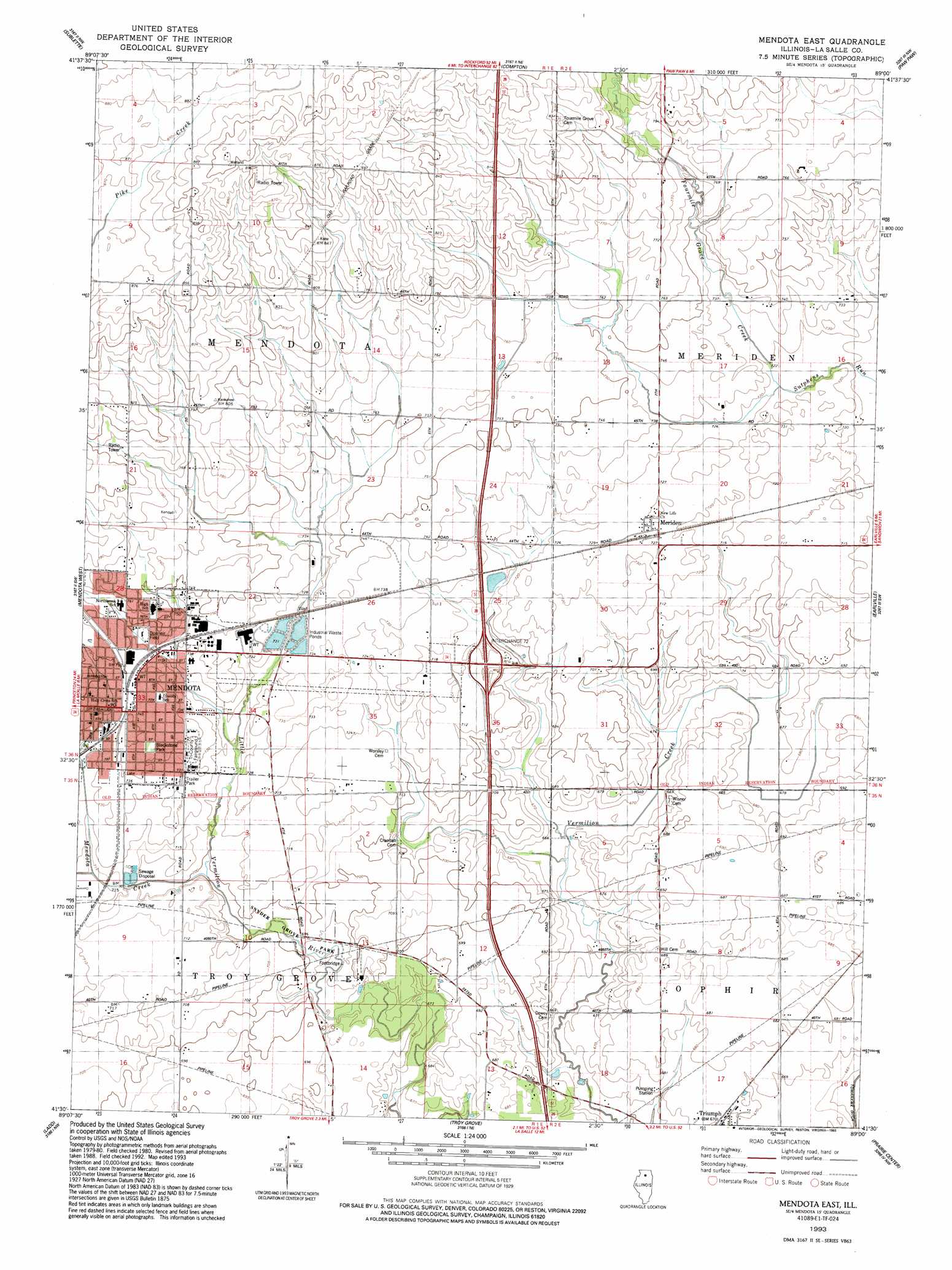
USGS Topo Quad 41089e1 - 1:24,000 scale
| Topo Map Name: | Mendota East |
| USGS Topo Quad ID: | 41089e1 |
| Print Size: | ca. 21 1/4" wide x 27" high |
| Southeast Coordinates: | 41.5° N latitude / 89° W longitude |
| Map Center Coordinates: | 41.5625° N latitude / 89.0625° W longitude |
| U.S. State: | IL |
| Filename: | o41089e1.jpg |
| Download Map JPG Image: | Mendota East topo map 1:24,000 scale |
| Map Type: | Topographic |
| Topo Series: | 7.5´ |
| Map Scale: | 1:24,000 |
| Source of Map Images: | United States Geological Survey (USGS) |
| Alternate Map Versions: |
Mendota East IL 1982, updated 1982 Download PDF Buy paper map Mendota East IL 1993, updated 1993 Download PDF Buy paper map Mendota East IL 2012 Download PDF Buy paper map Mendota East IL 2015 Download PDF Buy paper map |
1:24,000 Topo Quads surrounding Mendota East
Franklin Grove |
Ashton |
Steward |
Lee |
Waterman |
Amboy |
Sublette |
Compton |
Paw Paw |
Shabbona Grove |
Lamoille |
Mendota West |
Mendota East |
Earlville |
Leland |
Malden |
Ladd |
Troy Grove |
Prairie Center |
Wedron |
Depue |
Spring Valley |
La Salle |
Starved Rock |
Ottawa |
> Back to 41089e1 at 1:100,000 scale
> Back to 41088a1 at 1:250,000 scale
> Back to U.S. Topo Maps home
Mendota East topo map: Gazetteer
Mendota East: Crossings
Interchange 72 elevation 218m 715′Mendota East: Parks
Apple Orchard Park elevation 222m 728′Blackstone Park elevation 226m 741′
Mendota Swimming Pool elevation 230m 754′
Snyder Grove Park elevation 211m 692′
Mendota East: Populated Places
Mendota elevation 226m 741′Meriden elevation 221m 725′
Mendota East: Post Offices
Mendota Post Office elevation 226m 741′Mendota East: Streams
Fourmile Grove Creek elevation 217m 711′Mendota Creek elevation 211m 692′
Mendota East digital topo map on disk
Buy this Mendota East topo map showing relief, roads, GPS coordinates and other geographical features, as a high-resolution digital map file on DVD:
Northern Illinois, Northern Indiana & Southwestern Michigan
Buy digital topo maps: Northern Illinois, Northern Indiana & Southwestern Michigan