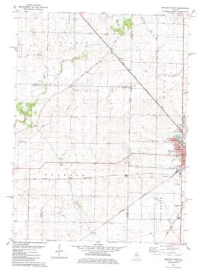
Mendota West Topo Map Illinois
To zoom in, hover over the map of Mendota West
USGS Topo Quad 41089e2 - 1:24,000 scale
| Topo Map Name: | Mendota West |
| USGS Topo Quad ID: | 41089e2 |
| Print Size: | ca. 21 1/4" wide x 27" high |
| Southeast Coordinates: | 41.5° N latitude / 89.125° W longitude |
| Map Center Coordinates: | 41.5625° N latitude / 89.1875° W longitude |
| U.S. State: | IL |
| Filename: | o41089e2.jpg |
| Download Map JPG Image: | Mendota West topo map 1:24,000 scale |
| Map Type: | Topographic |
| Topo Series: | 7.5´ |
| Map Scale: | 1:24,000 |
| Source of Map Images: | United States Geological Survey (USGS) |
| Alternate Map Versions: |
Mendota West IL 1982, updated 1982 Download PDF Buy paper map Mendota West IL 2012 Download PDF Buy paper map Mendota West IL 2015 Download PDF Buy paper map |
1:24,000 Topo Quads surrounding Mendota West
> Back to 41089e1 at 1:100,000 scale
> Back to 41088a1 at 1:250,000 scale
> Back to U.S. Topo Maps home
Mendota West topo map: Gazetteer
Mendota West: Airports
Grandpas Farm Mendota Airport elevation 219m 718′Keutzer Airport elevation 241m 790′
Mendota Community Hospital Heliport elevation 234m 767′
Otterbach Farm Airport elevation 265m 869′
Rapp Landing Strip elevation 267m 875′
Mendota West: Dams
Lake Mendota Dam elevation 233m 764′Mendota West: Lakes
Lake Mendota elevation 233m 764′Mendota West: Parks
Bartlett Woods Nature Preserve elevation 267m 875′Hetzler Cemetery Prairie Nature Preserve elevation 246m 807′
Mendota Lake Park elevation 233m 764′
Mendota West: Populated Places
Clarion elevation 225m 738′Henkel elevation 256m 839′
Wendel elevation 244m 800′
Mendota West: Woods
Knoxe Grove elevation 261m 856′Mendota West digital topo map on disk
Buy this Mendota West topo map showing relief, roads, GPS coordinates and other geographical features, as a high-resolution digital map file on DVD:
Northern Illinois, Northern Indiana & Southwestern Michigan
Buy digital topo maps: Northern Illinois, Northern Indiana & Southwestern Michigan


