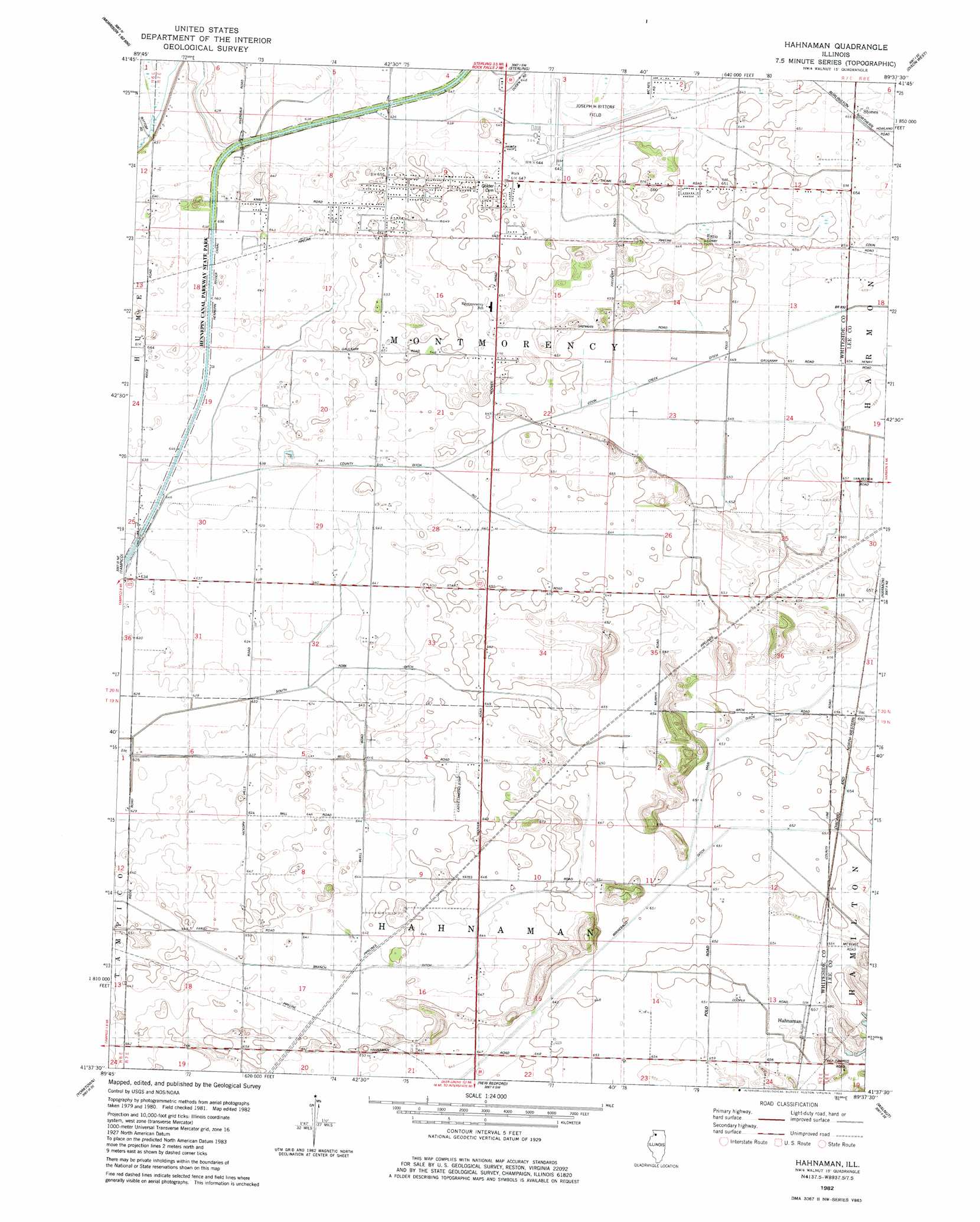
Hahnaman Topo Map Illinois
To zoom in, hover over the map of Hahnaman
USGS Topo Quad 41089f6 - 1:24,000 scale
| Topo Map Name: | Hahnaman |
| USGS Topo Quad ID: | 41089f6 |
| Print Size: | ca. 21 1/4" wide x 27" high |
| Southeast Coordinates: | 41.625° N latitude / 89.625° W longitude |
| Map Center Coordinates: | 41.6875° N latitude / 89.6875° W longitude |
| U.S. State: | IL |
| Filename: | o41089f6.jpg |
| Download Map JPG Image: | Hahnaman topo map 1:24,000 scale |
| Map Type: | Topographic |
| Topo Series: | 7.5´ |
| Map Scale: | 1:24,000 |
| Source of Map Images: | United States Geological Survey (USGS) |
| Alternate Map Versions: |
Hahnaman IL 1982, updated 1982 Download PDF Buy paper map Hahnaman IL 2012 Download PDF Buy paper map Hahnaman IL 2015 Download PDF Buy paper map |
1:24,000 Topo Quads surrounding Hahnaman
Fairhaven |
Milledgeville |
Hazelhurst |
Polo |
Grand Detour |
Morrison |
Como |
Sterling |
Dixon West |
Dixon East |
Prophetstown |
Tampico |
Hahnaman |
Harmon |
Walton |
Hooppole |
Yorktown |
New Bedford |
Walnut |
Ohio |
Annawan |
Mineral |
Manlius |
Buoane |
Princeton North |
> Back to 41089e1 at 1:100,000 scale
> Back to 41088a1 at 1:250,000 scale
> Back to U.S. Topo Maps home
Hahnaman topo map: Gazetteer
Hahnaman: Airports
Cadys Landing Strip elevation 198m 649′Whiteside County Airport elevation 195m 639′
Hahnaman: Canals
Branch F Ditch elevation 195m 639′South Fork Ditch elevation 192m 629′
Winnebago Ditch elevation 196m 643′
Hahnaman: Lakes
Goose Lake elevation 198m 649′Hahnaman: Parks
Foley Sand Prairie Nature Preserve elevation 201m 659′Hahnaman: Populated Places
Hahnaman elevation 200m 656′Hahnaman digital topo map on disk
Buy this Hahnaman topo map showing relief, roads, GPS coordinates and other geographical features, as a high-resolution digital map file on DVD:
Northern Illinois, Northern Indiana & Southwestern Michigan
Buy digital topo maps: Northern Illinois, Northern Indiana & Southwestern Michigan