Wataga Topo Map Illinois
To zoom in, hover over the map of Wataga
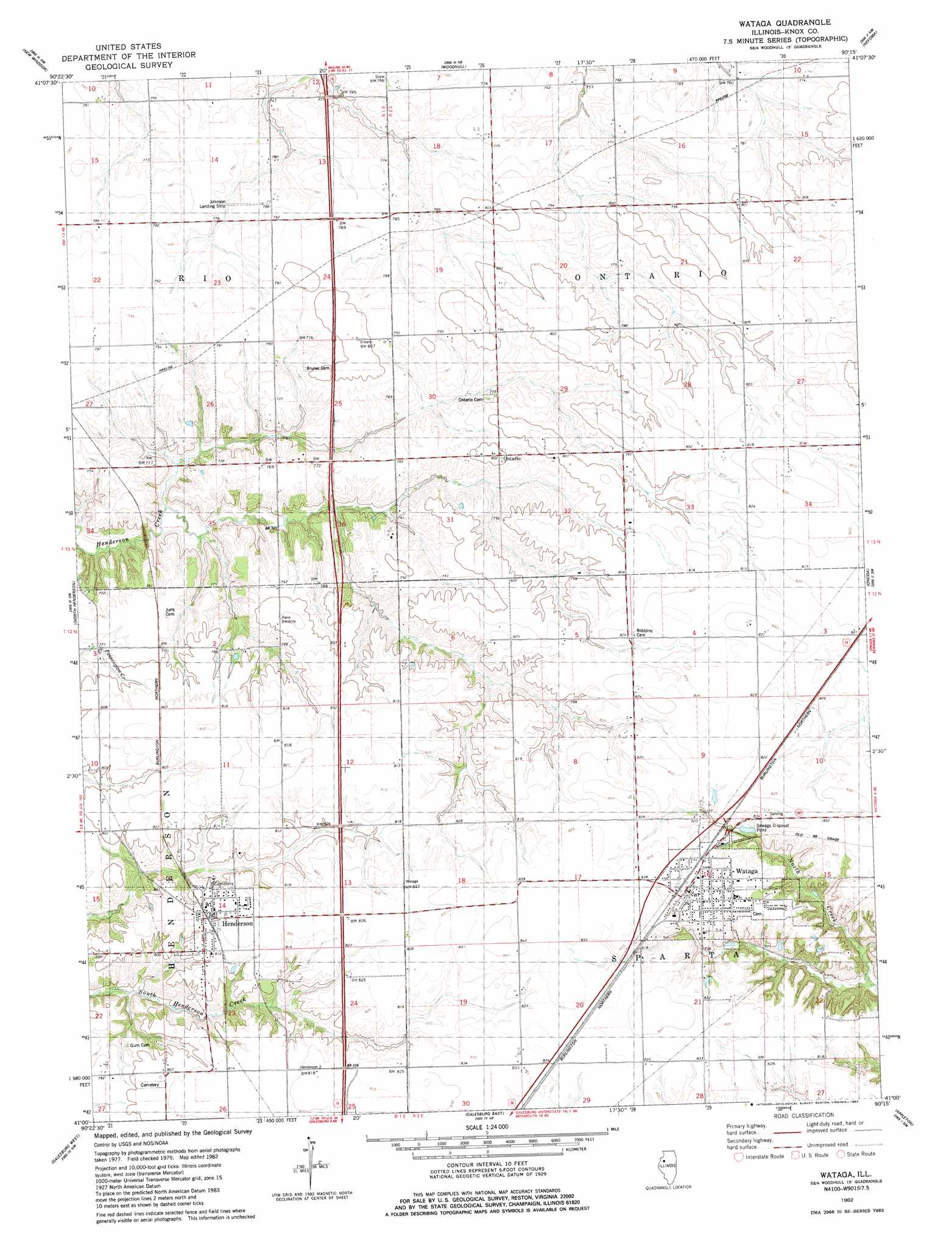
USGS Topo Quad 41090a3 - 1:24,000 scale
| Topo Map Name: | Wataga |
| USGS Topo Quad ID: | 41090a3 |
| Print Size: | ca. 21 1/4" wide x 27" high |
| Southeast Coordinates: | 41° N latitude / 90.25° W longitude |
| Map Center Coordinates: | 41.0625° N latitude / 90.3125° W longitude |
| U.S. State: | IL |
| Filename: | o41090a3.jpg |
| Download Map JPG Image: | Wataga topo map 1:24,000 scale |
| Map Type: | Topographic |
| Topo Series: | 7.5´ |
| Map Scale: | 1:24,000 |
| Source of Map Images: | United States Geological Survey (USGS) |
| Alternate Map Versions: |
Wataga IL 1982, updated 1983 Download PDF Buy paper map Wataga IL 2012 Download PDF Buy paper map Wataga IL 2015 Download PDF Buy paper map |
1:24,000 Topo Quads surrounding Wataga
Matherville |
Orion |
Andover |
Cambridge |
German Corner |
Viola |
New Windsor |
Woodhull |
Nekoma |
Galva |
Alexis |
North Henderson |
Wataga |
Oneida |
Victoria |
Cameron |
Galesburg West |
Galesburg East |
Appleton |
Williamsfield |
Berwick |
Abingdon |
De Long |
Maquon |
Yates City |
> Back to 41090a1 at 1:100,000 scale
> Back to 41090a1 at 1:250,000 scale
> Back to U.S. Topo Maps home
Wataga topo map: Gazetteer
Wataga: Airports
Johnson Landing Strip elevation 239m 784′Wataga: Populated Places
Henderson elevation 249m 816′Ontario elevation 246m 807′
Wataga elevation 253m 830′
Wataga digital topo map on disk
Buy this Wataga topo map showing relief, roads, GPS coordinates and other geographical features, as a high-resolution digital map file on DVD: