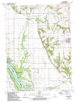
Joy Topo Map Illinois
To zoom in, hover over the map of Joy
USGS Topo Quad 41090b8 - 1:24,000 scale
| Topo Map Name: | Joy |
| USGS Topo Quad ID: | 41090b8 |
| Print Size: | ca. 21 1/4" wide x 27" high |
| Southeast Coordinates: | 41.125° N latitude / 90.875° W longitude |
| Map Center Coordinates: | 41.1875° N latitude / 90.9375° W longitude |
| U.S. States: | IL, IA |
| Filename: | o41090b8.jpg |
| Download Map JPG Image: | Joy topo map 1:24,000 scale |
| Map Type: | Topographic |
| Topo Series: | 7.5´ |
| Map Scale: | 1:24,000 |
| Source of Map Images: | United States Geological Survey (USGS) |
| Alternate Map Versions: |
Joy IL 1953, updated 1958 Download PDF Buy paper map Joy IL 1953, updated 1977 Download PDF Buy paper map Joy IL 1991, updated 1992 Download PDF Buy paper map Joy IL 2010 Download PDF Buy paper map Joy IL 2012 Download PDF Buy paper map Joy IL 2015 Download PDF Buy paper map |
1:24,000 Topo Quads surrounding Joy
> Back to 41090a1 at 1:100,000 scale
> Back to 41090a1 at 1:250,000 scale
> Back to U.S. Topo Maps home
Joy topo map: Gazetteer
Joy: Airports
M and J Air Incorporated Airport elevation 207m 679′Joy: Dams
Morrison Lake Dam elevation 192m 629′Joy: Islands
Corsepius Island elevation 165m 541′Joy: Populated Places
Arpee elevation 176m 577′Joy elevation 209m 685′
Mannon elevation 176m 577′
New Boston elevation 173m 567′
Joy: Reservoirs
Morrison Lake elevation 192m 629′Joy: Streams
Big Chief Run elevation 170m 557′Camp Creek elevation 176m 577′
Edwards River elevation 164m 538′
Mad River elevation 167m 547′
Winters Creek elevation 170m 557′
Joy digital topo map on disk
Buy this Joy topo map showing relief, roads, GPS coordinates and other geographical features, as a high-resolution digital map file on DVD:


