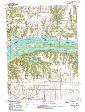
Montpelier Topo Map Illinois
To zoom in, hover over the map of Montpelier
USGS Topo Quad 41090d7 - 1:24,000 scale
| Topo Map Name: | Montpelier |
| USGS Topo Quad ID: | 41090d7 |
| Print Size: | ca. 21 1/4" wide x 27" high |
| Southeast Coordinates: | 41.375° N latitude / 90.75° W longitude |
| Map Center Coordinates: | 41.4375° N latitude / 90.8125° W longitude |
| U.S. States: | IL, IA |
| Filename: | o41090d7.jpg |
| Download Map JPG Image: | Montpelier topo map 1:24,000 scale |
| Map Type: | Topographic |
| Topo Series: | 7.5´ |
| Map Scale: | 1:24,000 |
| Source of Map Images: | United States Geological Survey (USGS) |
| Alternate Map Versions: |
Montpelier IA 1953, updated 1958 Download PDF Buy paper map Montpelier IA 1953, updated 1971 Download PDF Buy paper map Montpelier IA 1953, updated 1976 Download PDF Buy paper map Montpelier IA 1991, updated 1992 Download PDF Buy paper map Montpelier IA 2010 Download PDF Buy paper map Montpelier IA 2013 Download PDF Buy paper map Montpelier IA 2015 Download PDF Buy paper map |
1:24,000 Topo Quads surrounding Montpelier
> Back to 41090a1 at 1:100,000 scale
> Back to 41090a1 at 1:250,000 scale
> Back to U.S. Topo Maps home
Montpelier topo map: Gazetteer
Montpelier: Airports
Village Oaks Landing Strip elevation 222m 728′Montpelier: Bridges
Pine Mill Bridge elevation 180m 590′Montpelier: Dams
Valley Friends Lake Dam elevation 225m 738′Montpelier: Islands
Andalusia Island elevation 167m 547′Island Number 322 elevation 167m 547′
Montpelier: Lakes
Lake George elevation 188m 616′Montpelier: Parks
Andalusia Slough Recreation Area elevation 168m 551′Clarks Ferry Recreation Area elevation 170m 557′
Clarks Ferry Recreation Area elevation 168m 551′
Loud Thunder Forest Preserve elevation 188m 616′
Shady Creek Recreation Area elevation 168m 551′
Shady Creek Recreation Area elevation 167m 547′
Montpelier: Populated Places
Edgington elevation 238m 780′Midway Beach elevation 174m 570′
Montpelier elevation 172m 564′
Pine Mills (historical) elevation 181m 593′
Montpelier: Post Offices
Montpelier Post Office (historical) elevation 172m 564′Pine Mills Post Office (historical) elevation 181m 593′
Montpelier: Reservoirs
Valley Friends Lake elevation 225m 738′Montpelier: Streams
Big Branch elevation 167m 547′Coal Creek elevation 167m 547′
Pine Creek elevation 167m 547′
Velie Chute elevation 168m 551′
Montpelier: Valleys
Heck Hollow elevation 171m 561′Montpelier digital topo map on disk
Buy this Montpelier topo map showing relief, roads, GPS coordinates and other geographical features, as a high-resolution digital map file on DVD:


