Mccausland Topo Map Iowa
To zoom in, hover over the map of Mccausland
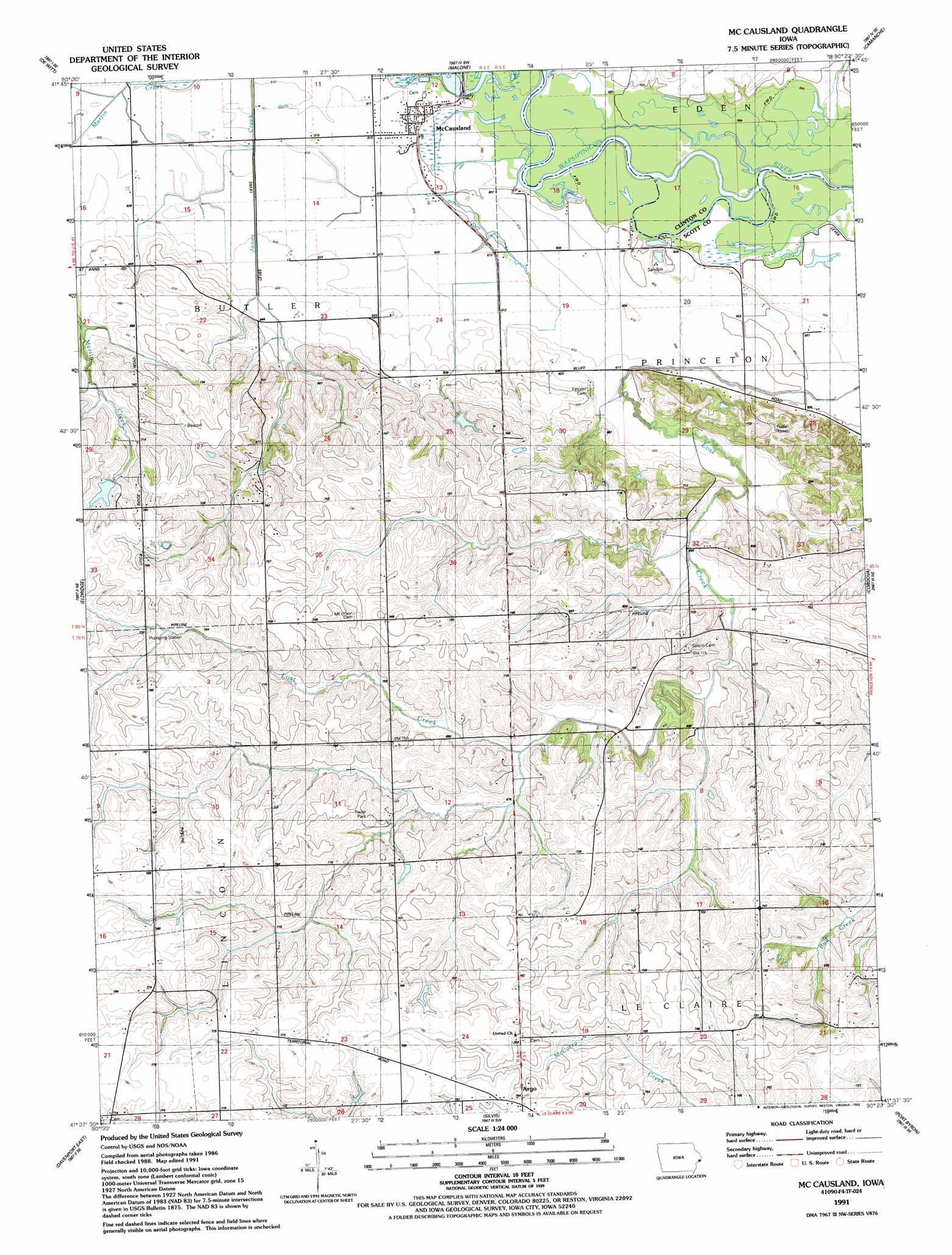
USGS Topo Quad 41090f4 - 1:24,000 scale
| Topo Map Name: | Mccausland |
| USGS Topo Quad ID: | 41090f4 |
| Print Size: | ca. 21 1/4" wide x 27" high |
| Southeast Coordinates: | 41.625° N latitude / 90.375° W longitude |
| Map Center Coordinates: | 41.6875° N latitude / 90.4375° W longitude |
| U.S. State: | IA |
| Filename: | o41090f4.jpg |
| Download Map JPG Image: | Mccausland topo map 1:24,000 scale |
| Map Type: | Topographic |
| Topo Series: | 7.5´ |
| Map Scale: | 1:24,000 |
| Source of Map Images: | United States Geological Survey (USGS) |
| Alternate Map Versions: |
Mc Causland IA 1953, updated 1957 Download PDF Buy paper map Mc Causland IA 1953, updated 1971 Download PDF Buy paper map Mc Causland IA 1953, updated 1976 Download PDF Buy paper map Mc Causland IA 1991, updated 1992 Download PDF Buy paper map McCausland IA 2010 Download PDF Buy paper map McCausland IA 2013 Download PDF Buy paper map McCausland IA 2015 Download PDF Buy paper map |
1:24,000 Topo Quads surrounding Mccausland
Elwood |
Delmar South |
Goose Lake |
Andover |
Clinton Nw |
Grand Mound |
De Witt |
Malone |
Camanche |
Clinton |
Donahue |
Eldridge |
Mccausland |
Cordova |
Erie Nw |
Davenport West |
Davenport East |
Silvis |
Port Byron |
Hillsdale |
Andalusia |
Milan |
Coal Valley |
Green Rock |
Geneseo |
> Back to 41090e1 at 1:100,000 scale
> Back to 41090a1 at 1:250,000 scale
> Back to U.S. Topo Maps home
Mccausland topo map: Gazetteer
Mccausland: Airports
Quiet Valley Heliport elevation 228m 748′Mccausland: Parks
Lost Grove Lake Wildlife Management Area elevation 228m 748′Mccausland: Populated Places
Argo elevation 234m 767′McCausland elevation 186m 610′
Mccausland: Post Offices
Argo Post Office (historical) elevation 234m 767′Kerr Post Office (historical) elevation 225m 738′
McCausland Post Office elevation 186m 610′
Mccausland: Streams
Old Channel Lost Creek elevation 180m 590′South Fork Lost Creek elevation 202m 662′
Mccausland digital topo map on disk
Buy this Mccausland topo map showing relief, roads, GPS coordinates and other geographical features, as a high-resolution digital map file on DVD: