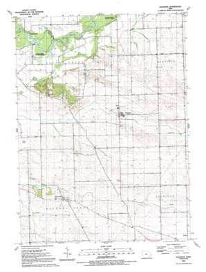
Donahue Topo Map Iowa
To zoom in, hover over the map of Donahue
USGS Topo Quad 41090f6 - 1:24,000 scale
| Topo Map Name: | Donahue |
| USGS Topo Quad ID: | 41090f6 |
| Print Size: | ca. 21 1/4" wide x 27" high |
| Southeast Coordinates: | 41.625° N latitude / 90.625° W longitude |
| Map Center Coordinates: | 41.6875° N latitude / 90.6875° W longitude |
| U.S. State: | IA |
| Filename: | o41090f6.jpg |
| Download Map JPG Image: | Donahue topo map 1:24,000 scale |
| Map Type: | Topographic |
| Topo Series: | 7.5´ |
| Map Scale: | 1:24,000 |
| Source of Map Images: | United States Geological Survey (USGS) |
| Alternate Map Versions: |
Donahue IA 1953, updated 1958 Download PDF Buy paper map Donahue IA 1953, updated 1971 Download PDF Buy paper map Donahue IA 1953, updated 1977 Download PDF Buy paper map Donahue IA 1991, updated 1992 Download PDF Buy paper map Donahue IA 2010 Download PDF Buy paper map Donahue IA 2013 Download PDF Buy paper map Donahue IA 2015 Download PDF Buy paper map |
1:24,000 Topo Quads surrounding Donahue
> Back to 41090e1 at 1:100,000 scale
> Back to 41090a1 at 1:250,000 scale
> Back to U.S. Topo Maps home
Donahue topo map: Gazetteer
Donahue: Airports
Stender Airport elevation 211m 692′Donahue: Parks
Allens Grove County Park elevation 193m 633′Buena Vista County Park elevation 197m 646′
Cameron Woods State Preserve elevation 208m 682′
Donahue: Populated Places
Buena Vista elevation 199m 652′Donahue elevation 216m 708′
Hickory Grove elevation 208m 682′
Maysville elevation 225m 738′
Donahue: Post Offices
Allens Grove Post Office (historical) elevation 232m 761′Amity Post Office (historical) elevation 224m 734′
Buenavista Post Office (historical) elevation 198m 649′
Donahue Post Office elevation 216m 708′
Donahue Station Post Office (historical) elevation 219m 718′
Hickory Grove Post Office (historical) elevation 229m 751′
Donahue: Streams
Walnut Creek elevation 196m 643′Donahue digital topo map on disk
Buy this Donahue topo map showing relief, roads, GPS coordinates and other geographical features, as a high-resolution digital map file on DVD:


