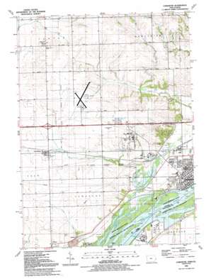
Camanche Topo Map Iowa
To zoom in, hover over the map of Camanche
USGS Topo Quad 41090g3 - 1:24,000 scale
| Topo Map Name: | Camanche |
| USGS Topo Quad ID: | 41090g3 |
| Print Size: | ca. 21 1/4" wide x 27" high |
| Southeast Coordinates: | 41.75° N latitude / 90.25° W longitude |
| Map Center Coordinates: | 41.8125° N latitude / 90.3125° W longitude |
| U.S. States: | IA, IL |
| Filename: | o41090g3.jpg |
| Download Map JPG Image: | Camanche topo map 1:24,000 scale |
| Map Type: | Topographic |
| Topo Series: | 7.5´ |
| Map Scale: | 1:24,000 |
| Source of Map Images: | United States Geological Survey (USGS) |
| Alternate Map Versions: |
Camanche IA 1953, updated 1957 Download PDF Buy paper map Camanche IA 1953, updated 1976 Download PDF Buy paper map Camanche IA 1953, updated 1977 Download PDF Buy paper map Camanche IA 1991, updated 1992 Download PDF Buy paper map Camanche IA 2010 Download PDF Buy paper map Camanche IA 2013 Download PDF Buy paper map Camanche IA 2015 Download PDF Buy paper map |
1:24,000 Topo Quads surrounding Camanche
> Back to 41090e1 at 1:100,000 scale
> Back to 41090a1 at 1:250,000 scale
> Back to U.S. Topo Maps home
Camanche topo map: Gazetteer
Camanche: Airports
Clinton Municipal Airport elevation 211m 692′Samaritan Hospital South Heliport elevation 197m 646′
Camanche: Lakes
Nancy Elaine Lake elevation 176m 577′Willow Lake elevation 179m 587′
Camanche: Parks
Follett Park elevation 184m 603′Platt Park elevation 182m 597′
Rock Creek County Park elevation 176m 577′
Camanche: Populated Places
Camanche elevation 182m 597′Chaney elevation 180m 590′
Elvira elevation 222m 728′
Low Moor elevation 198m 649′
Shaffton elevation 184m 603′
Camanche: Post Offices
Camanche Post Office elevation 182m 597′Elvira Post Office (historical) elevation 222m 728′
Folletts Post Office (historical) elevation 184m 603′
Low Moor Post Office elevation 198m 649′
Camanche: Streams
Little Mill Creek elevation 189m 620′Rock Creek elevation 176m 577′
Camanche: Valleys
Devils Hollow elevation 194m 636′Camanche digital topo map on disk
Buy this Camanche topo map showing relief, roads, GPS coordinates and other geographical features, as a high-resolution digital map file on DVD:


