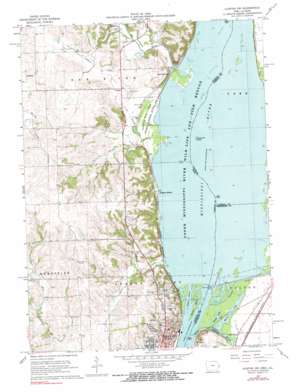
Clinton Nw Topo Map Iowa
To zoom in, hover over the map of Clinton Nw
USGS Topo Quad 41090h2 - 1:24,000 scale
| Topo Map Name: | Clinton Nw |
| USGS Topo Quad ID: | 41090h2 |
| Print Size: | ca. 21 1/4" wide x 27" high |
| Southeast Coordinates: | 41.875° N latitude / 90.125° W longitude |
| Map Center Coordinates: | 41.9375° N latitude / 90.1875° W longitude |
| U.S. States: | IA, IL |
| Filename: | o41090h2.jpg |
| Download Map JPG Image: | Clinton Nw topo map 1:24,000 scale |
| Map Type: | Topographic |
| Topo Series: | 7.5´ |
| Map Scale: | 1:24,000 |
| Source of Map Images: | United States Geological Survey (USGS) |
| Alternate Map Versions: |
Clinton NW IA 1967, updated 1968 Download PDF Buy paper map Clinton NW IA 1967, updated 1969 Download PDF Buy paper map Clinton NW IA 2010 Download PDF Buy paper map Clinton NW IA 2013 Download PDF Buy paper map Clinton NW IA 2015 Download PDF Buy paper map |
1:24,000 Topo Quads surrounding Clinton Nw
> Back to 41090e1 at 1:100,000 scale
> Back to 41090a1 at 1:250,000 scale
> Back to U.S. Topo Maps home
Clinton Nw topo map: Gazetteer
Clinton Nw: Cliffs
Bald Point elevation 243m 797′Clinton Nw: Dams
Lock and Dam No elevation 178m 583′Lock and Dam Number 13 elevation 184m 603′
Mississippi River Lock Dam Number Thirteen elevation 185m 606′
Clinton Nw: Flats
Pomme de Terre Prairie elevation 178m 583′Clinton Nw: Islands
Stamps Island elevation 177m 580′Woodruffs Island elevation 178m 583′
Clinton Nw: Lakes
Swedes Lake elevation 177m 580′Wares Lake elevation 177m 580′
Clinton Nw: Mines
Lyons Quarry elevation 198m 649′Clinton Nw: Parks
Eagle Point Park elevation 225m 738′Clinton Nw: Populated Places
Almont elevation 200m 656′Bulgers Hollow elevation 184m 603′
Elk River Junction elevation 187m 613′
Sibyl (historical) elevation 179m 587′
Clinton Nw: Post Offices
Almont Post Office (historical) elevation 200m 656′Elk River Post Office (historical) elevation 181m 593′
Mead Post Office (historical) elevation 180m 590′
Watkyns Glen Post Office (historical) elevation 205m 672′
Clinton Nw: Streams
Cattail Slough elevation 177m 580′Deer Creek elevation 177m 580′
Elk River elevation 178m 583′
Johnson Creek elevation 177m 580′
Lyons Chute elevation 176m 577′
Silver Creek elevation 177m 580′
Willow Brook elevation 178m 583′
Clinton Nw digital topo map on disk
Buy this Clinton Nw topo map showing relief, roads, GPS coordinates and other geographical features, as a high-resolution digital map file on DVD:


