Goose Lake Topo Map Iowa
To zoom in, hover over the map of Goose Lake
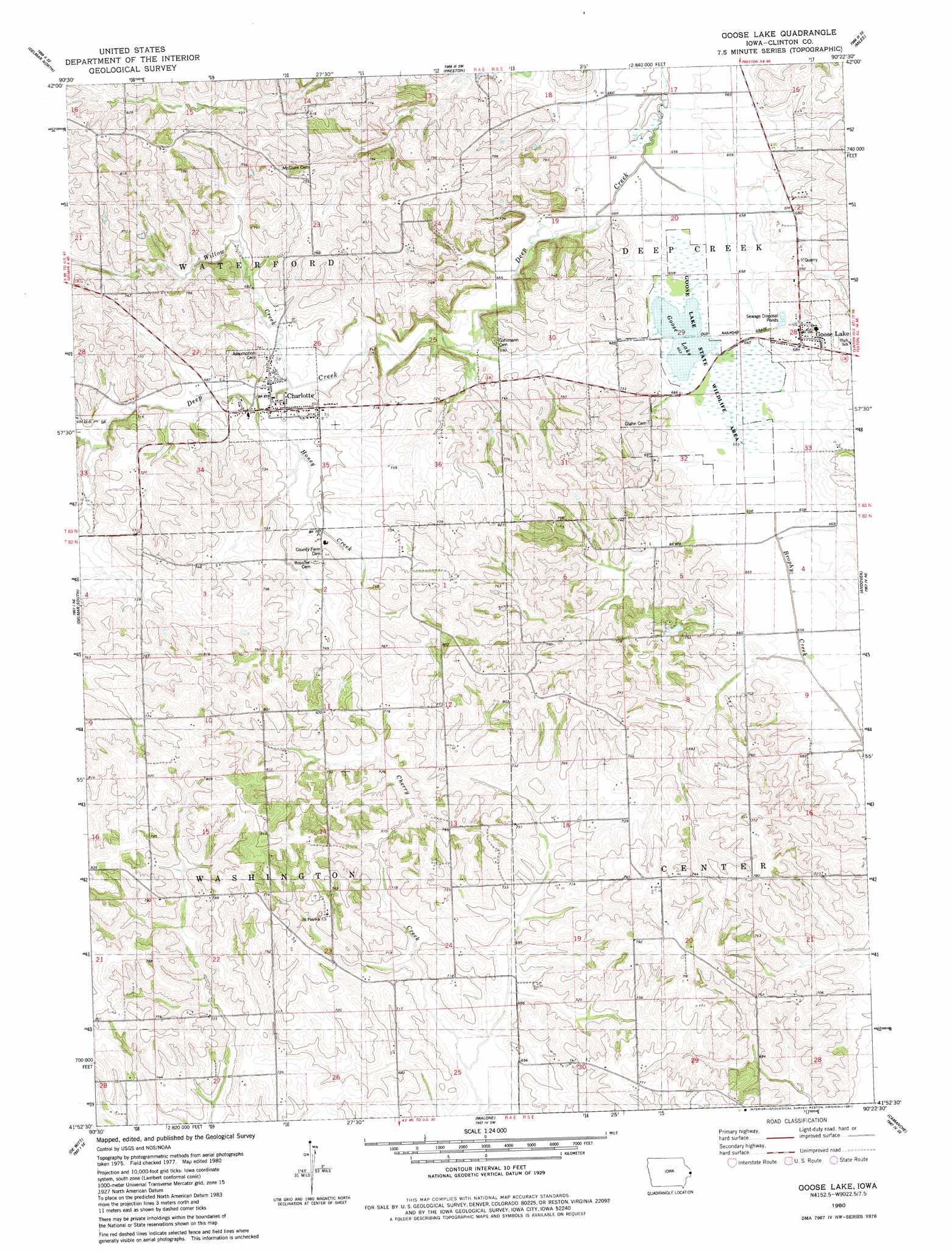
USGS Topo Quad 41090h4 - 1:24,000 scale
| Topo Map Name: | Goose Lake |
| USGS Topo Quad ID: | 41090h4 |
| Print Size: | ca. 21 1/4" wide x 27" high |
| Southeast Coordinates: | 41.875° N latitude / 90.375° W longitude |
| Map Center Coordinates: | 41.9375° N latitude / 90.4375° W longitude |
| U.S. State: | IA |
| Filename: | o41090h4.jpg |
| Download Map JPG Image: | Goose Lake topo map 1:24,000 scale |
| Map Type: | Topographic |
| Topo Series: | 7.5´ |
| Map Scale: | 1:24,000 |
| Source of Map Images: | United States Geological Survey (USGS) |
| Alternate Map Versions: |
Goose Lake IA 1980, updated 1981 Download PDF Buy paper map Goose Lake IA 2010 Download PDF Buy paper map Goose Lake IA 2013 Download PDF Buy paper map Goose Lake IA 2015 Download PDF Buy paper map |
1:24,000 Topo Quads surrounding Goose Lake
Fulton |
Andrew |
Springbrook |
Green Island |
Blackhawk |
Maquoketa |
Delmar North |
Preston |
Miles |
Savanna |
Elwood |
Delmar South |
Goose Lake |
Andover |
Clinton Nw |
Grand Mound |
De Witt |
Malone |
Camanche |
Clinton |
Donahue |
Eldridge |
Mccausland |
Cordova |
Erie Nw |
> Back to 41090e1 at 1:100,000 scale
> Back to 41090a1 at 1:250,000 scale
> Back to U.S. Topo Maps home
Goose Lake topo map: Gazetteer
Goose Lake: Lakes
Goose Lake elevation 200m 656′Goose Lake: Parks
Goose Lake State Wildlife Area elevation 200m 656′Goose Lake: Populated Places
Charlotte elevation 212m 695′Goose Lake elevation 210m 688′
Goose Lake: Post Offices
Charlotte Post Office elevation 212m 695′Goose Lake Post Office elevation 210m 688′
Villanova Post Office (historical) elevation 240m 787′
Goose Lake: Reservoirs
Lake Storey elevation 198m 649′Goose Lake: Streams
Honey Creek elevation 204m 669′Williams Creek elevation 222m 728′
Williams Creek elevation 207m 679′
Willow Creek elevation 204m 669′
Goose Lake digital topo map on disk
Buy this Goose Lake topo map showing relief, roads, GPS coordinates and other geographical features, as a high-resolution digital map file on DVD: