Lost Nation Topo Map Iowa
To zoom in, hover over the map of Lost Nation
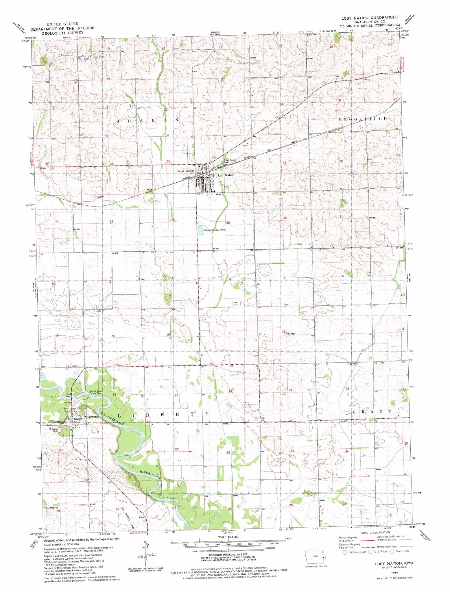
USGS Topo Quad 41090h7 - 1:24,000 scale
| Topo Map Name: | Lost Nation |
| USGS Topo Quad ID: | 41090h7 |
| Print Size: | ca. 21 1/4" wide x 27" high |
| Southeast Coordinates: | 41.875° N latitude / 90.75° W longitude |
| Map Center Coordinates: | 41.9375° N latitude / 90.8125° W longitude |
| U.S. State: | IA |
| Filename: | o41090h7.jpg |
| Download Map JPG Image: | Lost Nation topo map 1:24,000 scale |
| Map Type: | Topographic |
| Topo Series: | 7.5´ |
| Map Scale: | 1:24,000 |
| Source of Map Images: | United States Geological Survey (USGS) |
| Alternate Map Versions: |
Lost Nation IA 1980, updated 1981 Download PDF Buy paper map Lost Nation IA 2010 Download PDF Buy paper map Lost Nation IA 2013 Download PDF Buy paper map Lost Nation IA 2015 Download PDF Buy paper map |
1:24,000 Topo Quads surrounding Lost Nation
Scotch Grove |
Canton |
Leisure Lake |
Fulton |
Andrew |
Wyoming West |
Wyoming East |
Baldwin |
Maquoketa |
Delmar North |
Clarence |
Oxford Junction |
Lost Nation |
Elwood |
Delmar South |
Tipton East |
Lowden |
Wheatland |
Grand Mound |
De Witt |
Lime City |
Bennett |
Dixon |
Donahue |
Eldridge |
> Back to 41090e1 at 1:100,000 scale
> Back to 41090a1 at 1:250,000 scale
> Back to U.S. Topo Maps home
Lost Nation topo map: Gazetteer
Lost Nation: Parks
Gilroy Rustic Park elevation 224m 734′Walnut Grove County Park elevation 211m 692′
Lost Nation: Populated Places
Lost Nation elevation 230m 754′Toronto elevation 220m 721′
Lost Nation: Post Offices
Lost Nation Post Office elevation 232m 761′Toronto Post Office elevation 220m 721′
Lost Nation digital topo map on disk
Buy this Lost Nation topo map showing relief, roads, GPS coordinates and other geographical features, as a high-resolution digital map file on DVD: