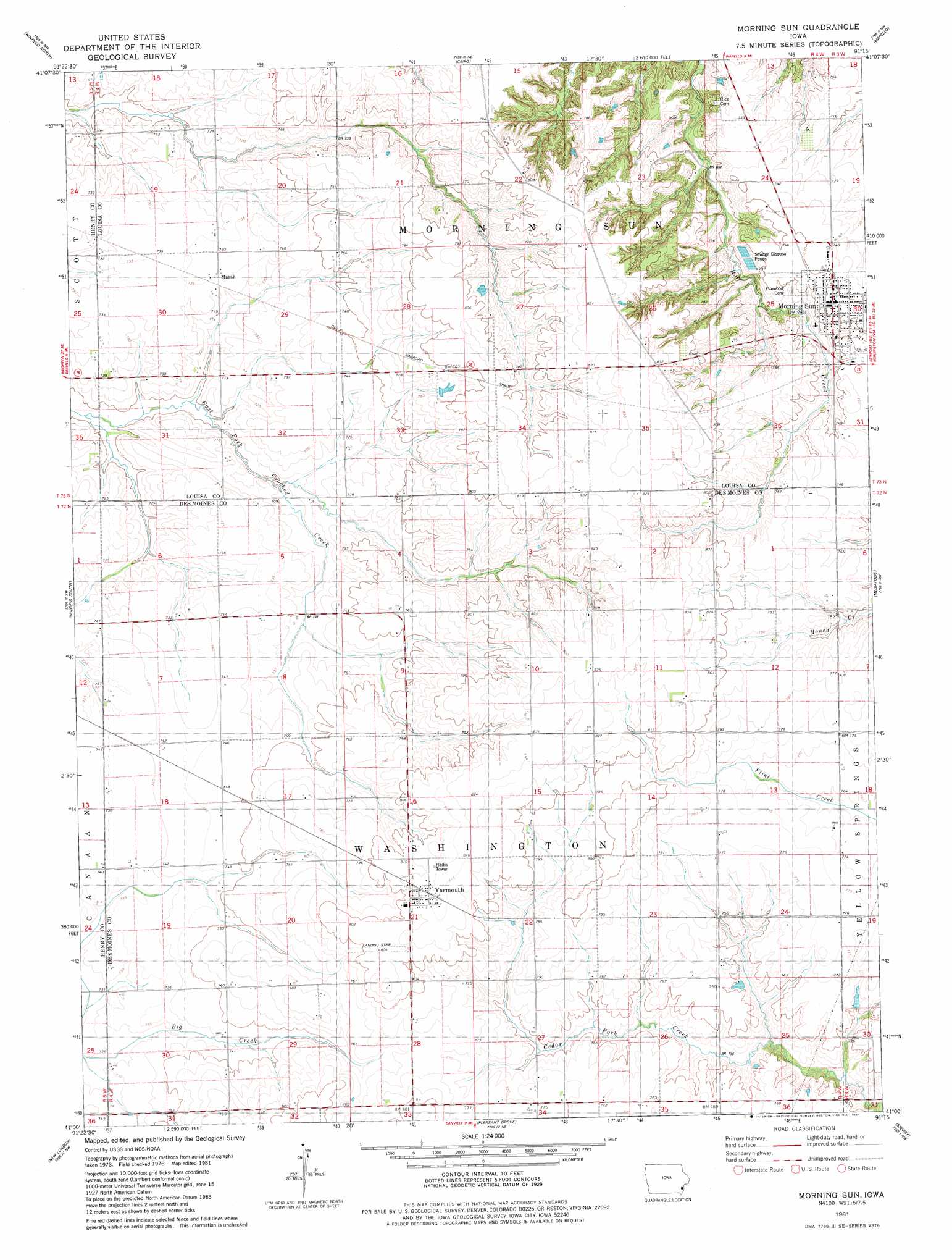
Morning Sun Topo Map Iowa
To zoom in, hover over the map of Morning Sun
USGS Topo Quad 41091a3 - 1:24,000 scale
| Topo Map Name: | Morning Sun |
| USGS Topo Quad ID: | 41091a3 |
| Print Size: | ca. 21 1/4" wide x 27" high |
| Southeast Coordinates: | 41° N latitude / 91.25° W longitude |
| Map Center Coordinates: | 41.0625° N latitude / 91.3125° W longitude |
| U.S. State: | IA |
| Filename: | o41091a3.jpg |
| Download Map JPG Image: | Morning Sun topo map 1:24,000 scale |
| Map Type: | Topographic |
| Topo Series: | 7.5´ |
| Map Scale: | 1:24,000 |
| Source of Map Images: | United States Geological Survey (USGS) |
| Alternate Map Versions: |
Morning Sun IA 1981, updated 1981 Download PDF Buy paper map Morning Sun IA 2010 Download PDF Buy paper map Morning Sun IA 2013 Download PDF Buy paper map Morning Sun IA 2015 Download PDF Buy paper map |
1:24,000 Topo Quads surrounding Morning Sun
Ainsworth |
Cotter |
Columbus Junction |
Letts |
Blanchard Island |
Crawfordsville |
Winfield North |
Cairo |
Wapello |
Toolesboro |
Swedesburg |
Winfield South |
Morning Sun |
Mediapolis |
Oakville |
Mount Pleasant |
New London |
Pleasant Grove |
Sperry |
Kingston |
Salem |
Lowell |
Danville |
West Burlington |
Burlington |
> Back to 41091a1 at 1:100,000 scale
> Back to 41090a1 at 1:250,000 scale
> Back to U.S. Topo Maps home
Morning Sun topo map: Gazetteer
Morning Sun: Populated Places
Marsh elevation 225m 738′Morning Sun elevation 230m 754′
Roscoe elevation 236m 774′
Yarmouth elevation 246m 807′
Morning Sun: Post Offices
Marsh Post Office (historical) elevation 225m 738′Mid Prairie Post Office (historical) elevation 220m 721′
Morning Sun Post Office elevation 229m 751′
Roscoe Post Office (historical) elevation 236m 774′
Yarmouth Post Office elevation 246m 807′
Morning Sun digital topo map on disk
Buy this Morning Sun topo map showing relief, roads, GPS coordinates and other geographical features, as a high-resolution digital map file on DVD: