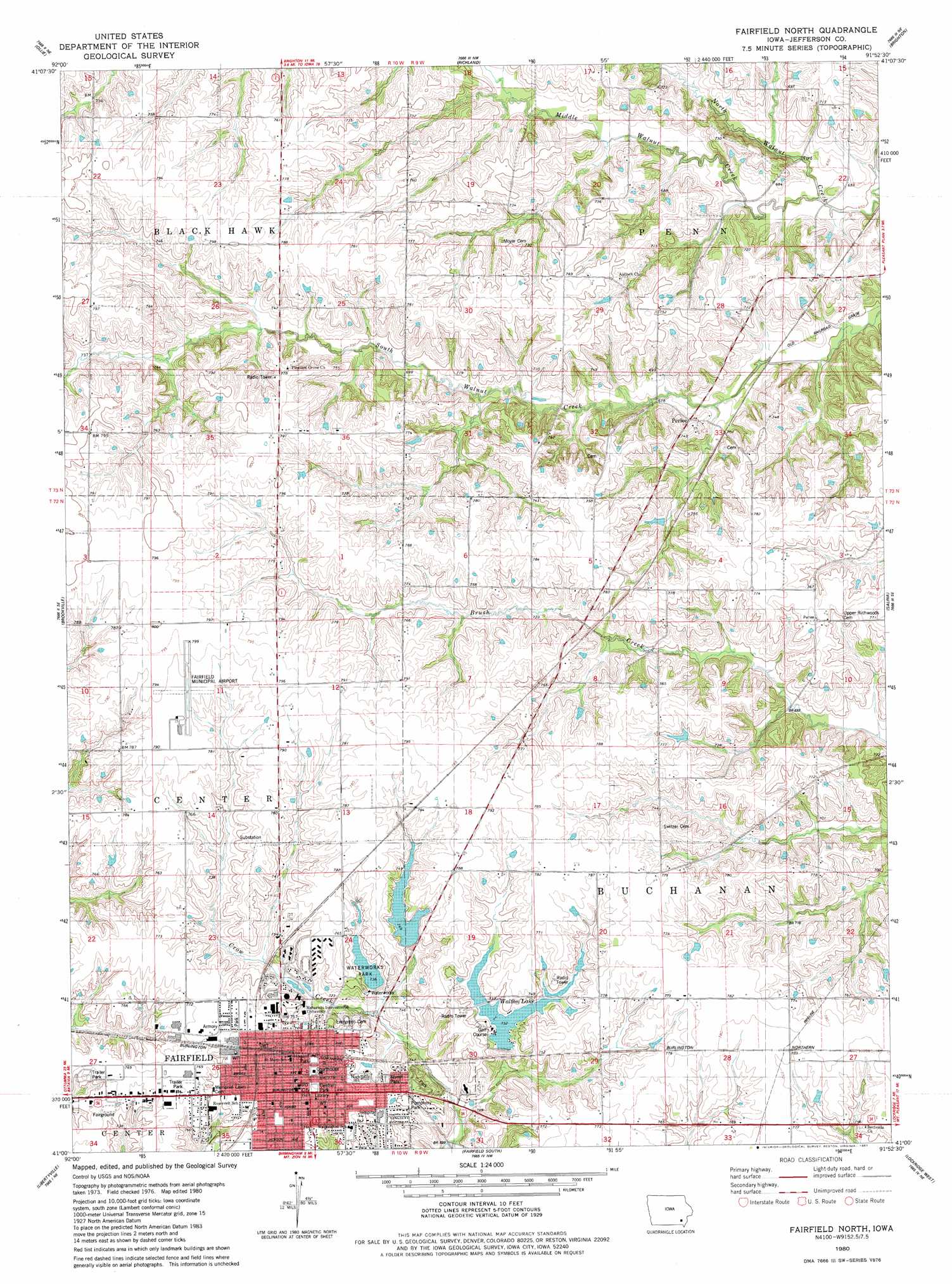
Fairfield North Topo Map Iowa
To zoom in, hover over the map of Fairfield North
USGS Topo Quad 41091a8 - 1:24,000 scale
| Topo Map Name: | Fairfield North |
| USGS Topo Quad ID: | 41091a8 |
| Print Size: | ca. 21 1/4" wide x 27" high |
| Southeast Coordinates: | 41° N latitude / 91.875° W longitude |
| Map Center Coordinates: | 41.0625° N latitude / 91.9375° W longitude |
| U.S. State: | IA |
| Filename: | o41091a8.jpg |
| Download Map JPG Image: | Fairfield North topo map 1:24,000 scale |
| Map Type: | Topographic |
| Topo Series: | 7.5´ |
| Map Scale: | 1:24,000 |
| Source of Map Images: | United States Geological Survey (USGS) |
| Alternate Map Versions: |
Fairfield North IA 1980, updated 1981 Download PDF Buy paper map Fairfield North IA 2010 Download PDF Buy paper map Fairfield North IA 2013 Download PDF Buy paper map Fairfield North IA 2015 Download PDF Buy paper map |
1:24,000 Topo Quads surrounding Fairfield North
Sigourney |
Harper |
Keota |
West Chester |
Washington |
Pekin |
Ollie |
Richland |
Brighton |
Wayland |
Abingdon |
Brookville |
Fairfield North |
Salina |
Trenton |
Eldon |
Libertyville |
Fairfield South |
Lockridge West |
Lockridge East |
Selma |
Douds |
Mount Zion |
Stockport |
Hillsboro |
> Back to 41091a1 at 1:100,000 scale
> Back to 41090a1 at 1:250,000 scale
> Back to U.S. Topo Maps home
Fairfield North topo map: Gazetteer
Fairfield North: Airports
Fairfield Municipal Airport elevation 239m 784′Fairfield North: Parks
Central Park elevation 235m 770′Chautauqua Park elevation 217m 711′
First Iowa State Fair 1854 Historical Marker elevation 236m 774′
Forest Park elevation 227m 744′
Heritage Park elevation 235m 770′
Howard Park elevation 235m 770′
Little League Park elevation 228m 748′
Livingston Timber Recreation Area elevation 211m 692′
Pumphery Park elevation 229m 751′
United States Constitution Bicentennial Tree Historical Marker elevation 224m 734′
Utopia Park elevation 231m 757′
Waterworks Park elevation 228m 748′
Fairfield North: Populated Places
Fairfield elevation 236m 774′Maharishi Vedic City elevation 241m 790′
Perlee elevation 211m 692′
Fairfield North: Post Offices
Baker Post Office (historical) elevation 237m 777′Fairfield Post Office elevation 235m 770′
Perlee Post Office (historical) elevation 211m 692′
Pleasant Grove Post Office (historical) elevation 229m 751′
Walnut Post Office (historical) elevation 206m 675′
Fairfield North: Reservoirs
Reservoir Number One elevation 225m 738′Reservoir Number Two elevation 228m 748′
Walton Lake elevation 223m 731′
Fairfield North: Streams
Middle Walnut Creek elevation 198m 649′Fairfield North digital topo map on disk
Buy this Fairfield North topo map showing relief, roads, GPS coordinates and other geographical features, as a high-resolution digital map file on DVD: