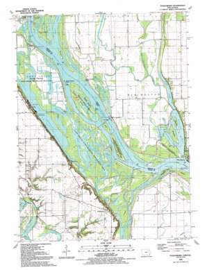
Toolesboro Topo Map Iowa
To zoom in, hover over the map of Toolesboro
USGS Topo Quad 41091b1 - 1:24,000 scale
| Topo Map Name: | Toolesboro |
| USGS Topo Quad ID: | 41091b1 |
| Print Size: | ca. 21 1/4" wide x 27" high |
| Southeast Coordinates: | 41.125° N latitude / 91° W longitude |
| Map Center Coordinates: | 41.1875° N latitude / 91.0625° W longitude |
| U.S. States: | IA, IL |
| Filename: | o41091b1.jpg |
| Download Map JPG Image: | Toolesboro topo map 1:24,000 scale |
| Map Type: | Topographic |
| Topo Series: | 7.5´ |
| Map Scale: | 1:24,000 |
| Source of Map Images: | United States Geological Survey (USGS) |
| Alternate Map Versions: |
Toolesboro IA 1953, updated 1958 Download PDF Buy paper map Toolesboro IA 1953, updated 1977 Download PDF Buy paper map Toolesboro IA 1992, updated 1992 Download PDF Buy paper map Toolesboro IA 2012 Download PDF Buy paper map Toolesboro IA 2013 Download PDF Buy paper map Toolesboro IA 2015 Download PDF Buy paper map |
1:24,000 Topo Quads surrounding Toolesboro
> Back to 41091a1 at 1:100,000 scale
> Back to 41090a1 at 1:250,000 scale
> Back to U.S. Topo Maps home
Toolesboro topo map: Gazetteer
Toolesboro: Areas
Lake Odessa Public Hunting Area elevation 183m 600′Toolesboro: Bays
Boston Bay elevation 165m 541′Sturgeon Bay elevation 164m 538′
Toolesboro: Canals
Eliza Lake Ditch Cutoff elevation 160m 524′Ives Ditch elevation 159m 521′
Swan Lake Ditch elevation 161m 528′
Toolesboro: Dams
Dam and Lock Number 17 elevation 165m 541′Dam and Lock Number 17 elevation 164m 538′
Mississippi River Lock Dam Number Seventeen elevation 174m 570′
Toolesboro: Guts
Half Moon Slough elevation 162m 531′Heiser Slough elevation 163m 534′
Meyer Slough elevation 161m 528′
Toolesboro: Islands
Bell Island elevation 167m 547′Brass Island elevation 165m 541′
Buzzard Island elevation 166m 544′
Jonas Johnson Island elevation 165m 541′
Keg Island elevation 165m 541′
Otter Island elevation 165m 541′
Otter Island elevation 165m 541′
Turkey Island elevation 165m 541′
Turkey Towhead Island elevation 165m 541′
Toolesboro: Lakes
Beebe Pond elevation 165m 541′Big Goose Pond elevation 164m 538′
Fox Pond elevation 164m 538′
Goose Pond (historical) elevation 165m 541′
Little Fox Pond elevation 164m 538′
Lower Eliza Lake (historical) elevation 161m 528′
Stone Lake elevation 169m 554′
Swan Lake elevation 160m 524′
Swarms Pond elevation 164m 538′
Toolesboro: Parks
Ferry Landing Recreation Area elevation 164m 538′Sand Run Park elevation 167m 547′
Toolesboro Mounds State Preserve elevation 179m 587′
Toolesboro: Populated Places
Toolesboro elevation 208m 682′Toolesboro: Post Offices
Burris City Post Office (historical) elevation 163m 534′Toosesboro Post Office (historical) elevation 208m 682′
Toolesboro: Streams
Bogus Chute elevation 165m 541′Cleveland Slough elevation 165m 541′
Coleman Slough elevation 165m 541′
Eliza Creek elevation 165m 541′
Iowa River elevation 164m 538′
Keg Slough (historical) elevation 164m 538′
Michaels Creek elevation 166m 544′
Willow Slough elevation 161m 528′
Toolesboro digital topo map on disk
Buy this Toolesboro topo map showing relief, roads, GPS coordinates and other geographical features, as a high-resolution digital map file on DVD:


