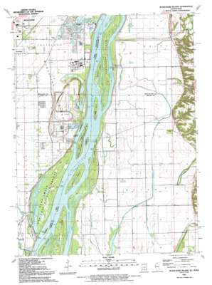
Blanchard Island Topo Map Illinois
To zoom in, hover over the map of Blanchard Island
USGS Topo Quad 41091c1 - 1:24,000 scale
| Topo Map Name: | Blanchard Island |
| USGS Topo Quad ID: | 41091c1 |
| Print Size: | ca. 21 1/4" wide x 27" high |
| Southeast Coordinates: | 41.25° N latitude / 91° W longitude |
| Map Center Coordinates: | 41.3125° N latitude / 91.0625° W longitude |
| U.S. States: | IL, IA |
| Filename: | o41091c1.jpg |
| Download Map JPG Image: | Blanchard Island topo map 1:24,000 scale |
| Map Type: | Topographic |
| Topo Series: | 7.5´ |
| Map Scale: | 1:24,000 |
| Source of Map Images: | United States Geological Survey (USGS) |
| Alternate Map Versions: |
Blanchard Island IL 1953, updated 1958 Download PDF Buy paper map Blanchard Island IL 1953, updated 1977 Download PDF Buy paper map Blanchard Island IL 1991, updated 1992 Download PDF Buy paper map Blanchard Island IL 2010 Download PDF Buy paper map Blanchard Island IL 2012 Download PDF Buy paper map Blanchard Island IL 2015 Download PDF Buy paper map |
1:24,000 Topo Quads surrounding Blanchard Island
> Back to 41091a1 at 1:100,000 scale
> Back to 41090a1 at 1:250,000 scale
> Back to U.S. Topo Maps home
Blanchard Island topo map: Gazetteer
Blanchard Island: Airports
Carl Ritter Landing Strip elevation 165m 541′Ritter Field elevation 167m 547′
Russell Farms Airport elevation 163m 534′
Blanchard Island: Canals
Dolan Ditch elevation 163m 534′Eagle Ditch elevation 162m 531′
Frieden Ditch elevation 164m 538′
Hampton Ditch elevation 163m 534′
Main Ditch North elevation 163m 534′
Prentis Ditch elevation 163m 534′
School Ditch elevation 162m 531′
Blanchard Island: Islands
Barkis Island elevation 165m 541′Bass Island elevation 166m 544′
Blanchard Island elevation 166m 544′
Bogus Island elevation 165m 541′
Coleman Island elevation 166m 544′
Island Number 347 elevation 165m 541′
Kilpeck Island elevation 165m 541′
Muscatine Island elevation 166m 544′
Ramsey Island elevation 165m 541′
Willow Island elevation 165m 541′
Blanchard Island: Lakes
Beattys Pond elevation 165m 541′Clear Lake (historical) elevation 163m 534′
Glancey Lake (historical) elevation 162m 531′
Jones Lake elevation 164m 538′
Otter Pond elevation 163m 534′
Spring Lake elevation 165m 541′
Upper Eliza Lake (historical) elevation 160m 524′
Blanchard Island: Parks
Blanchard Island Recreation Area elevation 165m 541′Kilpeck Landing Recreation Area elevation 165m 541′
Mark Twain National Wildlife Refuge elevation 165m 541′
Mississippi River Islands State Wildlife Management Area elevation 166m 544′
Pagel Flaming Prairie Park elevation 164m 538′
Blanchard Island: Populated Places
Kammerer Trailer Court elevation 167m 547′Blanchard Island: Streams
Blanchard Chute elevation 165m 541′Coolegar Slough elevation 165m 541′
Copperas Creek elevation 165m 541′
Dolan Creek elevation 169m 554′
Keating Creek elevation 163m 534′
Muscatine Slough elevation 169m 554′
Blanchard Island digital topo map on disk
Buy this Blanchard Island topo map showing relief, roads, GPS coordinates and other geographical features, as a high-resolution digital map file on DVD:


