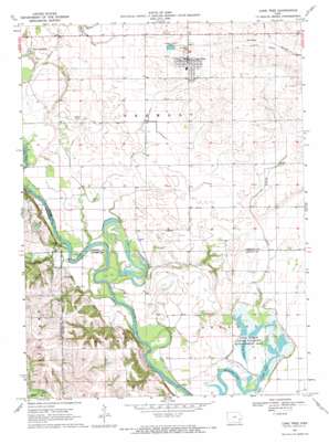
Lone Tree Topo Map Iowa
To zoom in, hover over the map of Lone Tree
USGS Topo Quad 41091d4 - 1:24,000 scale
| Topo Map Name: | Lone Tree |
| USGS Topo Quad ID: | 41091d4 |
| Print Size: | ca. 21 1/4" wide x 27" high |
| Southeast Coordinates: | 41.375° N latitude / 91.375° W longitude |
| Map Center Coordinates: | 41.4375° N latitude / 91.4375° W longitude |
| U.S. State: | IA |
| Filename: | o41091d4.jpg |
| Download Map JPG Image: | Lone Tree topo map 1:24,000 scale |
| Map Type: | Topographic |
| Topo Series: | 7.5´ |
| Map Scale: | 1:24,000 |
| Source of Map Images: | United States Geological Survey (USGS) |
| Alternate Map Versions: |
Lone Tree IA 1969, updated 1972 Download PDF Buy paper map Lone Tree IA 2010 Download PDF Buy paper map Lone Tree IA 2013 Download PDF Buy paper map Lone Tree IA 2015 Download PDF Buy paper map |
1:24,000 Topo Quads surrounding Lone Tree
> Back to 41091a1 at 1:100,000 scale
> Back to 41090a1 at 1:250,000 scale
> Back to U.S. Topo Maps home
Lone Tree topo map: Gazetteer
Lone Tree: Capes
Graveyard Point elevation 210m 688′Lone Tree: Lakes
Big Lake elevation 178m 583′Hills Lake (historical) elevation 178m 583′
Horseshoe Lake elevation 178m 583′
Long Lake elevation 181m 593′
Lone Tree: Parks
Cone Marsh State Wildlife Management Area elevation 180m 590′Lone Tree: Populated Places
Lone Tree elevation 221m 725′River Junction elevation 198m 649′
Lone Tree: Post Offices
Big Springs Post Office (historical) elevation 197m 646′Lone Tree Post Office elevation 222m 728′
Palestine Post Office (historical) elevation 196m 643′
River Junction Post Office (historical) elevation 198m 649′
Shoo Fly Post Office (historical) elevation 198m 649′
White Ash Post Office (historical) elevation 211m 692′
Lone Tree: Reservoirs
McDowell Lake elevation 200m 656′Lone Tree: Streams
Davis Creek elevation 183m 600′Des Moines River elevation 182m 597′
Prairie Creek elevation 183m 600′
Richey Creek elevation 181m 593′
Lone Tree digital topo map on disk
Buy this Lone Tree topo map showing relief, roads, GPS coordinates and other geographical features, as a high-resolution digital map file on DVD:


