West Liberty Topo Map Iowa
To zoom in, hover over the map of West Liberty
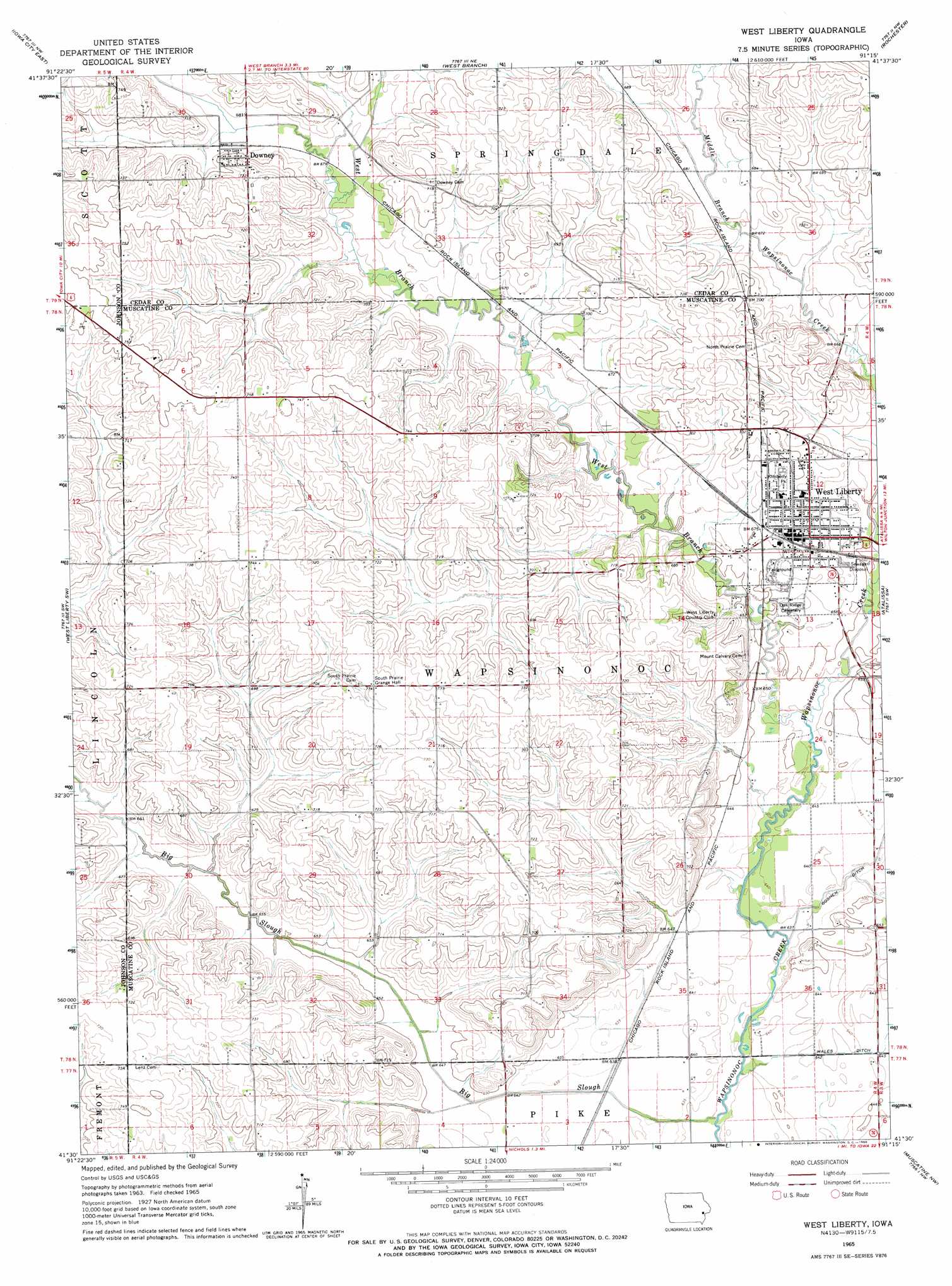
USGS Topo Quad 41091e3 - 1:24,000 scale
| Topo Map Name: | West Liberty |
| USGS Topo Quad ID: | 41091e3 |
| Print Size: | ca. 21 1/4" wide x 27" high |
| Southeast Coordinates: | 41.5° N latitude / 91.25° W longitude |
| Map Center Coordinates: | 41.5625° N latitude / 91.3125° W longitude |
| U.S. State: | IA |
| Filename: | o41091e3.jpg |
| Download Map JPG Image: | West Liberty topo map 1:24,000 scale |
| Map Type: | Topographic |
| Topo Series: | 7.5´ |
| Map Scale: | 1:24,000 |
| Source of Map Images: | United States Geological Survey (USGS) |
| Alternate Map Versions: |
West Liberty IA 1965, updated 1966 Download PDF Buy paper map West Liberty IA 2010 Download PDF Buy paper map West Liberty IA 2013 Download PDF Buy paper map West Liberty IA 2015 Download PDF Buy paper map |
1:24,000 Topo Quads surrounding West Liberty
Ely |
Solon |
Cedar Bluff |
Tipton West |
Tipton East |
Iowa City West |
Iowa City East |
West Branch |
Rochester |
Lime City |
Hills |
West Liberty Sw |
West Liberty |
Atalissa |
Wilton Junction |
Riverside |
Lone Tree |
Nichols |
Muscatine Nw |
Muscatine |
Ainsworth |
Cotter |
Columbus Junction |
Letts |
Blanchard Island |
> Back to 41091e1 at 1:100,000 scale
> Back to 41090a1 at 1:250,000 scale
> Back to U.S. Topo Maps home
West Liberty topo map: Gazetteer
West Liberty: Parks
Kimberly Park elevation 209m 685′Wapsie Park elevation 199m 652′
West Liberty: Populated Places
Downey elevation 210m 688′West Liberty elevation 206m 675′
West Liberty: Post Offices
Downey Post Office (historical) elevation 210m 688′West Liberty Post Office elevation 208m 682′
West Liberty: Streams
Big Slough elevation 189m 620′West Branch Wapsinonoc Creek elevation 195m 639′
West Liberty digital topo map on disk
Buy this West Liberty topo map showing relief, roads, GPS coordinates and other geographical features, as a high-resolution digital map file on DVD: