Conroy Topo Map Iowa
To zoom in, hover over the map of Conroy
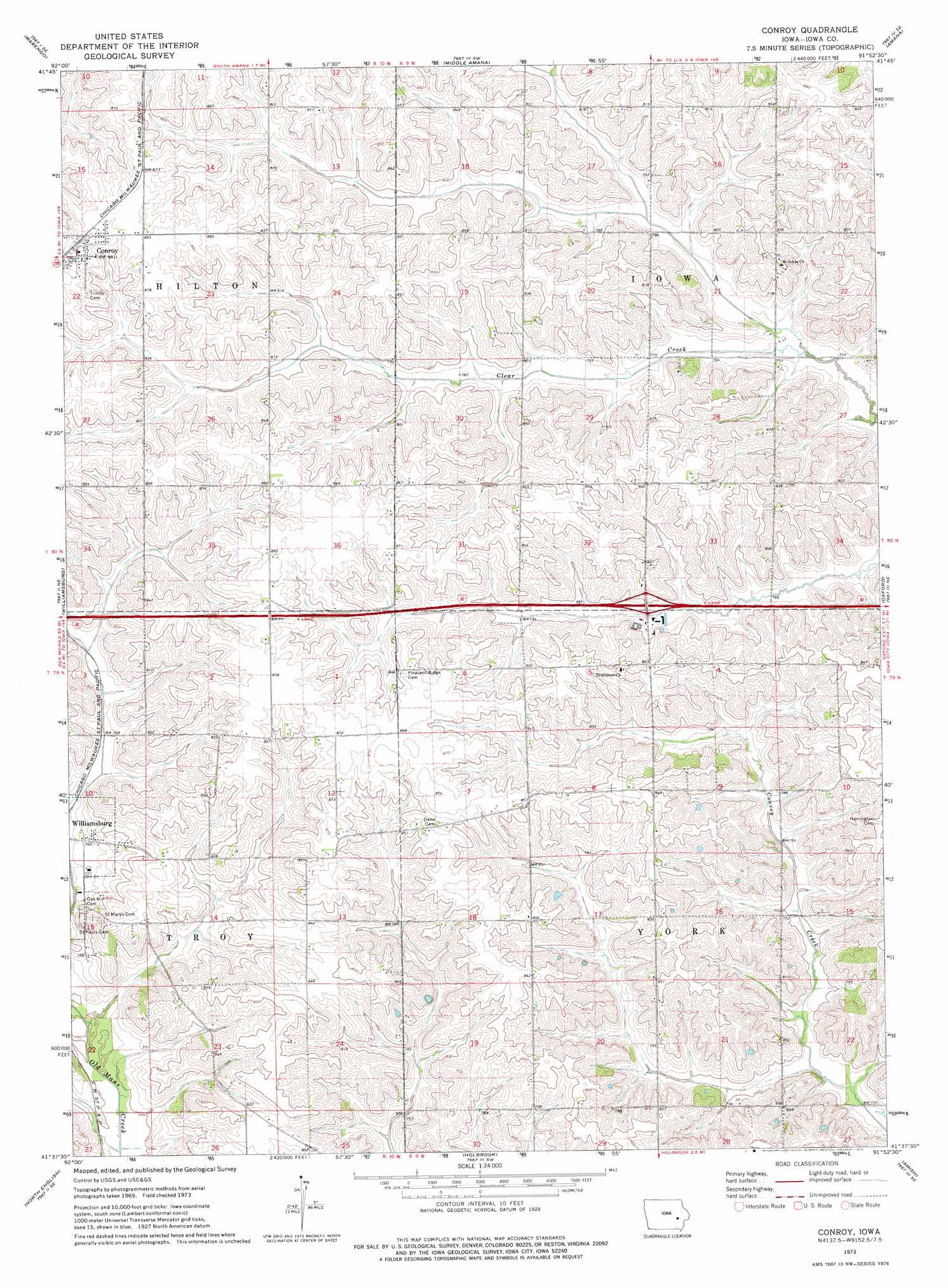
USGS Topo Quad 41091f8 - 1:24,000 scale
| Topo Map Name: | Conroy |
| USGS Topo Quad ID: | 41091f8 |
| Print Size: | ca. 21 1/4" wide x 27" high |
| Southeast Coordinates: | 41.625° N latitude / 91.875° W longitude |
| Map Center Coordinates: | 41.6875° N latitude / 91.9375° W longitude |
| U.S. State: | IA |
| Filename: | o41091f8.jpg |
| Download Map JPG Image: | Conroy topo map 1:24,000 scale |
| Map Type: | Topographic |
| Topo Series: | 7.5´ |
| Map Scale: | 1:24,000 |
| Source of Map Images: | United States Geological Survey (USGS) |
| Alternate Map Versions: |
Conroy IA 1973, updated 1975 Download PDF Buy paper map Conroy IA 2010 Download PDF Buy paper map Conroy IA 2013 Download PDF Buy paper map Conroy IA 2015 Download PDF Buy paper map |
1:24,000 Topo Quads surrounding Conroy
Keystone South |
Blairstown |
Newhall |
Fairfax |
Cedar Rapids South |
Ladora |
Marengo |
Middle Amana |
Amana |
Swisher |
Williamsburg Nw |
Williamsburg |
Conroy |
Oxford |
Tiffin |
Millersburg |
North English |
Holbrook |
Amish |
Williamstown |
Keswick |
South English |
Kinross |
Wellman |
Kalona |
> Back to 41091e1 at 1:100,000 scale
> Back to 41090a1 at 1:250,000 scale
> Back to U.S. Topo Maps home
Conroy topo map: Gazetteer
Conroy: Airports
Weiss Airport elevation 258m 846′Conroy: Crossings
Interchange 225 elevation 238m 780′Conroy: Populated Places
Conroy elevation 268m 879′Conroy: Post Offices
Conroy Post Office elevation 267m 875′Fox Post Office (historical) elevation 259m 849′
York Center Post Office (historical) elevation 250m 820′
Conroy digital topo map on disk
Buy this Conroy topo map showing relief, roads, GPS coordinates and other geographical features, as a high-resolution digital map file on DVD: