Keystone South Topo Map Iowa
To zoom in, hover over the map of Keystone South
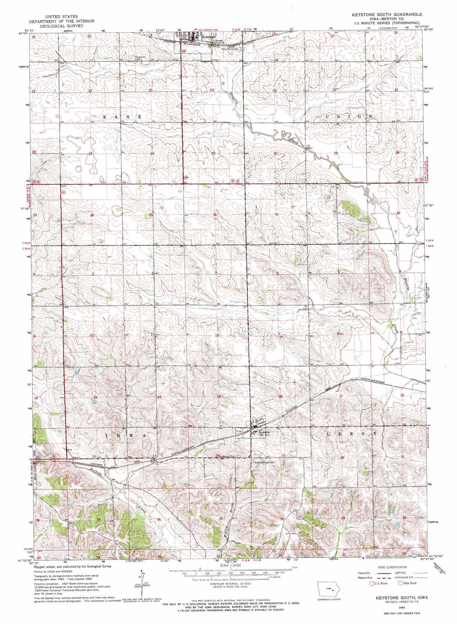
USGS Topo Quad 41092h2 - 1:24,000 scale
| Topo Map Name: | Keystone South |
| USGS Topo Quad ID: | 41092h2 |
| Print Size: | ca. 21 1/4" wide x 27" high |
| Southeast Coordinates: | 41.875° N latitude / 92.125° W longitude |
| Map Center Coordinates: | 41.9375° N latitude / 92.1875° W longitude |
| U.S. State: | IA |
| Filename: | o41092h2.jpg |
| Download Map JPG Image: | Keystone South topo map 1:24,000 scale |
| Map Type: | Topographic |
| Topo Series: | 7.5´ |
| Map Scale: | 1:24,000 |
| Source of Map Images: | United States Geological Survey (USGS) |
| Alternate Map Versions: |
Keystone South IA 1965, updated 1966 Download PDF Buy paper map Keystone South IA 2010 Download PDF Buy paper map Keystone South IA 2013 Download PDF Buy paper map Keystone South IA 2015 Download PDF Buy paper map |
1:24,000 Topo Quads surrounding Keystone South
Traer |
Dysart |
Garrison |
Vinton |
Center Point Nw |
Clutier |
Elberon |
Keystone North |
Van Horne |
Center Point Sw |
Chelsea |
Belle Plaine |
Keystone South |
Blairstown |
Newhall |
Belle Plaine Sw |
Hartwick |
Ladora |
Marengo |
Middle Amana |
Brooklyn |
Victor |
Williamsburg Nw |
Williamsburg |
Conroy |
> Back to 41092e1 at 1:100,000 scale
> Back to 41092a1 at 1:250,000 scale
> Back to U.S. Topo Maps home
Keystone South topo map: Gazetteer
Keystone South: Populated Places
Keystone elevation 269m 882′Luzerne elevation 286m 938′
Keystone South: Post Offices
Keystone Post Office elevation 271m 889′Luzerne Post Office elevation 274m 898′
Pickaway Post Office (historical) elevation 270m 885′
Keystone South digital topo map on disk
Buy this Keystone South topo map showing relief, roads, GPS coordinates and other geographical features, as a high-resolution digital map file on DVD: