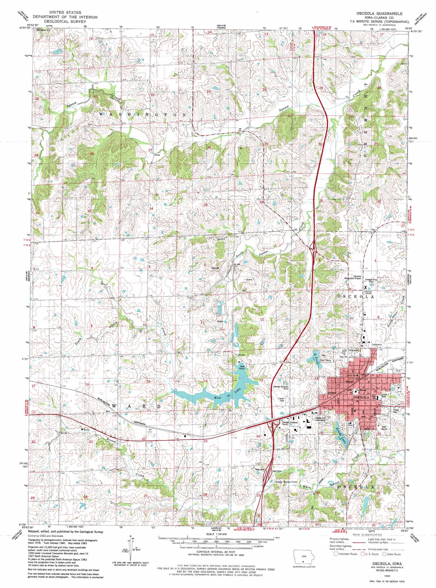
Osceola Topo Map Iowa
To zoom in, hover over the map of Osceola
USGS Topo Quad 41093a7 - 1:24,000 scale
| Topo Map Name: | Osceola |
| USGS Topo Quad ID: | 41093a7 |
| Print Size: | ca. 21 1/4" wide x 27" high |
| Southeast Coordinates: | 41° N latitude / 93.75° W longitude |
| Map Center Coordinates: | 41.0625° N latitude / 93.8125° W longitude |
| U.S. State: | IA |
| Filename: | o41093a7.jpg |
| Download Map JPG Image: | Osceola topo map 1:24,000 scale |
| Map Type: | Topographic |
| Topo Series: | 7.5´ |
| Map Scale: | 1:24,000 |
| Source of Map Images: | United States Geological Survey (USGS) |
| Alternate Map Versions: |
Osceola IA 1983, updated 1983 Download PDF Buy paper map Osceola IA 2010 Download PDF Buy paper map Osceola IA 2013 Download PDF Buy paper map Osceola IA 2015 Download PDF Buy paper map |
1:24,000 Topo Quads surrounding Osceola
Winterset |
Patterson |
Saint Charles |
Martensdale |
Indianola |
Lorimor North |
East Peru |
Truro |
New Virginia |
Medora |
Lorimor South |
Murray |
Osceola |
Jamison |
Woodburn |
Tingley Ne |
Hopeville |
Lacelle |
Weldon |
Le Roy |
Ellston |
Grand River |
Van Wert |
Garden Grove Sw |
Garden Grove |
> Back to 41093a1 at 1:100,000 scale
> Back to 41092a1 at 1:250,000 scale
> Back to U.S. Topo Maps home
Osceola topo map: Gazetteer
Osceola: Crossings
Interchange 33 elevation 340m 1115′Interchange 36 elevation 310m 1017′
Osceola: Dams
West Lake Dam elevation 327m 1072′Osceola: Mines
Osceola Quarry elevation 325m 1066′Osceola: Parks
Coyote Canyon Wildlife Area elevation 335m 1099′Lions Park elevation 333m 1092′
Q Pond City Park elevation 330m 1082′
Siemens Ball Park elevation 348m 1141′
The Mormon Trail State Historical Marker elevation 333m 1092′
Osceola: Populated Places
Osceola elevation 348m 1141′Osceola: Post Offices
Balaka Post Office (historical) elevation 307m 1007′Osceola Post Office elevation 350m 1148′
Osceola: Reservoirs
Grade Lake elevation 323m 1059′Q Pond elevation 318m 1043′
West Lake elevation 323m 1059′
Osceola: Streams
South Squaw Creek elevation 289m 948′Osceola digital topo map on disk
Buy this Osceola topo map showing relief, roads, GPS coordinates and other geographical features, as a high-resolution digital map file on DVD: