Newton Topo Map Iowa
To zoom in, hover over the map of Newton
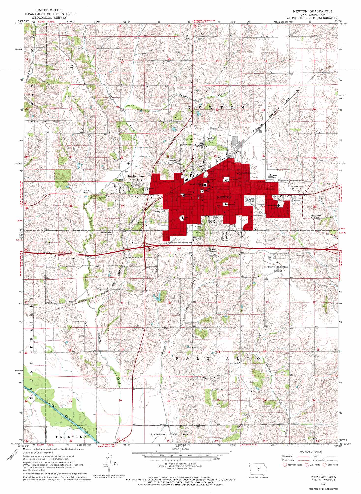
USGS Topo Quad 41093f1 - 1:24,000 scale
| Topo Map Name: | Newton |
| USGS Topo Quad ID: | 41093f1 |
| Print Size: | ca. 21 1/4" wide x 27" high |
| Southeast Coordinates: | 41.625° N latitude / 93° W longitude |
| Map Center Coordinates: | 41.6875° N latitude / 93.0625° W longitude |
| U.S. State: | IA |
| Filename: | o41093f1.jpg |
| Download Map JPG Image: | Newton topo map 1:24,000 scale |
| Map Type: | Topographic |
| Topo Series: | 7.5´ |
| Map Scale: | 1:24,000 |
| Source of Map Images: | United States Geological Survey (USGS) |
| Alternate Map Versions: |
Newton IA 1965, updated 1966 Download PDF Buy paper map Newton IA 2010 Download PDF Buy paper map Newton IA 2013 Download PDF Buy paper map Newton IA 2015 Download PDF Buy paper map |
1:24,000 Topo Quads surrounding Newton
Collins |
Rhodes |
Melbourne |
Laurel |
Gilman |
Mingo |
Baxter |
Baxter Se |
Alloway Creek |
Newburg |
Mitchellville |
Colfax |
Newton |
Kellogg |
Oakland Acres |
Runnells |
Prairie City |
Monroe |
Killduff |
Sully |
Pleasantville |
Knoxville Nw |
Otley |
Pella |
Peoria |
> Back to 41093e1 at 1:100,000 scale
> Back to 41092a1 at 1:250,000 scale
> Back to U.S. Topo Maps home
Newton topo map: Gazetteer
Newton: Airports
Newton Municipal Airport elevation 288m 944′Newton: Crossings
Interchange 164 elevation 260m 853′Newton: Parks
Agnes Patterson Memorial Park elevation 289m 948′Aurora Park elevation 289m 948′
Bailey Wildlife Area elevation 232m 761′
Boyhood Home of Emerson Hough Historical Marker elevation 289m 948′
Callison Park elevation 280m 918′
Denniston Knolls Park elevation 274m 898′
Hillcrest Park elevation 287m 941′
Lincoln Park elevation 290m 951′
Maytag Park elevation 287m 941′
Sunset Park elevation 283m 928′
Thirty Acre Park elevation 269m 882′
Westwood Park elevation 258m 846′
Woodland Park elevation 291m 954′
Newton: Populated Places
Coal Siding (historical) elevation 248m 813′Lambs Grove elevation 280m 918′
Newton elevation 290m 951′
Sunrise Mobile Home Community elevation 290m 951′
Wilson (historical) elevation 234m 767′
Newton: Post Offices
Newton Post Office elevation 292m 958′Newton: Streams
Benjamin Creek elevation 250m 820′Newton digital topo map on disk
Buy this Newton topo map showing relief, roads, GPS coordinates and other geographical features, as a high-resolution digital map file on DVD: