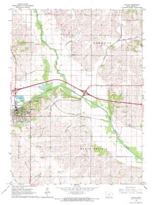
Colfax Topo Map Iowa
To zoom in, hover over the map of Colfax
USGS Topo Quad 41093f2 - 1:24,000 scale
| Topo Map Name: | Colfax |
| USGS Topo Quad ID: | 41093f2 |
| Print Size: | ca. 21 1/4" wide x 27" high |
| Southeast Coordinates: | 41.625° N latitude / 93.125° W longitude |
| Map Center Coordinates: | 41.6875° N latitude / 93.1875° W longitude |
| U.S. State: | IA |
| Filename: | o41093f2.jpg |
| Download Map JPG Image: | Colfax topo map 1:24,000 scale |
| Map Type: | Topographic |
| Topo Series: | 7.5´ |
| Map Scale: | 1:24,000 |
| Source of Map Images: | United States Geological Survey (USGS) |
| Alternate Map Versions: |
Colfax IA 1965, updated 1966 Download PDF Buy paper map Colfax IA 2010 Download PDF Buy paper map Colfax IA 2013 Download PDF Buy paper map Colfax IA 2015 Download PDF Buy paper map |
1:24,000 Topo Quads surrounding Colfax
> Back to 41093e1 at 1:100,000 scale
> Back to 41092a1 at 1:250,000 scale
> Back to U.S. Topo Maps home
Colfax topo map: Gazetteer
Colfax: Airports
Prairie City-Krohn Airport elevation 284m 931′Colfax: Areas
Colfax Public Hunting Area elevation 238m 780′Colfax: Crossings
Interchange 155 elevation 246m 807′Interchange 159 elevation 237m 777′
Colfax: Parks
Schlosser Park elevation 239m 784′Colfax: Populated Places
Colfax elevation 244m 800′Goddard elevation 249m 816′
Metz elevation 248m 813′
Severs elevation 259m 849′
Colfax: Post Offices
Bush Post Office (historical) elevation 237m 777′Chalybeate Springs Post Office (historical) elevation 256m 839′
Colfax Post Office elevation 249m 816′
Goddard Post Office (historical) elevation 249m 816′
Metz Post Office (historical) elevation 248m 813′
Parkersburgh Post Office (historical) elevation 240m 787′
Seevers Post Office (historical) elevation 259m 849′
Watson Station Post Office (historical) elevation 241m 790′
Colfax: Streams
East Grand Creek elevation 243m 797′Fullington Creek elevation 238m 780′
Indian Creek elevation 0m 0′
Prairie Creek elevation 235m 770′
Severs Creek elevation 235m 770′
Colfax digital topo map on disk
Buy this Colfax topo map showing relief, roads, GPS coordinates and other geographical features, as a high-resolution digital map file on DVD:


