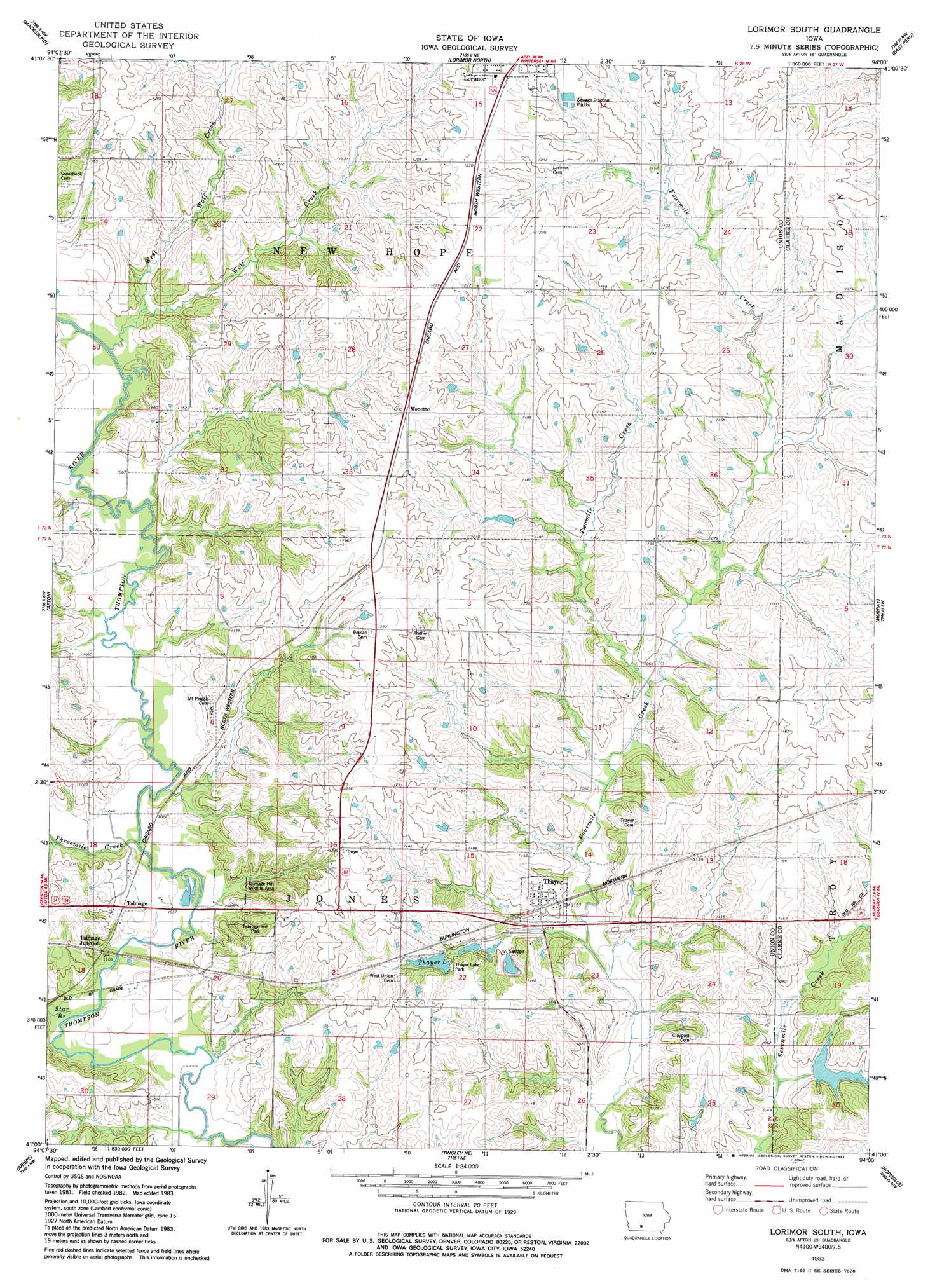
Lorimor South Topo Map Iowa
To zoom in, hover over the map of Lorimor South
USGS Topo Quad 41094a1 - 1:24,000 scale
| Topo Map Name: | Lorimor South |
| USGS Topo Quad ID: | 41094a1 |
| Print Size: | ca. 21 1/4" wide x 27" high |
| Southeast Coordinates: | 41° N latitude / 94° W longitude |
| Map Center Coordinates: | 41.0625° N latitude / 94.0625° W longitude |
| U.S. State: | IA |
| Filename: | o41094a1.jpg |
| Download Map JPG Image: | Lorimor South topo map 1:24,000 scale |
| Map Type: | Topographic |
| Topo Series: | 7.5´ |
| Map Scale: | 1:24,000 |
| Source of Map Images: | United States Geological Survey (USGS) |
| Alternate Map Versions: |
Lorimor South IA 1983, updated 1984 Download PDF Buy paper map Lorimor South IA 2010 Download PDF Buy paper map Lorimor South IA 2013 Download PDF Buy paper map Lorimor South IA 2015 Download PDF Buy paper map |
1:24,000 Topo Quads surrounding Lorimor South
Arbor Hill |
Pitzer |
Winterset |
Patterson |
Saint Charles |
Zion |
Macksburg |
Lorimor North |
East Peru |
Truro |
Creston East |
Afton |
Lorimor South |
Murray |
Osceola |
Shannon City |
Arispe |
Tingley Ne |
Hopeville |
Lacelle |
Diagonal |
Tingley |
Ellston |
Grand River |
Van Wert |
> Back to 41094a1 at 1:100,000 scale
> Back to 41094a1 at 1:250,000 scale
> Back to U.S. Topo Maps home
Lorimor South topo map: Gazetteer
Lorimor South: Areas
Thayer Ponds Public Hunting Area elevation 337m 1105′Lorimor South: Parks
First White Settlement in Union County Historical Marker elevation 351m 1151′Mount Pisgah Park elevation 351m 1151′
Talmage Hill Park elevation 349m 1145′
Talmage Hill Wildlife Area elevation 320m 1049′
Thayer Lake Park elevation 338m 1108′
Lorimor South: Populated Places
Afton Junction (historical) elevation 322m 1056′Monette elevation 374m 1227′
Talmage elevation 328m 1076′
Thayer elevation 337m 1105′
Lorimor South: Post Offices
Kings Post Office (historical) elevation 369m 1210′Monette Post Office (historical) elevation 374m 1227′
New Hope Post Office (historical) elevation 373m 1223′
Patriot Post Office (historical) elevation 363m 1190′
Petersville Post Office (historical) elevation 344m 1128′
Talmage Post Office (historical) elevation 328m 1076′
Thayer Post Office elevation 337m 1105′
Lorimor South: Reservoirs
Thayer Lake elevation 341m 1118′Lorimor South: Streams
Star Branch elevation 314m 1030′Threemile Creek elevation 317m 1040′
Twomile Creek elevation 324m 1062′
West Long Creek elevation 318m 1043′
West Wolf Creek elevation 326m 1069′
Wolf Creek elevation 323m 1059′
Lorimor South digital topo map on disk
Buy this Lorimor South topo map showing relief, roads, GPS coordinates and other geographical features, as a high-resolution digital map file on DVD: