Prescott Topo Map Iowa
To zoom in, hover over the map of Prescott
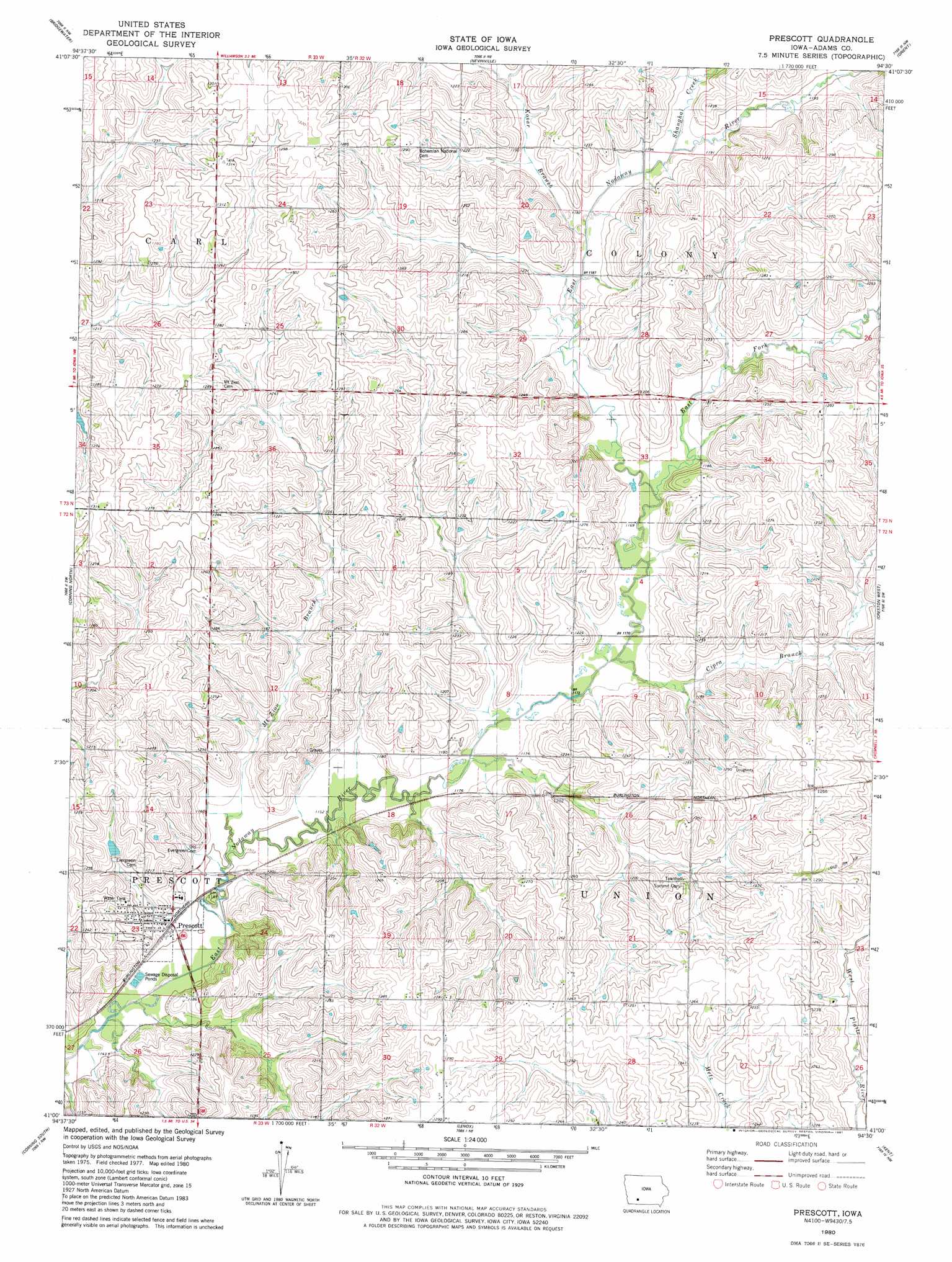
USGS Topo Quad 41094a5 - 1:24,000 scale
| Topo Map Name: | Prescott |
| USGS Topo Quad ID: | 41094a5 |
| Print Size: | ca. 21 1/4" wide x 27" high |
| Southeast Coordinates: | 41° N latitude / 94.5° W longitude |
| Map Center Coordinates: | 41.0625° N latitude / 94.5625° W longitude |
| U.S. State: | IA |
| Filename: | o41094a5.jpg |
| Download Map JPG Image: | Prescott topo map 1:24,000 scale |
| Map Type: | Topographic |
| Topo Series: | 7.5´ |
| Map Scale: | 1:24,000 |
| Source of Map Images: | United States Geological Survey (USGS) |
| Alternate Map Versions: |
Prescott IA 1980, updated 1981 Download PDF Buy paper map Prescott IA 2010 Download PDF Buy paper map Prescott IA 2013 Download PDF Buy paper map Prescott IA 2015 Download PDF Buy paper map |
1:24,000 Topo Quads surrounding Prescott
Massena |
Fontanelle Sw |
Fontanelle |
Greenfield |
Arbor Hill |
Dewey |
Bridgewater |
Nevinville |
Orient |
Zion |
Carbon |
Corning North |
Prescott |
Creston West |
Creston East |
Brooks |
Corning South |
Lenox |
Kent |
Shannon City |
Guss |
Gravity |
Merle Junction |
Clearfield |
Diagonal |
> Back to 41094a1 at 1:100,000 scale
> Back to 41094a1 at 1:250,000 scale
> Back to U.S. Topo Maps home
Prescott topo map: Gazetteer
Prescott: Parks
Prescott Community Park elevation 364m 1194′Prescott: Populated Places
Prescott elevation 364m 1194′Prescott: Post Offices
Prescott Post Office elevation 358m 1174′Prescott: Streams
Cipra Branch elevation 356m 1167′East Fork East Nodaway River elevation 359m 1177′
Kosar Branch elevation 360m 1181′
Mount Zion Branch elevation 350m 1148′
Shanghai Creek elevation 360m 1181′
Prescott digital topo map on disk
Buy this Prescott topo map showing relief, roads, GPS coordinates and other geographical features, as a high-resolution digital map file on DVD: