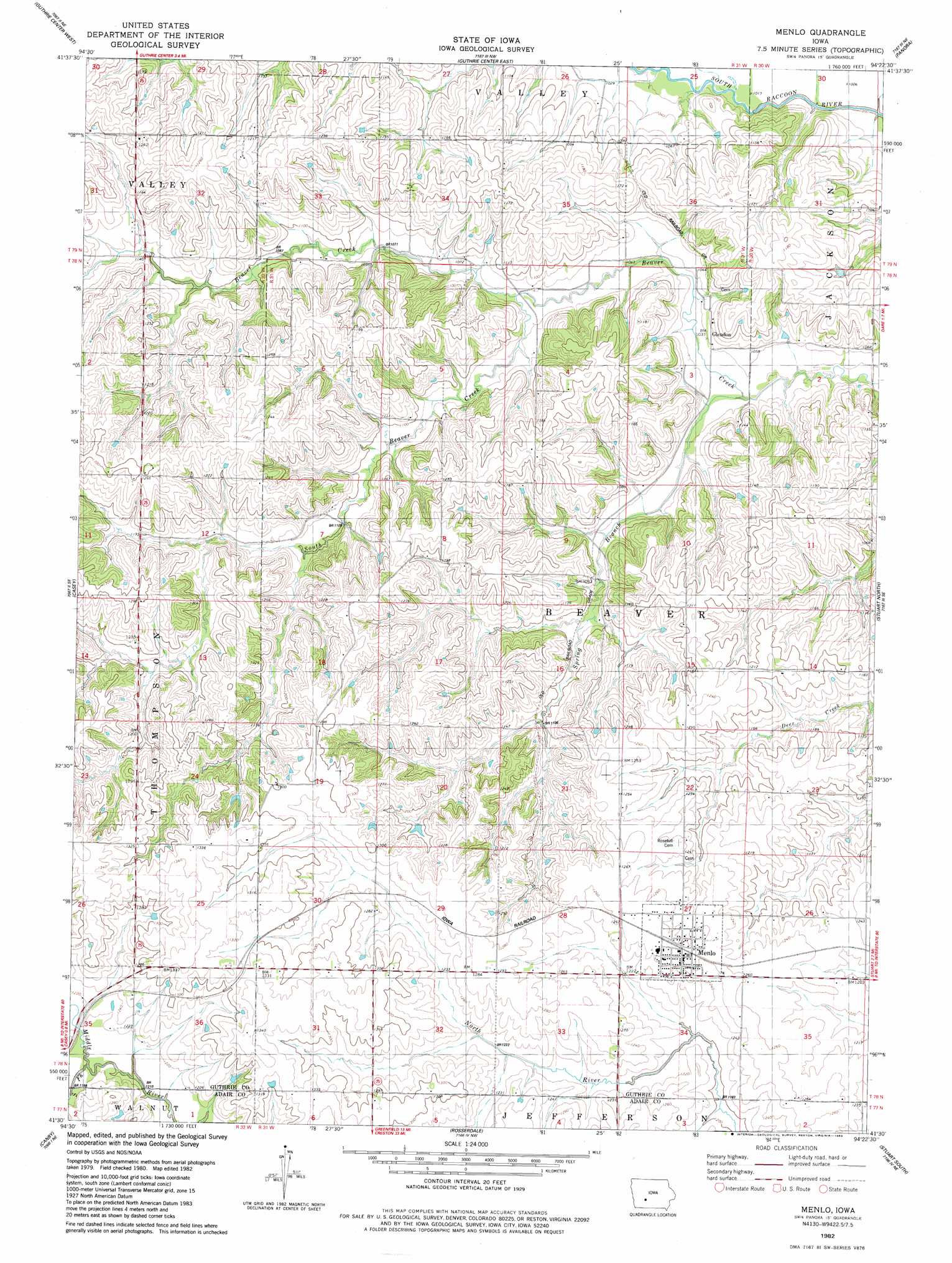
Menlo Topo Map Iowa
To zoom in, hover over the map of Menlo
USGS Topo Quad 41094e4 - 1:24,000 scale
| Topo Map Name: | Menlo |
| USGS Topo Quad ID: | 41094e4 |
| Print Size: | ca. 21 1/4" wide x 27" high |
| Southeast Coordinates: | 41.5° N latitude / 94.375° W longitude |
| Map Center Coordinates: | 41.5625° N latitude / 94.4375° W longitude |
| U.S. State: | IA |
| Filename: | o41094e4.jpg |
| Download Map JPG Image: | Menlo topo map 1:24,000 scale |
| Map Type: | Topographic |
| Topo Series: | 7.5´ |
| Map Scale: | 1:24,000 |
| Source of Map Images: | United States Geological Survey (USGS) |
| Alternate Map Versions: |
Menlo IA 1982, updated 1983 Download PDF Buy paper map Menlo IA 2010 Download PDF Buy paper map Menlo IA 2013 Download PDF Buy paper map Menlo IA 2015 Download PDF Buy paper map |
1:24,000 Topo Quads surrounding Menlo
Coon Rapids South |
Bayard |
Bagley |
Yale |
Dawson |
North Branch |
Guthrie Center West |
Guthrie Center East |
Panora |
Adel Nw |
Adair North |
Casey |
Menlo |
Stuart North |
Redfield |
Adair South |
Canby |
Rosserdale |
Stuart South |
Earlham West |
Fontanelle Sw |
Fontanelle |
Greenfield |
Arbor Hill |
Pitzer |
> Back to 41094e1 at 1:100,000 scale
> Back to 41094a1 at 1:250,000 scale
> Back to U.S. Topo Maps home
Menlo topo map: Gazetteer
Menlo: Parks
Montieth Wildlife Area elevation 342m 1122′Menlo: Populated Places
Glendon elevation 320m 1049′Menlo elevation 384m 1259′
Menlo: Post Offices
Ava Post Office (historical) elevation 317m 1040′Glendon Post Office (historical) elevation 320m 1049′
Menlo Post Office elevation 385m 1263′
Ridgeway Post Office (historical) elevation 384m 1259′
Menlo: Streams
South Beaver Creek elevation 323m 1059′Spring Branch elevation 311m 1020′
Menlo digital topo map on disk
Buy this Menlo topo map showing relief, roads, GPS coordinates and other geographical features, as a high-resolution digital map file on DVD: