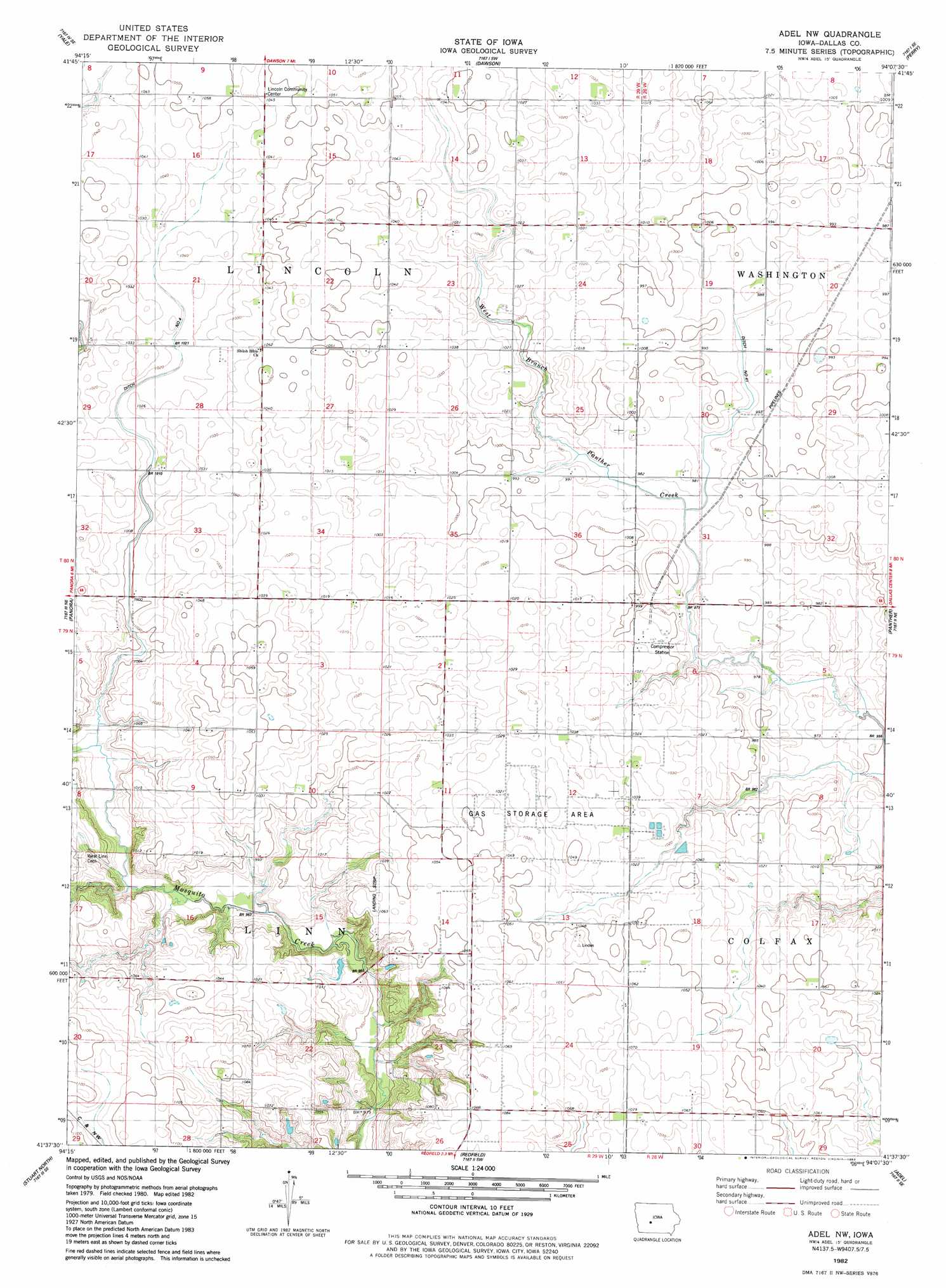
Adel Nw Topo Map Iowa
To zoom in, hover over the map of Adel Nw
USGS Topo Quad 41094f2 - 1:24,000 scale
| Topo Map Name: | Adel Nw |
| USGS Topo Quad ID: | 41094f2 |
| Print Size: | ca. 21 1/4" wide x 27" high |
| Southeast Coordinates: | 41.625° N latitude / 94.125° W longitude |
| Map Center Coordinates: | 41.6875° N latitude / 94.1875° W longitude |
| U.S. State: | IA |
| Filename: | o41094f2.jpg |
| Download Map JPG Image: | Adel Nw topo map 1:24,000 scale |
| Map Type: | Topographic |
| Topo Series: | 7.5´ |
| Map Scale: | 1:24,000 |
| Source of Map Images: | United States Geological Survey (USGS) |
| Alternate Map Versions: |
Adel NW IA 1982, updated 1983 Download PDF Buy paper map Adel NW IA 2010 Download PDF Buy paper map Adel NW IA 2013 Download PDF Buy paper map Adel NW IA 2015 Download PDF Buy paper map |
1:24,000 Topo Quads surrounding Adel Nw
Bagley Nw |
Cooper |
Rippey |
Berkley |
Madrid Nw |
Bagley |
Yale |
Dawson |
Perry |
Woodward |
Guthrie Center East |
Panora |
Adel Nw |
Panther |
Dallas Center |
Menlo |
Stuart North |
Redfield |
Adel |
Waukee |
Rosserdale |
Stuart South |
Earlham West |
Earlham East |
Saint Charles Nw |
> Back to 41094e1 at 1:100,000 scale
> Back to 41094a1 at 1:250,000 scale
> Back to U.S. Topo Maps home
Adel Nw topo map: Gazetteer
Adel Nw: Canals
Ditch Number 4 elevation 308m 1010′Ditch Number 41 elevation 299m 980′
Adel Nw: Post Offices
Brough Post Office (historical) elevation 318m 1043′Ephesus Post Office (historical) elevation 303m 994′
Greenvale Post Office (historical) elevation 323m 1059′
Langfitt Post Office (historical) elevation 301m 987′
Adel Nw digital topo map on disk
Buy this Adel Nw topo map showing relief, roads, GPS coordinates and other geographical features, as a high-resolution digital map file on DVD: