Viola Center Topo Map Iowa
To zoom in, hover over the map of Viola Center
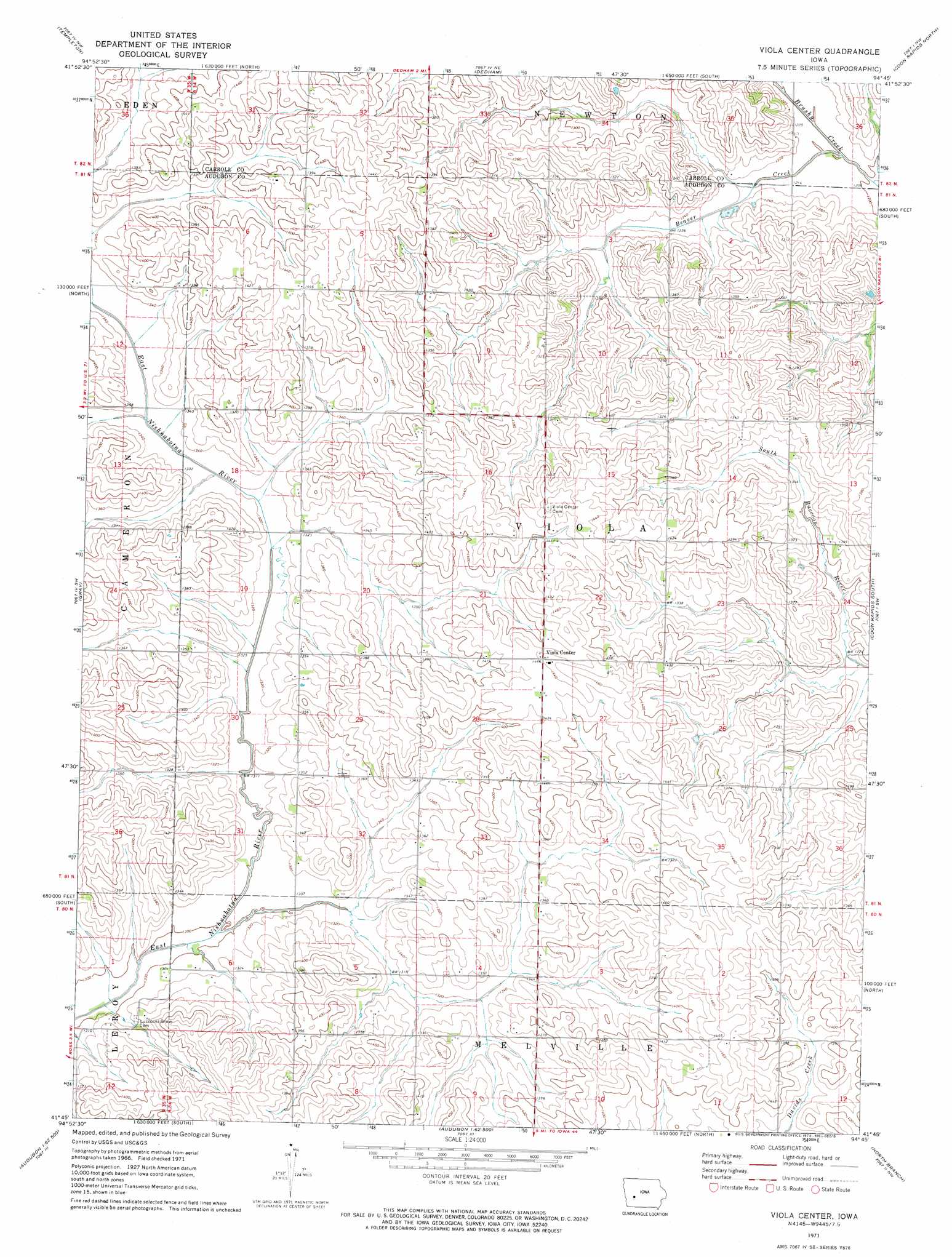
USGS Topo Quad 41094g7 - 1:24,000 scale
| Topo Map Name: | Viola Center |
| USGS Topo Quad ID: | 41094g7 |
| Print Size: | ca. 21 1/4" wide x 27" high |
| Southeast Coordinates: | 41.75° N latitude / 94.75° W longitude |
| Map Center Coordinates: | 41.8125° N latitude / 94.8125° W longitude |
| U.S. State: | IA |
| Filename: | o41094g7.jpg |
| Download Map JPG Image: | Viola Center topo map 1:24,000 scale |
| Map Type: | Topographic |
| Topo Series: | 7.5´ |
| Map Scale: | 1:24,000 |
| Source of Map Images: | United States Geological Survey (USGS) |
| Alternate Map Versions: |
Viola Center IA 1971, updated 1973 Download PDF Buy paper map Viola Center IA 2010 Download PDF Buy paper map Viola Center IA 2013 Download PDF Buy paper map Viola Center IA 2015 Download PDF Buy paper map |
1:24,000 Topo Quads surrounding Viola Center
Arcadia |
Carroll West |
Carroll East |
Glidden |
Scranton |
Manning |
Templeton |
Dedham |
Coon Rapids North |
Coon Rapids Ne |
Manning Se |
Gray |
Viola Center |
Coon Rapids South |
Bayard |
Kimballton |
Audubon |
Gardner |
North Branch |
Guthrie Center West |
Elk Horn |
Exira West |
Exira East |
Adair North |
Casey |
> Back to 41094e1 at 1:100,000 scale
> Back to 41094a1 at 1:250,000 scale
> Back to U.S. Topo Maps home
Viola Center topo map: Gazetteer
Viola Center: Populated Places
Viola Center elevation 440m 1443′Viola Center: Post Offices
Irwin Post Office (historical) elevation 410m 1345′Viola Center Post Office (historical) elevation 440m 1443′
Viola Center: Streams
Beaver Creek elevation 366m 1200′Viola Center digital topo map on disk
Buy this Viola Center topo map showing relief, roads, GPS coordinates and other geographical features, as a high-resolution digital map file on DVD: