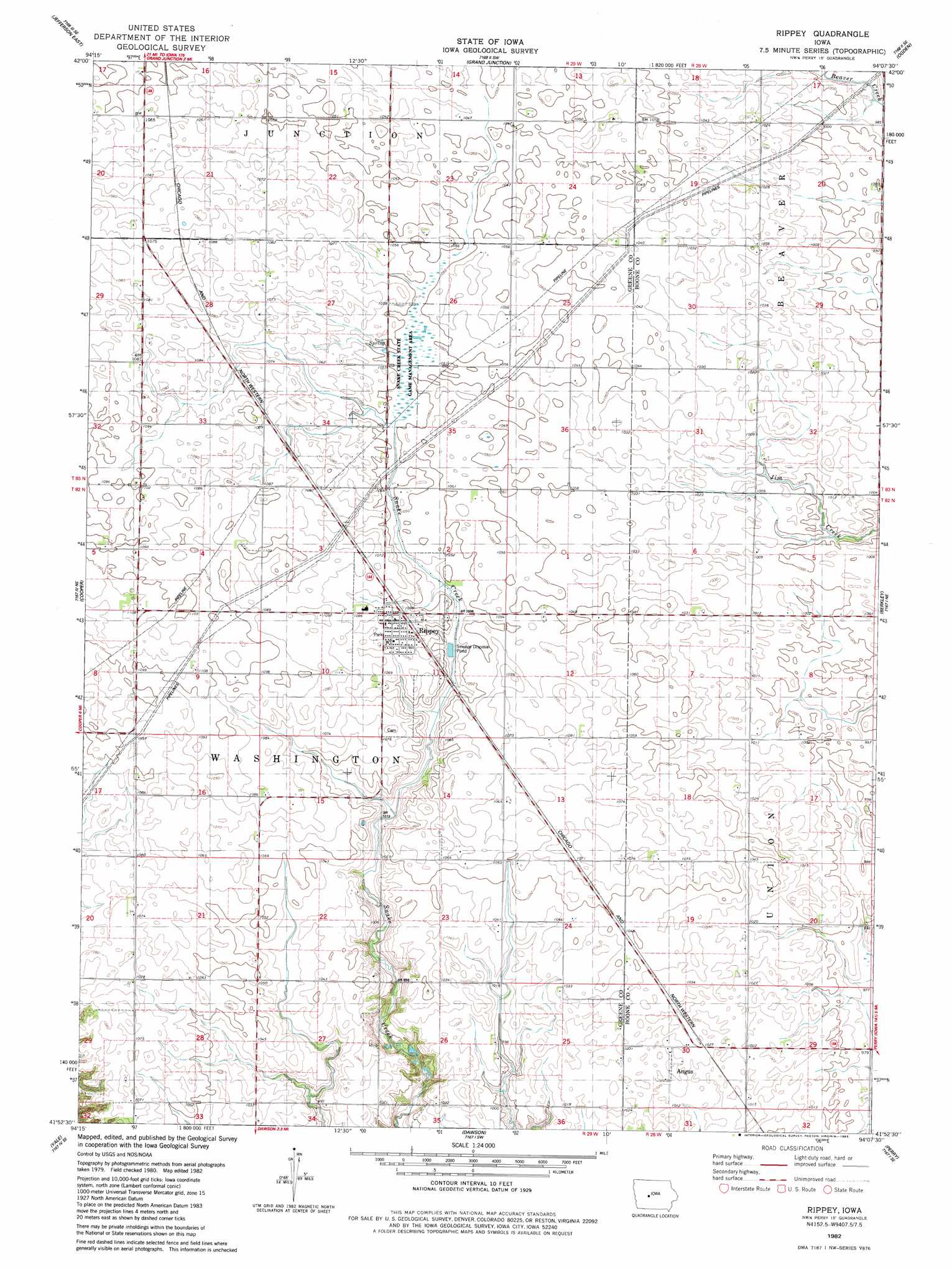
Rippey Topo Map Iowa
To zoom in, hover over the map of Rippey
USGS Topo Quad 41094h2 - 1:24,000 scale
| Topo Map Name: | Rippey |
| USGS Topo Quad ID: | 41094h2 |
| Print Size: | ca. 21 1/4" wide x 27" high |
| Southeast Coordinates: | 41.875° N latitude / 94.125° W longitude |
| Map Center Coordinates: | 41.9375° N latitude / 94.1875° W longitude |
| U.S. State: | IA |
| Filename: | o41094h2.jpg |
| Download Map JPG Image: | Rippey topo map 1:24,000 scale |
| Map Type: | Topographic |
| Topo Series: | 7.5´ |
| Map Scale: | 1:24,000 |
| Source of Map Images: | United States Geological Survey (USGS) |
| Alternate Map Versions: |
Rippey IA 1982, updated 1983 Download PDF Buy paper map Rippey IA 2010 Download PDF Buy paper map Rippey IA 2013 Download PDF Buy paper map Rippey IA 2015 Download PDF Buy paper map |
1:24,000 Topo Quads surrounding Rippey
Churdan |
Paton |
Lanyon |
Boxholm |
Fraser |
Jefferson West |
Jefferson East |
Grand Junction |
Ogden |
Boone West |
Bagley Nw |
Cooper |
Rippey |
Berkley |
Madrid Nw |
Bagley |
Yale |
Dawson |
Perry |
Woodward |
Guthrie Center East |
Panora |
Adel Nw |
Panther |
Dallas Center |
> Back to 41094e1 at 1:100,000 scale
> Back to 41094a1 at 1:250,000 scale
> Back to U.S. Topo Maps home
Rippey topo map: Gazetteer
Rippey: Areas
Snake Creek State Game Management Area elevation 320m 1049′Rippey: Populated Places
Angus elevation 314m 1030′Rippey elevation 327m 1072′
Rippey: Post Offices
Angus Post Office (historical) elevation 314m 1030′Rippey Post Office elevation 327m 1072′
Surry Post Office (historical) elevation 314m 1030′
Rippey: Streams
Parrish Branch elevation 320m 1049′Rippey: Trails
Perry to Rippey Trail elevation 319m 1046′Rippey digital topo map on disk
Buy this Rippey topo map showing relief, roads, GPS coordinates and other geographical features, as a high-resolution digital map file on DVD: