Griswold Ne Topo Map Iowa
To zoom in, hover over the map of Griswold Ne
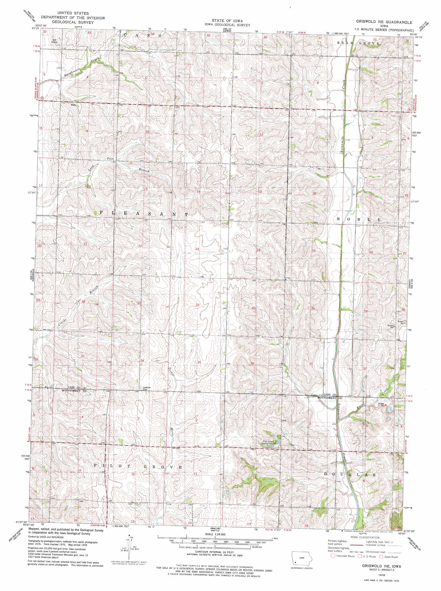
USGS Topo Quad 41095b1 - 1:24,000 scale
| Topo Map Name: | Griswold Ne |
| USGS Topo Quad ID: | 41095b1 |
| Print Size: | ca. 21 1/4" wide x 27" high |
| Southeast Coordinates: | 41.125° N latitude / 95° W longitude |
| Map Center Coordinates: | 41.1875° N latitude / 95.0625° W longitude |
| U.S. State: | IA |
| Filename: | o41095b1.jpg |
| Download Map JPG Image: | Griswold Ne topo map 1:24,000 scale |
| Map Type: | Topographic |
| Topo Series: | 7.5´ |
| Map Scale: | 1:24,000 |
| Source of Map Images: | United States Geological Survey (USGS) |
| Alternate Map Versions: |
Griswold NE IA 1978, updated 1978 Download PDF Buy paper map Griswold NE IA 2010 Download PDF Buy paper map Griswold NE IA 2013 Download PDF Buy paper map Griswold NE IA 2015 Download PDF Buy paper map |
1:24,000 Topo Quads surrounding Griswold Ne
Avoca |
Walnut |
Atlantic |
Wiota |
Anita |
Avoca Se |
Atlantic Sw |
Lewis |
Anita Sw |
Massena |
Carson Ne |
Griswold |
Griswold Ne |
Grant |
Dewey |
Walles |
Red Oak North |
Wallin |
Morton Mills |
Carbon |
Coburg |
Red Oak South |
Stanton |
Villisca |
Brooks |
> Back to 41095a1 at 1:100,000 scale
> Back to 41094a1 at 1:250,000 scale
> Back to U.S. Topo Maps home
Griswold Ne topo map: Gazetteer
Griswold Ne: Bridges
Nodaway River Bridge elevation 356m 1167′Griswold Ne: Parks
Nishna Valley Recreation Area elevation 352m 1154′Pilot Grove County Park elevation 365m 1197′
Griswold Ne: Post Offices
Wax Post Office (historical) elevation 340m 1115′Griswold Ne: Streams
Rose Creek elevation 332m 1089′Griswold Ne digital topo map on disk
Buy this Griswold Ne topo map showing relief, roads, GPS coordinates and other geographical features, as a high-resolution digital map file on DVD: