Mcclelland Topo Map Iowa
To zoom in, hover over the map of Mcclelland
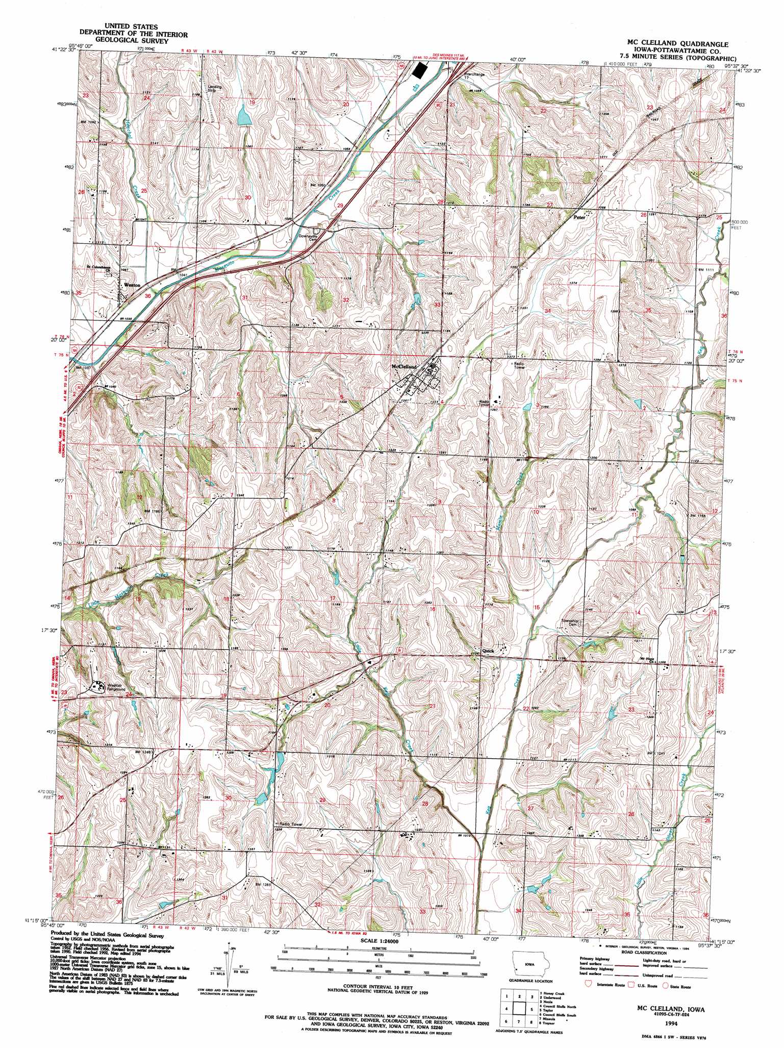
USGS Topo Quad 41095c6 - 1:24,000 scale
| Topo Map Name: | Mcclelland |
| USGS Topo Quad ID: | 41095c6 |
| Print Size: | ca. 21 1/4" wide x 27" high |
| Southeast Coordinates: | 41.25° N latitude / 95.625° W longitude |
| Map Center Coordinates: | 41.3125° N latitude / 95.6875° W longitude |
| U.S. State: | IA |
| Filename: | o41095c6.jpg |
| Download Map JPG Image: | Mcclelland topo map 1:24,000 scale |
| Map Type: | Topographic |
| Topo Series: | 7.5´ |
| Map Scale: | 1:24,000 |
| Source of Map Images: | United States Geological Survey (USGS) |
| Alternate Map Versions: |
Mc Clelland IA 1956, updated 1958 Download PDF Buy paper map Mc Clelland IA 1956, updated 1973 Download PDF Buy paper map Mc Clelland IA 1956, updated 1984 Download PDF Buy paper map Mc Clelland IA 1994, updated 1994 Download PDF Buy paper map McClelland IA 2010 Download PDF Buy paper map McClelland IA 2013 Download PDF Buy paper map McClelland IA 2015 Download PDF Buy paper map |
1:24,000 Topo Quads surrounding Mcclelland
Missouri Valley |
Beebeetown |
Hard Scratch |
Persia |
Shelby |
Loveland |
Honey Creek |
Underwood |
Neola |
Avoca Nw |
Omaha North |
Council Bluffs North |
Mcclelland |
Taylor |
Oakland |
Omaha South |
Council Bluffs South |
Mineola |
Treynor |
Carson |
Plattsmouth |
Pacific Junction |
Glenwood |
Malvern |
Emerson |
> Back to 41095a1 at 1:100,000 scale
> Back to 41094a1 at 1:250,000 scale
> Back to U.S. Topo Maps home
Mcclelland topo map: Gazetteer
Mcclelland: Airports
Ryans Airport elevation 370m 1213′Mcclelland: Populated Places
McClelland elevation 379m 1243′Peter elevation 388m 1272′
Quick elevation 342m 1122′
Weston elevation 332m 1089′
Mcclelland: Post Offices
Armour Post Office (historical) elevation 363m 1190′Downsville Post Office (historical) elevation 322m 1056′
McClelland Post Office elevation 379m 1243′
Quick Post Office (historical) elevation 342m 1122′
Weston Post Office (historical) elevation 332m 1089′
Mcclelland: Streams
Henchal Creek elevation 312m 1023′Little Keg Creek elevation 321m 1053′
Mamie Creek elevation 382m 1253′
Mcclelland digital topo map on disk
Buy this Mcclelland topo map showing relief, roads, GPS coordinates and other geographical features, as a high-resolution digital map file on DVD: